LE14 Postcode District
LE14 is the Postcode District for Asfordby, Melton Mowbray Leicestershire
The LE14 postcode district is located in the LE Leicester postal area, LE14 has a population of 18,115 residents according to the 2021 England and Wales Census..
The area of the district is 137.02 square miles (354.88 square kilometres or 87,691.78 acres).
A wide range of spatial data has been analysed to present this overview of LE14. If you would like anything added, please contact us.
Map of LE14
Explore the postcode district using the interactive map.
Larger circles indicate higher recorded crime totals.
On this page
District overview
The primary settlement in the LE14 postcode district is Melton Mowbray, which is located in the county of Leicestershire in England. Other significant settlements in this district include Asfordby, Old Dalby, Eastwell, Harby, Hose, Long Clawson, Scalford, Stathern, and Waltham On The Wolds.
There are 3 postcode sectors within the district. Here's a breakdown:
The sector LE14 2, covers Wymondham in Leicestershire.
The sector LE14 3, covers Asfordby and Old Dalby in Leicestershire.
The sector LE14 4, covers Waltham On The Wolds and Long Clawson and Stathern and Harby in Leicestershire.
The post town for this district is MELTON MOWBRAY.
When it comes to local government, postal geography often disregards political borders. However, this district intersects the following councils: the district mostly encompasses the Melton District (B) (630 postal codes), followed by the Rushcliffe District (B) area (33 postal codes), and finally, the Charnwood District (B) area (3 postal codes).
Postcode sectors and neighbouring districts
Nearest towns
To help place the district geographically, here are nearby towns and their approximate direction from the district centre.
| Town | Distance (miles) | Direction |
|---|---|---|
| Melton Mowbray | 1.19 | S |
| Syston | 9.87 | SW |
| Oakham | 10.13 | SE |
| Cotgrave | 11.13 | NW |
| Bingham | 11.98 | NNW |
| Grantham | 13.44 | NE |
| Loughborough | 13.58 | W |
| Leicester | 14.76 | SW |
| West Bridgford | 14.94 | NW |
| Uppingham | 15.08 | SSE |
| Nottingham | 16.41 | NW |
| Shepshed | 17.10 | W |
| Beeston | 17.14 | NW |
| Long Eaton | 18.21 | WNW |
| Arnold | 18.25 | NNW |
| Stamford | 19.15 | ESE |
| Stapleford | 19.26 | WNW |
| Sandiacre | 19.57 | WNW |
| Newark-on-Trent | 20.47 | N |
| Coalville | 20.49 | WSW |
Postcode information
Total geographical postcodes: 648
| Location | Post Town | Sector | Number of postcodes |
|---|---|---|---|
| Asfordby | MELTON MOWBRAY | LE14 3 | 63 |
| Old Dalby | MELTON MOWBRAY | LE14 3 | 33 |
| Long Clawson | MELTON MOWBRAY | LE14 4 | 29 |
| Waltham On The Wolds | MELTON MOWBRAY | LE14 4 | 26 |
| Wymondham | MELTON MOWBRAY | LE14 2 | 25 |
| Stathern | MELTON MOWBRAY | LE14 4 | 25 |
| Harby | MELTON MOWBRAY | LE14 4 | 22 |
| Somerby | MELTON MOWBRAY | LE14 2 | 19 |
| Scalford | MELTON MOWBRAY | LE14 4 | 17 |
| Great Dalby | MELTON MOWBRAY | LE14 2 | 16 |
| Frisby On The Wreake | MELTON MOWBRAY | LE14 2 | 15 |
| Hose | MELTON MOWBRAY | LE14 4 | 15 |
| Hickling | MELTON MOWBRAY | LE14 3 | 14 |
| Twyford | MELTON MOWBRAY | LE14 2 | 13 |
| Burton Lazars | MELTON MOWBRAY | LE14 2 | 13 |
| Upper Broughton | MELTON MOWBRAY | LE14 3 | 12 |
| Nether Broughton | MELTON MOWBRAY | LE14 3 | 12 |
| Asfordby Hill | MELTON MOWBRAY | LE14 3 | 12 |
| Ab Kettleby | MELTON MOWBRAY | LE14 3 | 11 |
| Thorpe Satchville | MELTON MOWBRAY | LE14 2 | 9 |
| Pickwell | MELTON MOWBRAY | LE14 2 | 9 |
| Sproxton | MELTON MOWBRAY | LE14 4 | 9 |
| Kirby Bellars | MELTON MOWBRAY | LE14 2 | 8 |
| Hoby | MELTON MOWBRAY | LE14 3 | 8 |
| Burrough On The Hill | MELTON MOWBRAY | LE14 2 | 7 |
| Goadby Marwood | MELTON MOWBRAY | LE14 4 | 7 |
| Leesthorpe | MELTON MOWBRAY | LE14 2 | 6 |
| Asfordby Valley | MELTON MOWBRAY | LE14 3 | 6 |
| Eastwell | MELTON MOWBRAY | LE14 4 | 6 |
| Saltby | MELTON MOWBRAY | LE14 4 | 6 |
| Holwell | MELTON MOWBRAY | LE14 4 | 6 |
| Wartnaby | MELTON MOWBRAY | LE14 3 | 5 |
| Old Dalby | MELTON MOWBRAY | LE14 3 | 5 |
| Thorpe Arnold | MELTON MOWBRAY | LE14 4 | 5 |
| Stonesby | MELTON MOWBRAY | LE14 4 | 5 |
| Edmondthorpe | MELTON MOWBRAY | LE14 2 | 4 |
| Rotherby | MELTON MOWBRAY | LE14 2 | 4 |
| Saxby | MELTON MOWBRAY | LE14 2 | 4 |
| Freeby | MELTON MOWBRAY | LE14 2 | 4 |
| Stapleford | MELTON MOWBRAY | LE14 2 | 4 |
| Ashby Folville | MELTON MOWBRAY | LE14 2 | 4 |
| Little Dalby | MELTON MOWBRAY | LE14 2 | 4 |
| Grimston | MELTON MOWBRAY | LE14 3 | 4 |
| Saxelby | MELTON MOWBRAY | LE14 3 | 4 |
| Ragdale | MELTON MOWBRAY | LE14 3 | 4 |
| Waltham On The Wolds | MELTON MOWBRAY | LE14 4 | 4 |
| Wycombe | MELTON MOWBRAY | LE14 4 | 4 |
| Wymondham | MELTON MOWBRAY | LE14 2 | 3 |
| Little Dalby | MELTON MOWBRAY | LE14 2 | 3 |
| Stapleford | MELTON MOWBRAY | LE14 2 | 3 |
| Burrough On The Hill | MELTON MOWBRAY | LE14 2 | 3 |
| Brooksby | MELTON MOWBRAY | LE14 2 | 3 |
| Frisby On The Wreake | MELTON MOWBRAY | LE14 2 | 3 |
| Garthorpe | MELTON MOWBRAY | LE14 2 | 3 |
| Eye Kettleby | MELTON MOWBRAY | LE14 2 | 3 |
| Ashby Folville | MELTON MOWBRAY | LE14 2 | 3 |
| Six Hills | MELTON MOWBRAY | LE14 3 | 3 |
| Hickling Pastures | MELTON MOWBRAY | LE14 3 | 3 |
| Saltby | MELTON MOWBRAY | LE14 4 | 3 |
| Edmondthorpe | MELTON MOWBRAY | LE14 2 | 2 |
| John O' Gaunt | MELTON MOWBRAY | LE14 2 | 2 |
| Thorpe Satchville | MELTON MOWBRAY | LE14 2 | 2 |
| Kirby Bellars | MELTON MOWBRAY | LE14 2 | 2 |
| Wartnaby | MELTON MOWBRAY | LE14 3 | 2 |
| Upper Broughton | MELTON MOWBRAY | LE14 3 | 2 |
| Hoby | MELTON MOWBRAY | LE14 3 | 2 |
| Welby | MELTON MOWBRAY | LE14 3 | 2 |
| Shoby | MELTON MOWBRAY | LE14 3 | 2 |
| Sproxton | MELTON MOWBRAY | LE14 4 | 2 |
| Harby | MELTON MOWBRAY | LE14 4 | 2 |
| Eastwell | MELTON MOWBRAY | LE14 4 | 2 |
| Stathern | MELTON MOWBRAY | LE14 4 | 2 |
| Chadwell | MELTON MOWBRAY | LE14 4 | 2 |
| Brentingby | MELTON MOWBRAY | LE14 4 | 2 |
| Thorpe Arnold | MELTON MOWBRAY | LE14 4 | 2 |
| Scalford | MELTON MOWBRAY | LE14 4 | 2 |
| MELTON MOWBRAY | MELTON MOWBRAY | LE14 2 | 1 |
| Great Dalby | MELTON MOWBRAY | LE14 2 | 1 |
| Rotherby | MELTON MOWBRAY | LE14 2 | 1 |
| Brooksby | MELTON MOWBRAY | LE14 2 | 1 |
| Somerby | MELTON MOWBRAY | LE14 2 | 1 |
| Coston | MELTON MOWBRAY | LE14 2 | 1 |
| Saxby | MELTON MOWBRAY | LE14 2 | 1 |
| Eye Kettleby | MELTON MOWBRAY | LE14 2 | 1 |
| Wymondham | MELTON MOWBRAY | LE14 2 | 1 |
| Leesthorpe | MELTON MOWBRAY | LE14 2 | 1 |
| Old Dalby | MELTON MOWBRAY | LE14 3 | 1 |
| Little Belvoir | MELTON MOWBRAY | LE14 3 | 1 |
| MELTON MOWBRAY | MELTON MOWBRAY | LE14 3 | 1 |
| Welby | MELTON MOWBRAY | LE14 3 | 1 |
| Ragdale | MELTON MOWBRAY | LE14 3 | 1 |
| Six Hills | MELTON MOWBRAY | LE14 3 | 1 |
| Saxelby | MELTON MOWBRAY | LE14 3 | 1 |
| Hickling Pastures | MELTON MOWBRAY | LE14 3 | 1 |
| Asfordby | MELTON MOWBRAY | LE14 3 | 1 |
| Bescaby | MELTON MOWBRAY | LE14 4 | 1 |
| Waltham On The Wolds | MELTON MOWBRAY | LE14 4 | 1 |
| Holwell | MELTON MOWBRAY | LE14 4 | 1 |
| Hose | MELTON MOWBRAY | LE14 4 | 1 |
| Stonesby | MELTON MOWBRAY | LE14 4 | 1 |
| Wycombe | MELTON MOWBRAY | LE14 4 | 1 |
| Brentingby | MELTON MOWBRAY | LE14 4 | 1 |
| Wyfordby | MELTON MOWBRAY | LE14 4 | 1 |
| Wyfordby | MELTON MOWBRAY | LE14 4 | 1 |
| Long Clawson | MELTON MOWBRAY | LE14 4 | 1 |
| Harby | MELTON MOWBRAY | LE14 4 | 1 |
| Waltham On The Wolds | MELTON MOWBRAY | LE14 4 | 1 |
Street list for LE14
ASHBY FOLVILLE ROAD
Minor roadGREAT DALBY, Burton And Dalby, Leicestershire
Minor Road
USRN: 24901417
BAKEHOUSE LANE
TWYFORD, Twyford And Thorpe, Leicestershire
Restricted Local Access Road
USRN: 24902788
BLACKSMITHS CLOSE
NETHER BROUGHTON, Broughton And Old Dalby, Leicestershire
Local Road
USRN: 24900061
BURROUGH COURT
BURROUGH ON THE HILL, Somerby, Leicestershire
Restricted Local Access Road
USRN: 24901130
CANAL LANE
Minor roadLONG CLAWSON, Clawson Hose And Harby, Leicestershire
Minor Road
USRN: 24900106
CHAPEL LANE
Minor roadNETHER BROUGHTON, Broughton And Old Dalby, Leicestershire
Minor Road
USRN: 24900122
CHURCH END
Minor roadNETHER BROUGHTON, Broughton And Old Dalby, Leicestershire
Minor Road
USRN: 24900141
CHURCH LANE
Minor roadLONG CLAWSON, Clawson Hose And Harby, Leicestershire
Minor Road
USRN: 24900158
CHURCH WALK
THORPE SATCHVILLE, Twyford And Thorpe, Leicestershire
Restricted Local Access Road
USRN: 24902342
CLAWSON LANE
Minor roadNETHER BROUGHTON, Broughton And Old Dalby, Leicestershire
Minor Road
USRN: 24900178
COLSTON BASSETT LANE
Minor roadHOSE, Clawson Hose And Harby, Leicestershire
Minor Road
USRN: 24901489
COPPER MEADOW
ASFORDBY HILL, Melton Mowbray, Leicestershire
Restricted Local Access Road
USRN: 24903027
DAIRY GARDENS
HARBY, Clawson Hose And Harby, Leicestershire
Restricted Local Access Road
USRN: 24902732
DALBY LODGE CLOSE
OLD DALBY, Broughton And Old Dalby, Leicestershire
Restricted Local Access Road
USRN: 24903025
DOG LANE
BURTON LAZARS, Burton And Dalby, Leicestershire
Restricted Local Access Road
USRN: 24900232
ENTERPRISE WAY
OLD DALBY, Broughton And Old Dalby, Leicestershire
Restricted Local Access Road
USRN: 24902907
GARTREE HILL ROAD
Minor roadLITTLE DALBY, Burton And Dalby, Leicestershire
Minor Road
USRN: 24901404
GATED ROAD
Minor roadTHORPE SATCHVILLE, Twyford And Thorpe, Leicestershire
Minor Road
USRN: 24902366
GLEBE CLOSE
LONG CLAWSON, Clawson Hose And Harby, Leicestershire
Restricted Local Access Road
USRN: 24902652
GLEBE COURT
GREAT DALBY, Burton And Dalby, Leicestershire
Restricted Local Access Road
USRN: 24902691
GREAT DALBY ROAD B6047
B-roadTHORPE SATCHVILLE, Twyford And Thorpe, Leicestershire
B Road
USRN: 24900312
HALL DRIVE
BURTON LAZARS, Burton And Dalby, Leicestershire
Restricted Local Access Road
USRN: 24901642
HECADECK LANE
Minor roadNETHER BROUGHTON, Broughton And Old Dalby, Leicestershire
Minor Road
USRN: 24900337
HICKLING LANE
Minor roadLONG CLAWSON, Clawson Hose And Harby, Leicestershire
Minor Road
USRN: 24900338
HICKLING ROAD
Minor roadNETHER BROUGHTON, Broughton And Old Dalby, Leicestershire
Minor Road
USRN: 24901618
LITTLE DALBY ROAD
Minor roadGREAT DALBY, Burton And Dalby, Leicestershire
Minor Road
USRN: 24901403
LOWER ENTERPRISE ROAD
OLD DALBY, Broughton And Old Dalby, Leicestershire
Restricted Local Access Road
USRN: 24902908
MAIN ROAD A606
A-roadNETHER BROUGHTON, Broughton And Old Dalby, Leicestershire
A Road
USRN: 24901435
MAIN STREET B6047
B-roadTHORPE SATCHVILLE, Twyford And Thorpe, Leicestershire
B Road
USRN: 24900444
MELTON ROAD
Minor roadLONG CLAWSON, Clawson Hose And Harby, Leicestershire
Minor Road
USRN: 24900500
MELTON ROAD
Minor roadLONG CLAWSON, Clawson Hose And Harby, Leicestershire
Minor Road
USRN: 24900500
MELTON ROAD A606
A-roadNETHER BROUGHTON, Broughton And Old Dalby, Leicestershire
A Road
USRN: 24901437
MIDDLE ENTERPRISE ROAD
OLD DALBY, Broughton And Old Dalby, Leicestershire
Restricted Local Access Road
USRN: 24902909
MIDDLE LANE
Minor roadNETHER BROUGHTON, Broughton And Old Dalby, Leicestershire
Minor Road
USRN: 24900507
MOOR LEAS LANE
WALTHAM ON THE WOLDS, Waltham, Leicestershire
Restricted Local Access Road
USRN: 24902352
NEWBOLD LANE
Minor roadNEWBOLD IN OWSTON, Owston And Newbold, Leicestershire
Minor Road
USRN: 16402339
NOTTINGHAM LANE
Minor roadOLD DALBY, Broughton And Old Dalby, Leicestershire
Minor Road
USRN: 24900546
NOTTINGHAM ROAD A606
A-roadNETHER BROUGHTON, Broughton And Old Dalby, Leicestershire
A Road
USRN: 24901438
PAGETS END
LONG CLAWSON, Clawson Hose And Harby, Leicestershire
Restricted Local Access Road
USRN: 24901572
POST OFFICE LANE
TWYFORD, Twyford And Thorpe, Leicestershire
Restricted Local Access Road
USRN: 24901602
RACECOURSE LANE
BURTON LAZARS, Burton And Dalby, Leicestershire
Restricted Local Access Road
USRN: 24902346
RUSHLAND FIELDS
LONG CLAWSON, Clawson Hose And Harby, Leicestershire
Restricted Local Access Road
USRN: 24902651
RYDAL MANOR GARDENS
EYE KETTLEBY, Melton Mowbray, Leicestershire
Restricted Local Access Road
USRN: 24902791
STATION ROAD
Minor roadOLD DALBY, Broughton And Old Dalby, Leicestershire
Minor Road
USRN: 24901497
THE DRIVEWAY
RAGDALE, Hoby With Rotherby, Leicestershire
Restricted Local Access Road
USRN: 24901627
THE PADDOCK
OLD DALBY, Broughton And Old Dalby, Leicestershire
Restricted Local Access Road
USRN: 24902650
THOMPSON CLOSE
NETHER BROUGHTON, Broughton And Old Dalby, Leicestershire
Restricted Local Access Road
USRN: 24902937
THORPE SATCHVILLE ROAD B6047
B-roadTWYFORD, Twyford And Thorpe, Leicestershire
B Road
USRN: 24900773
WALTHAM LANE
Minor roadLONG CLAWSON, Clawson Hose And Harby, Leicestershire
Minor Road
USRN: 24900806
WHITAKERS FARM
HARBY, Clawson Hose And Harby, Leicestershire
Restricted Local Access Road
USRN: 24902781
WOODWELL HEAD LANE
EDMONDTHORPE, Wymondham, Leicestershire
Restricted Local Access Road
USRN: 24901394
Crime overview
Top streets by recorded crime
| Street | Crime count |
|---|---|
| WOODHOUSE ROAD | 29 |
| BRADGATE LANE | 27 |
| MELTON ROAD B676 | 26 |
| LEICESTER ROAD A607 | 26 |
| KIRBY LANE | 26 |
| BURNABY PLACE | 25 |
| STANTON ROAD | 24 |
| CHARNWOOD AVENUE | 24 |
| CANAL LANE | 21 |
| CHAPEL LANE | 20 |
Most common crime types
| Crime type | Count |
|---|---|
| Violence and sexual offences | 759 |
| Criminal damage and arson | 208 |
| Public order | 156 |
| Other theft | 151 |
| Vehicle crime | 129 |
| Burglary | 129 |
| Other crime | 55 |
| Drugs | 33 |
| Possession of weapons | 8 |
| Theft from the person | 7 |
| Anti-social behaviour | 6 |
| Bicycle theft | 4 |
| Shoplifting | 4 |
| Robbery | 2 |
Retail and shopping
| Street | Town | Locality | Number of shops | Central postcode | Map |
|---|---|---|---|---|---|
| BRADGATE LANE | MELTON MOWBRAY | ASFORDBY | 7 | LE14 3YD | View map |
| MAIN STREET | MELTON MOWBRAY | ASFORDBY | 6 | LE14 3RZ | View map |
Schools in the district
St Peter's Church of England Primary School Wymondham
Phase: Primary
Address:
Glebe Lane , Wymondham , Melton Mowbray
Postcode: LE14 2AF
Headteacher: Mrs Amanda Scott (Headteacher)
Ofsted rating: Good
Great Dalby School
Phase: Primary
Address:
Top End , Great Dalby , Melton Mowbray
Postcode: LE14 2HA
Headteacher: Mr Nick Sale (Headteacher)
Ofsted rating: Outstanding
Frisby Church of England Primary School
Phase: Primary
Address:
Hall Orchard Lane , Frisby-on-the-Wreake , Melton Mowbray
Postcode: LE14 2NH
Headteacher: Mrs Charmaine Ainge (Headteacher)
Ofsted rating: Good
Somerby Primary School
Phase: Primary
Address:
High Street , Somerby , Melton Mowbray
Postcode: LE14 2PZ
Headteacher: Mrs Andrea Brown (Headteacher)
Ofsted rating: Good
Ab Kettleby Primary School
Phase: Primary
Address:
Wartnaby Road , Ab Kettleby , Melton Mowbray
Postcode: LE14 3JJ
Headteacher: Mrs Andrea Brown (Head Teacher)
Ofsted rating: Good
Old Dalby Church of England Primary School
Phase: Primary
Address:
Longcliff Hill , Old Dalby , Melton Mowbray
Postcode: LE14 3JY
Headteacher: Mrs Rosemary Browne (Headteacher)
Ofsted rating: Good
Asfordby Hill Primary School
Phase: Primary
Address:
Melton Road , Asfordby Hill , Melton Mowbray
Postcode: LE14 3QX
Headteacher: Mrs Philippa Millward (Headteacher)
Ofsted rating: Good
Captains Close Primary School
Phase: Primary
Address:
Saxelby Road , Asfordby , Melton Mowbray
Postcode: LE14 3TU
Headteacher: Mr Liam Collins (Headteacher)
Ofsted rating: Good
Waltham on the Wolds Church of England Primary School
Phase: Primary
Address:
Melton Road , Waltham-on-the-Wolds , Melton Mowbray
Postcode: LE14 4AJ
Headteacher: Miss Hollie Geeson (Head Teacher)
Ofsted rating: Good
Harby Church of England Primary School
Phase: Primary
Address:
School Lane , Harby , Melton Mowbray
Postcode: LE14 4BZ
Headteacher: Mrs Bridget Bye (Headteacher)
Ofsted rating: Good
Scalford Church of England Primary School
Phase: Primary
Address:
School Lane , Scalford , Melton Mowbray
Postcode: LE14 4DT
Headteacher: Mrs Melanie Wrightam (Headteacher)
Ofsted rating: Good
Stathern Primary School
Phase: Primary
Address:
Water Lane , Stathern , Melton Mowbray
Postcode: LE14 4HX
Headteacher: Mrs Karen Lambert (Headteacher)
Ofsted rating: Outstanding
Hose Church of England Primary School
Phase: Primary
Address:
Bolton Lane , Hose , Melton Mowbray
Postcode: LE14 4JE
Headteacher: Mrs Lianne Hough (Headteacher)
Ofsted rating: Requires improvement
Long Clawson Church of England Primary School
Phase: Primary
Address:
School Lane , Long Clawson , Melton Mowbray
Postcode: LE14 4PB
Headteacher: Mrs Jane Dawda (Headteacher)
Ofsted rating: Good
Healthcare services
Data accessed from NHS Digital and updated monthly.
| # | Name | Address | Type | Contact |
|---|---|---|---|---|
| 1 | The New Surgery | BESCABY LANE, WALTHAM ON THE WOLDS, MELTON MOWBRAY, LEICESTERSHIRE, LE14 4AB | BRANCH SURGERY | Call 01664 464232 |
| 2 | Somerby Surgery | OAKHAM ROAD, SOMERBY, MELTON MOWBRAY, LEICESTERSHIRE, LE14 2QF | BRANCH SURGERY | Call 01664 454204 |
| 3 | Regency Road Surgery | REGENCY ROAD, ASFORDBY, MELTON MOWBRAY, LEICESTERSHIRE, LE14 3YL | BRANCH SURGERY | No contact details listed |
| 4 | Long Clawson Medical Practice | THE SANDS, LONG CLAWSON, MELTON MOWBRAY, LEICESTERSHIRE, LE14 4PA | GP PRACTICE | Call 01664 822214 |
Data accessed from NHS Digital and updated monthly.
| # | Name | Address | Type | Contact |
|---|---|---|---|---|
| 1 | Long Clawson Pharmacy | LONG CLAWSON MEDICAL PRACTICE, THE SANDS, LONG CLAWSON, MELTON MOWBRAY, LEICESTERSHIRE, LE14 4PA | PHARMACY | Call 01664 822214 |
| 2 | Boots | 5 BRADGATE LANE, ASFORDBY, MELTON MOWBRAY, LEICESTERSHIRE, LE14 3YD | PHARMACY | Call 01664 812284 |
Data accessed from NHS Digital and updated monthly.
| # | Name | Address | Type | Contact |
|---|---|---|---|---|
| 1 | Keyworth Optical Limited (harles Acres) | 10 HARLES ACRES, HICKLING, MELTON MOWBRAY, LEICESTERSHIRE, LE14 3AF | OPTICAL SITE | No contact details listed |
Data accessed from NHS Digital and updated monthly.
Property and housing
Yearly house price averages for the district
| Type of property | 2025 average | 2025 sales | 2024 average | 2024 sales | 2023 average | 2023 sales | 2022 average | 2022 sales |
|---|---|---|---|---|---|---|---|---|
| Detached | £510,213 | 164 | £496,718 | 164 | £498,421 | 171 | £519,410 | 163 |
| Semi-detached | £289,924 | 89 | £251,717 | 109 | £262,010 | 88 | £282,109 | 100 |
| Terraced | £221,826 | 33 | £217,413 | 60 | £194,687 | 40 | £224,182 | 51 |
| Flats | £235,500 | 2 | £134,975 | 2 | £242,125 | 4 | £106,350 | 5 |
Transport and connectivity
Stations in the district
No stations found in this postcode district.
Accessible motorway junctions
M1 J21A
Average Driving Time from within the district: 24.54
Average Driving Distance: 19.75
Number of Postcodes that can access the Motorway Junction: 448
M1 J21
Average Driving Time from within the district: 27.36
Average Driving Distance: 21.95
Number of Postcodes that can access the Motorway Junction: 329
M1 J22
Average Driving Time from within the district: 28.12
Average Driving Distance: 21.20
Number of Postcodes that can access the Motorway Junction: 420
M1 J24
Average Driving Time from within the district: 29.65
Average Driving Distance: 20.82
Number of Postcodes that can access the Motorway Junction: 633
M1 J25
Average Driving Time from within the district: 30.26
Average Driving Distance: 22.38
Number of Postcodes that can access the Motorway Junction: 211
M1 J23A
Average Driving Time from within the district: 31.18
Average Driving Distance: 22.39
Number of Postcodes that can access the Motorway Junction: 626
A1(M) J17
Average Driving Time from within the district: 32.12
Average Driving Distance: 27.21
Number of Postcodes that can access the Motorway Junction: 21
M1 J26
Average Driving Time from within the district: 33.06
Average Driving Distance: 22.06
Number of Postcodes that can access the Motorway Junction: 201
M69 J2
Average Driving Time from within the district: 33.63
Average Driving Distance: 26.84
Number of Postcodes that can access the Motorway Junction: 6
A1(M) J16
Average Driving Time from within the district: 34.60
Average Driving Distance: 28.92
Number of Postcodes that can access the Motorway Junction: 2
M1 J24A
Average Driving Time from within the district: 36.18
Average Driving Distance: 27.77
Number of Postcodes that can access the Motorway Junction: 332
M1 J20
Average Driving Time from within the district: 42.64
Average Driving Distance: 27.38
Number of Postcodes that can access the Motorway Junction: 6
Royal Mail delivery and sorting offices
| Postal sector | Delivery office |
|---|---|
| LE14 2 | Great Dalby Scale Payment Delivery Office |
| LE14 2 | Frisby On The Wreake Scale Payment Delivery Office |
| LE14 2 | Somerby Scale Payment Delivery Office |
| LE14 2 | Wymondham Scale Payment Delivery Office |
| LE14 2 | Kirby Bellars Scale Payment Delivery Office |
| LE14 2 | Melton Mowbray Delivery Office |
| LE14 3 | Melton Mowbray Delivery Office |
| LE14 4 | Melton Mowbray Delivery Office |
| LE14 4 | Stathern Scale Payment Delivery Office |
| LE14 4 | Harby Scale Payment Delivery Office |
Postcode format
| L | E | 1 | 4 | - | X | X | X |
| L | E | 1 | 4 | Space | Numeric | Letter | Letter |
Administrative and boundary notes
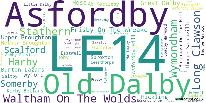
The largest settlement in the LE14 postal code is Asfordby followed by Old Dalby, and Long Clawson.
The LE14 Postcode shares a border with LE12 (Shepshed, Sileby, Mountsorrel), LE13 (MELTON MOWBRAY), LE15 (OAKHAM, Uppingham, Barleythorpe), LE7 (Syston, Anstey, Rothley), NG32 (Barrowby, Ancaster, Caythorpe), NG12 (Radcliffe-on-Trent, Keyworth, Cotgrave) and NG13 (Bingham, Bottesford, East Bridgford).
Maps and visuals
Weather
Weather Forecast for Grimston
Powered by Met Office DataPoint under the Open Government Licence.