The M21 8 postcode sector is within the county of Greater Manchester.
Did you know? According to the 2021 Census, the M21 8 postcode sector is home to a bustling 5,656 residents!
Given that each sector allows for 400 unique postcode combinations. Letters C, I, K, M, O and V are not allowed in the last two letters of a postcode. With 141 postcodes already in use, this leaves 259 units available.
The largest settlements in the M21 8 postal code are MANCHESTER and Chorlton Cum Hardy.
The M21 8 Postcode shares a border with M21 7 (MANCHESTER, Chorlton Cum Hardy), M32 8 (Stretford), M33 2 (SALE), M21 0 (MANCHESTER, Chorlton Cum Hardy) and M21 9 (MANCHESTER, Chorlton Cum Hardy).
The sector is within the post town of MANCHESTER.
M21 8 is a postcode sector within the M21 postcode district which is within the M Manchester postcode area.
The Royal Mail delivery office for the M21 8 postal sector is the Chorlton Delivery Office.
The area of the M21 8 postcode sector is 0.55 square miles which is 1.43 square kilometres or 354.54 square acres.
Waterways within the M21 8 postcode sector include the River Mersey, Chorlton Brook.

Map of the M21 8 Postcode Sector
Explore the M21 8 postcode sector by using our free interactive map.
| M | 2 | 1 | - | 8 | X | X |
| M | 2 | 1 | Space | 8 | Letter | Letter |
Official List of Streets
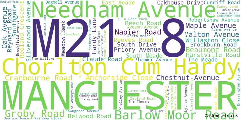
MANCHESTER (71 Streets)
Chorlton Cum Hardy (4 Streets)
Unofficial Streets or Alternative Spellings
MANCHESTER
BRUNDRETTS ROAD CROSS ROAD FINNEY DRIVE HIGH LANEChorlton Cum Hardy
MAULDETH ROAD WEST FALLOWFIELD LOOP JACKSONS BRIDGE NORTH MEAD THE MEADWeather Forecast for M21 8
Press Button to Show Forecast for Chorlton-Cum-Hardy
| Time Period | Icon | Description | Temperature | Rain Probability | Wind |
|---|---|---|---|---|---|
| 12:00 to 15:00 | Cloudy | 22.0°C (feels like 20.0°C) | 4.00% | SE 11 mph | |
| 15:00 to 18:00 | Thunder shower (day) | 24.0°C (feels like 21.0°C) | 59.00% | SE 11 mph | |
| 18:00 to 21:00 | Heavy rain shower (day) | 21.0°C (feels like 20.0°C) | 61.00% | SSE 7 mph | |
| 21:00 to 00:00 | Light rain shower (night) | 18.0°C (feels like 18.0°C) | 38.00% | SE 4 mph |
Press Button to Show Forecast for Chorlton-Cum-Hardy
| Time Period | Icon | Description | Temperature | Rain Probability | Wind |
|---|---|---|---|---|---|
| 00:00 to 03:00 | Cloudy | 16.0°C (feels like 16.0°C) | 13.00% | SE 4 mph | |
| 03:00 to 06:00 | Partly cloudy (night) | 15.0°C (feels like 15.0°C) | 2.00% | SSE 4 mph | |
| 06:00 to 09:00 | Cloudy | 15.0°C (feels like 14.0°C) | 5.00% | SSE 4 mph | |
| 09:00 to 12:00 | Cloudy | 17.0°C (feels like 15.0°C) | 5.00% | S 11 mph | |
| 12:00 to 15:00 | Cloudy | 19.0°C (feels like 17.0°C) | 4.00% | SSE 13 mph | |
| 15:00 to 18:00 | Cloudy | 21.0°C (feels like 17.0°C) | 8.00% | SSE 13 mph | |
| 18:00 to 21:00 | Cloudy | 19.0°C (feels like 16.0°C) | 12.00% | SSE 11 mph | |
| 21:00 to 00:00 | Cloudy | 16.0°C (feels like 15.0°C) | 14.00% | SE 9 mph |
Press Button to Show Forecast for Chorlton-Cum-Hardy
| Time Period | Icon | Description | Temperature | Rain Probability | Wind |
|---|---|---|---|---|---|
| 00:00 to 03:00 | Light rain | 15.0°C (feels like 14.0°C) | 48.00% | SE 9 mph | |
| 03:00 to 06:00 | Light rain | 15.0°C (feels like 13.0°C) | 53.00% | ESE 9 mph | |
| 06:00 to 09:00 | Light rain | 14.0°C (feels like 13.0°C) | 55.00% | ESE 9 mph | |
| 09:00 to 12:00 | Light rain | 15.0°C (feels like 14.0°C) | 58.00% | ESE 9 mph | |
| 12:00 to 15:00 | Heavy rain shower (day) | 17.0°C (feels like 15.0°C) | 67.00% | ESE 11 mph | |
| 15:00 to 18:00 | Light rain shower (day) | 17.0°C (feels like 16.0°C) | 49.00% | SE 9 mph | |
| 18:00 to 21:00 | Light rain shower (day) | 16.0°C (feels like 15.0°C) | 45.00% | SE 7 mph | |
| 21:00 to 00:00 | Cloudy | 15.0°C (feels like 14.0°C) | 18.00% | SE 7 mph |
Press Button to Show Forecast for Chorlton-Cum-Hardy
| Time Period | Icon | Description | Temperature | Rain Probability | Wind |
|---|---|---|---|---|---|
| 00:00 to 03:00 | Cloudy | 13.0°C (feels like 12.0°C) | 9.00% | ESE 7 mph | |
| 03:00 to 06:00 | Partly cloudy (night) | 12.0°C (feels like 11.0°C) | 3.00% | ESE 7 mph | |
| 06:00 to 09:00 | Partly cloudy (day) | 13.0°C (feels like 12.0°C) | 2.00% | ESE 7 mph | |
| 09:00 to 12:00 | Partly cloudy (day) | 16.0°C (feels like 15.0°C) | 9.00% | ESE 9 mph | |
| 12:00 to 15:00 | Light rain shower (day) | 19.0°C (feels like 17.0°C) | 36.00% | SSE 9 mph | |
| 15:00 to 18:00 | Partly cloudy (day) | 19.0°C (feels like 18.0°C) | 17.00% | SE 9 mph | |
| 18:00 to 21:00 | Partly cloudy (day) | 18.0°C (feels like 17.0°C) | 12.00% | SSE 7 mph | |
| 21:00 to 00:00 | Clear night | 15.0°C (feels like 15.0°C) | 6.00% | SSE 4 mph |
Press Button to Show Forecast for Chorlton-Cum-Hardy
| Time Period | Icon | Description | Temperature | Rain Probability | Wind |
|---|---|---|---|---|---|
| 00:00 to 03:00 | Clear night | 13.0°C (feels like 13.0°C) | 1.00% | SSE 4 mph | |
| 03:00 to 06:00 | Clear night | 12.0°C (feels like 12.0°C) | 2.00% | SE 4 mph | |
| 06:00 to 09:00 | Sunny day | 13.0°C (feels like 13.0°C) | 5.00% | E 4 mph | |
| 09:00 to 12:00 | Sunny day | 17.0°C (feels like 16.0°C) | 5.00% | S 4 mph | |
| 12:00 to 15:00 | Cloudy | 19.0°C (feels like 18.0°C) | 12.00% | W 4 mph | |
| 15:00 to 18:00 | Light rain shower (day) | 19.0°C (feels like 18.0°C) | 33.00% | NNW 7 mph | |
| 18:00 to 21:00 | Partly cloudy (day) | 18.0°C (feels like 17.0°C) | 11.00% | W 7 mph | |
| 21:00 to 00:00 | Clear night | 16.0°C (feels like 15.0°C) | 4.00% | WNW 7 mph |

House Prices in the M21 8 Postcode Sector
| Type of Property | 2018 Average | 2018 Sales | 2017 Average | 2017 Sales | 2016 Average | 2016 Sales | 2015 Average | 2015 Sales |
|---|---|---|---|---|---|---|---|---|
| Detached | £688,675 | 4 | £501,680 | 10 | £462,750 | 4 | £461,000 | 2 |
| Semi-Detached | £477,459 | 47 | £518,607 | 22 | £479,823 | 28 | £397,823 | 51 |
| Terraced | £327,841 | 38 | £346,144 | 28 | £319,575 | 44 | £278,909 | 34 |
| Flats | £191,467 | 12 | £195,603 | 29 | £178,285 | 35 | £149,690 | 21 |
Important Postcodes M21 8 in the Postcode Sector
M21 8EH is the postcode for Brookburn Primary School, Brookburn Road
| The M21 8 Sector is within these Local Authorities |
|
|---|---|
| The M21 8 Sector is within these Counties |
|
| The M21 8 Sector is within these Water Company Areas |
|