The N15 6 postcode sector is within the county of Greater London.
Did you know? According to the 2021 Census, the N15 6 postcode sector is home to a bustling 15,273 residents!
Given that each sector allows for 400 unique postcode combinations. Letters C, I, K, M, O and V are not allowed in the last two letters of a postcode. With 183 postcodes already in use, this leaves 217 units available.
The N15 6 postal code covers the settlement of TOTTENHAM .
The N15 6 Postcode shares a border with N4 1 (TOTTENHAM , HORNSEY , HACKNEY ), N15 5 (TOTTENHAM ), E17 7 (WALTHAMSTOW ), N15 4 (TOTTENHAM ), N16 5 (HACKNEY ) and N16 6 (HACKNEY ).
The sector is within the post town of LONDON.
N15 6 is a postcode sector within the N15 postcode district which is within the N North London postcode area.
The Royal Mail delivery office for the N15 6 postal sector is the South Tottenham Sdelivery Office.
The area of the N15 6 postcode sector is 0.33 square miles which is 0.85 square kilometres or 211.06 square acres.

Map of the N15 6 Postcode Sector
Explore the N15 6 postcode sector by using our free interactive map.
| N | 1 | 5 | - | 6 | X | X |
| N | 1 | 5 | Space | 6 | Letter | Letter |
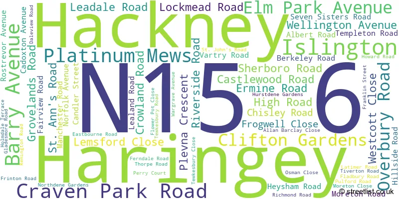
Official List of Streets
Haringey (60 Streets)
Unofficial Streets or Alternative Spellings
Weather Forecast for N15 6
Press Button to Show Forecast for Harringay
| Time Period | Icon | Description | Temperature | Rain Probability | Wind |
|---|---|---|---|---|---|
| 15:00 to 18:00 | Cloudy | 11.0°C (feels like 10.0°C) | 12.00% | NE 9 mph | |
| 18:00 to 21:00 | Heavy rain | 10.0°C (feels like 8.0°C) | 85.00% | NE 11 mph | |
| 21:00 to 00:00 | Heavy rain | 9.0°C (feels like 6.0°C) | 88.00% | NE 11 mph |
Press Button to Show Forecast for Harringay
| Time Period | Icon | Description | Temperature | Rain Probability | Wind |
|---|---|---|---|---|---|
| 00:00 to 03:00 | Heavy rain | 9.0°C (feels like 7.0°C) | 92.00% | NNE 9 mph | |
| 03:00 to 06:00 | Heavy rain | 10.0°C (feels like 8.0°C) | 92.00% | E 7 mph | |
| 06:00 to 09:00 | Cloudy | 10.0°C (feels like 8.0°C) | 41.00% | SW 7 mph | |
| 09:00 to 12:00 | Light rain | 10.0°C (feels like 8.0°C) | 62.00% | W 9 mph | |
| 12:00 to 15:00 | Light rain | 8.0°C (feels like 5.0°C) | 58.00% | W 13 mph | |
| 15:00 to 18:00 | Cloudy | 9.0°C (feels like 6.0°C) | 49.00% | WSW 11 mph | |
| 18:00 to 21:00 | Cloudy | 11.0°C (feels like 9.0°C) | 11.00% | SW 9 mph | |
| 21:00 to 00:00 | Clear night | 9.0°C (feels like 8.0°C) | 1.00% | SW 7 mph |
Press Button to Show Forecast for Harringay
| Time Period | Icon | Description | Temperature | Rain Probability | Wind |
|---|---|---|---|---|---|
| 00:00 to 03:00 | Clear night | 8.0°C (feels like 6.0°C) | 0.00% | SW 7 mph | |
| 03:00 to 06:00 | Clear night | 7.0°C (feels like 5.0°C) | 0.00% | SSW 7 mph | |
| 06:00 to 09:00 | Sunny day | 8.0°C (feels like 6.0°C) | 0.00% | S 7 mph | |
| 09:00 to 12:00 | Partly cloudy (day) | 12.0°C (feels like 10.0°C) | 1.00% | S 11 mph | |
| 12:00 to 15:00 | Partly cloudy (day) | 15.0°C (feels like 12.0°C) | 2.00% | S 11 mph | |
| 15:00 to 18:00 | Partly cloudy (day) | 16.0°C (feels like 13.0°C) | 1.00% | S 13 mph | |
| 18:00 to 21:00 | Sunny day | 14.0°C (feels like 12.0°C) | 2.00% | S 9 mph | |
| 21:00 to 00:00 | Clear night | 11.0°C (feels like 10.0°C) | 1.00% | SSE 7 mph |
Press Button to Show Forecast for Harringay
| Time Period | Icon | Description | Temperature | Rain Probability | Wind |
|---|---|---|---|---|---|
| 00:00 to 03:00 | Clear night | 10.0°C (feels like 8.0°C) | 1.00% | SE 7 mph | |
| 03:00 to 06:00 | Clear night | 9.0°C (feels like 8.0°C) | 1.00% | ESE 4 mph | |
| 06:00 to 09:00 | Partly cloudy (day) | 10.0°C (feels like 8.0°C) | 1.00% | ESE 7 mph | |
| 09:00 to 12:00 | Partly cloudy (day) | 14.0°C (feels like 13.0°C) | 6.00% | SE 7 mph | |
| 12:00 to 15:00 | Light rain shower (day) | 16.0°C (feels like 14.0°C) | 31.00% | SE 9 mph | |
| 15:00 to 18:00 | Cloudy | 17.0°C (feels like 15.0°C) | 14.00% | SE 9 mph | |
| 18:00 to 21:00 | Cloudy | 16.0°C (feels like 15.0°C) | 12.00% | SE 7 mph | |
| 21:00 to 00:00 | Cloudy | 13.0°C (feels like 13.0°C) | 12.00% | ESE 7 mph |
Press Button to Show Forecast for Harringay
| Time Period | Icon | Description | Temperature | Rain Probability | Wind |
|---|---|---|---|---|---|
| 00:00 to 03:00 | Cloudy | 12.0°C (feels like 12.0°C) | 14.00% | ESE 4 mph | |
| 03:00 to 06:00 | Cloudy | 11.0°C (feels like 10.0°C) | 11.00% | ESE 4 mph | |
| 06:00 to 09:00 | Fog | 11.0°C (feels like 11.0°C) | 19.00% | E 4 mph | |
| 09:00 to 12:00 | Cloudy | 14.0°C (feels like 14.0°C) | 13.00% | ENE 4 mph | |
| 12:00 to 15:00 | Partly cloudy (day) | 17.0°C (feels like 17.0°C) | 12.00% | E 4 mph | |
| 15:00 to 18:00 | Cloudy | 19.0°C (feels like 18.0°C) | 14.00% | ESE 7 mph | |
| 18:00 to 21:00 | Cloudy | 17.0°C (feels like 17.0°C) | 11.00% | SE 7 mph | |
| 21:00 to 00:00 | Cloudy | 14.0°C (feels like 13.0°C) | 11.00% | N 7 mph |
Schools and Places of Education Within the N15 6 Postcode Sector
Crowland Primary School
Community school
Crowland Road, London, , N15 6UX
Head: Mrs Stavroulla Stavrinou
Ofsted Rating: Outstanding
Inspection: 2014-07-03 (3586 days ago)
Website: Visit Crowland Primary School Website
Phone: 02088004553
Number of Pupils: 403
Gladesmore Community School
Community school
Crowland Road, London, , N15 6EB
Head: Mr Goldwater Ojokor
Ofsted Rating: Outstanding
Inspection: 2013-12-05 (3796 days ago)
Website: Visit Gladesmore Community School Website
Phone: 02088000884
Number of Pupils: 1304
St Ignatius RC Primary School
Voluntary aided school
St Ann's Road, London, , N15 6ND
Head: Mr Con Bonner
Ofsted Rating: Good
Inspection: 2019-05-09 (1815 days ago)
Website: Visit St Ignatius RC Primary School Website
Phone: 02088002771
Number of Pupils: 292
Tiverton Primary School
Community school
Pulford Road, London, , N15 6SP
Head: Miss Amardeep Panesar
Ofsted Rating: Requires improvement
Inspection: 2023-06-14 (318 days ago)
Website: Visit Tiverton Primary School Website
Phone: 02088003779
Number of Pupils: 293

House Prices in the N15 6 Postcode Sector
| Type of Property | 2018 Average | 2018 Sales | 2017 Average | 2017 Sales | 2016 Average | 2016 Sales | 2015 Average | 2015 Sales |
|---|---|---|---|---|---|---|---|---|
| Detached | £0 | 0 | £0 | 0 | £815,000 | 1 | £550,000 | 1 |
| Semi-Detached | £810,786 | 7 | £550,000 | 1 | £714,500 | 3 | £683,000 | 1 |
| Terraced | £798,877 | 53 | £717,922 | 55 | £637,554 | 48 | £580,556 | 38 |
| Flats | £362,608 | 51 | £356,343 | 47 | £362,530 | 44 | £340,169 | 40 |
Important Postcodes N15 6 in the Postcode Sector
N15 6DB is the postcode for Ermine Road Centre, 2 Ermine Road
N15 6EB is the postcode for Gladesmore Community School, Crowland Road, CLC BUILDING, Gladesmore Community School, Crowland Road, and SPORTS HALL, Gladesmore Community School, Crowland Road
N15 6HD is the postcode for Stamford Hill Primary School, Berkeley Road, and NURSERY, Stamford Hill Primary School, Berkeley Road
N15 6ND is the postcode for 27 HIGH ROAD, and St Ignatius RC Primary, St Ann's Road
N15 6NU is the postcode for Triangle Community Centre, 91-93 St Anns Road, Tottenham
N15 6SP is the postcode for 4, Pulford Road, and Tiverton Primary School, Pulford Road
N15 6UX is the postcode for Crowland Primary School, Crowland Road
| The N15 6 Sector is within these Local Authorities |
|
|---|---|
| The N15 6 Sector is within these Counties |
|
| The N15 6 Sector is within these Water Company Areas |
|