The SG13 postcode district is a postal district located in the SG Stevenage postcode area with a population of 17,948 residents according to the 2021 England and Wales Census.
The area of the SG13 postcode district is 15.69 square miles which is 40.63 square kilometres or 10,038.71 acres.
Currently, the SG13 district has about 528 postcode units spread across 2 geographic postcode sectors.
Given that each sector allows for 400 unique postcode combinations, the district has a capacity of 800 postcodes. With 528 postcodes already in use, this leaves 272 units available.
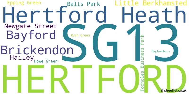
The largest settlement in the SG13 postal code is HERTFORD followed by Hertford Heath, and Bayford.
The SG13 Postcode shares a border with EN10 (BROXBOURNE, Turnford, Wormley), EN6 (POTTERS BAR, CUFFLEY), AL9 (HATFIELD, North Mymms, BROOKMANS PARK), EN11 (HODDESDON), EN7 (CHESHUNT, GOFFS OAK), SG12 (WARE, Stanstead Abbotts, Hunsdon) and SG14 (HERTFORD, Watton At Stone, Stapleford).
In the SG13 postcode district in Hertfordshire, the primary settlement is Hertford, which has the highest count. Other significant settlements in this district include Foxholes Business Park, Hailey, Hertford Heath, and Rush Green. The most significant Postal Town in this district is Hertford.
For the district SG13, we have data on 3 postcode sectors. Here's a breakdown: The sector SG13 7, covers Hertford and Hertford Heath in Hertfordshire. The sector SG13 8, covers Hertford in Hertfordshire. The sector SG13 9 is non-geographic. It's often designated for PO Boxes, large organisations, or special services.

Map of the SG13 Postcode District
Explore the SG13 postcode district by using our free interactive map.

When it comes to local government, postal geography often disregards political borders. However, for a breakdown in the SG13 District: the district mostly encompasses the East Hertfordshire District (507 postcodes), followed by the Welwyn Hatfield District (B) area (15 postcodes), and finally, the Broxbourne District (B) area (8 postcodes).
Recent House Sales in SG13
| Date | Price | Address |
|---|---|---|
| 16/10/2023 | £485,000 | Bullocks Lane, Hertford, SG13 8DB |
| 12/10/2023 | £119,280 | Burleigh Road, Hertford, SG13 7EZ |
| 06/10/2023 | £309,000 | Constables Way, Hertford, SG13 7LR |
| 14/09/2023 | £697,500 | Ashbourne Gardens, Hertford, SG13 8BQ |
| 11/09/2023 | £270,000 | Fallow Rise, Hertford, SG13 7NL |
| 01/09/2023 | £455,000 | Reynard Way, Hertford, SG13 7SQ |
| 01/09/2023 | £365,000 | Cublands, Hertford, SG13 7TS |
| 31/08/2023 | £255,000 | Constables Way, Hertford, SG13 7AF |
| 30/08/2023 | £432,500 | Railway Place, Hertford, SG13 7BS |
| 29/08/2023 | £355,000 | Constables Way, Hertford, SG13 7TY |
Weather Forecast for SG13
Press Button to Show Forecast for Hertford
| Time Period | Icon | Description | Temperature | Rain Probability | Wind |
|---|---|---|---|---|---|
| 09:00 to 12:00 | Partly cloudy (day) | 8.0°C (feels like 6.0°C) | 1.00% | ENE 7 mph | |
| 12:00 to 15:00 | Cloudy | 10.0°C (feels like 9.0°C) | 9.00% | ENE 4 mph | |
| 15:00 to 18:00 | Overcast | 11.0°C (feels like 10.0°C) | 12.00% | NE 4 mph | |
| 18:00 to 21:00 | Cloudy | 9.0°C (feels like 8.0°C) | 10.00% | ENE 7 mph | |
| 21:00 to 00:00 | Cloudy | 6.0°C (feels like 4.0°C) | 9.00% | E 7 mph |
Press Button to Show Forecast for Hertford
| Time Period | Icon | Description | Temperature | Rain Probability | Wind |
|---|---|---|---|---|---|
| 00:00 to 03:00 | Cloudy | 5.0°C (feels like 3.0°C) | 11.00% | ENE 4 mph | |
| 03:00 to 06:00 | Cloudy | 4.0°C (feels like 2.0°C) | 15.00% | ENE 7 mph | |
| 06:00 to 09:00 | Overcast | 5.0°C (feels like 2.0°C) | 24.00% | NE 7 mph | |
| 09:00 to 12:00 | Cloudy | 9.0°C (feels like 7.0°C) | 19.00% | ENE 9 mph | |
| 12:00 to 15:00 | Overcast | 11.0°C (feels like 9.0°C) | 19.00% | E 9 mph | |
| 15:00 to 18:00 | Cloudy | 12.0°C (feels like 10.0°C) | 18.00% | E 11 mph | |
| 18:00 to 21:00 | Cloudy | 11.0°C (feels like 9.0°C) | 19.00% | ENE 9 mph | |
| 21:00 to 00:00 | Light rain | 9.0°C (feels like 6.0°C) | 49.00% | NE 11 mph |
Press Button to Show Forecast for Hertford
| Time Period | Icon | Description | Temperature | Rain Probability | Wind |
|---|---|---|---|---|---|
| 00:00 to 03:00 | Light rain | 9.0°C (feels like 6.0°C) | 53.00% | NE 9 mph | |
| 03:00 to 06:00 | Heavy rain | 9.0°C (feels like 7.0°C) | 75.00% | ESE 9 mph | |
| 06:00 to 09:00 | Light rain | 9.0°C (feels like 7.0°C) | 52.00% | SE 9 mph | |
| 09:00 to 12:00 | Heavy rain shower (day) | 11.0°C (feels like 9.0°C) | 60.00% | ESE 9 mph | |
| 12:00 to 15:00 | Light rain | 12.0°C (feels like 10.0°C) | 58.00% | S 9 mph | |
| 15:00 to 18:00 | Light rain shower (day) | 13.0°C (feels like 11.0°C) | 39.00% | SSW 11 mph | |
| 18:00 to 21:00 | Cloudy | 12.0°C (feels like 10.0°C) | 15.00% | SW 11 mph | |
| 21:00 to 00:00 | Partly cloudy (night) | 9.0°C (feels like 7.0°C) | 5.00% | SW 9 mph |
Where is the SG13 Postcode District?
The postcode district with the code SG13 is located in the town of Hertford. Hertford is situated in close proximity to several nearby towns. To the South East is Hoddesdon, which is approximately 3.35 miles away. To the East is Broxbourne, located about 3.48 miles away. Goffs Oak is to the South, around 3.87 miles away. Cuffley is in the South West, around 4.03 miles away. To the West is Hatfield, located approximately 4.93 miles away. Finally, to the North East is Ware, around 5.02 miles away. Hertford is also located around 17.88 miles away from the center of London.
The district is within the post town of HERTFORD.
The sector has postcodes within the nation of England.
The SG13 Postcode District is in the Hertfordshire region of Bedfordshire and Hertfordshire within the East of England.
| Postcode Sector | Delivery Office |
|---|---|
| SG13 7 | Hertford Delivery Office |
| SG13 8 | Hertford Delivery Office |
| SG13 9 | Hertford Delivery Office |
| S | G | 1 | 3 | - | X | X | X |
| S | G | 1 | 3 | Space | Numeric | Letter | Letter |
Current Monthly Rental Prices
| # Bedrooms | Min Price | Max Price | Avg Price |
|---|---|---|---|
| £1,100 | £1,100 | £1,100 | |
| 1 | £1,450 | £3,320 | £2,824 |
| 2 | £1,300 | £3,250 | £1,906 |
| 3 | £2,200 | £2,200 | £2,200 |
| 4 | £2,850 | £2,850 | £2,850 |
| 5 | £3,000 | £3,000 | £3,000 |
Current House Prices
| # Bedrooms | Min Price | Max Price | Avg Price |
|---|---|---|---|
| £8,000 | £8,000 | £8,000 | |
| 1 | £210,000 | £375,000 | £264,457 |
| 2 | £130,000 | £999,000 | £441,503 |
| 3 | £350,000 | £2,000,000 | £657,087 |
| 4 | £535,000 | £1,750,000 | £941,615 |
| 5 | £550,000 | £2,750,000 | £1,389,208 |
| 6 | £1,699,995 | £4,250,000 | £2,974,998 |
| 8 | £4,250,000 | £4,250,000 | £4,250,000 |
Estate Agents who Operate in the SG13 District
| Logo | Name | Brand Name | Address | Contact Number | Total Properties |
|---|---|---|---|---|---|
 | Hertford | Steven Oates | 70 Fore Street Hertford SG14 1BY | 01992 661978 | 35 |
 | Hertford | Shepherds | Riverside House, 6 Millbridge, Hertford, Hertfordshire, SG14 1PY | 01992 662103 | 21 |
 | Hertford | Morgan Alexander | 40 Castle Street, Hertford, SG14 1HH | 01992 248028 | 19 |
 | Hertford | Lanes Exclusive Homes | 2 Market Street, Hertford, SG14 1BD | 01992 662022 | 12 |
 | Hertford | William H. Brown | 21 Castle Street, Hertford, SG14 1ER | 01992 662295 | 11 |
| Type of Property | 2018 Average | 2018 Sales | 2017 Average | 2017 Sales | 2016 Average | 2016 Sales | 2015 Average | 2015 Sales |
|---|---|---|---|---|---|---|---|---|
| Detached | £868,972 | 36 | £884,096 | 65 | £824,197 | 62 | £728,145 | 58 |
| Semi-Detached | £489,381 | 51 | £521,613 | 55 | £495,250 | 48 | £418,938 | 57 |
| Terraced | £409,277 | 92 | £433,711 | 103 | £404,695 | 125 | £370,932 | 128 |
| Flats | £321,296 | 173 | £309,440 | 125 | £270,189 | 182 | £240,871 | 271 |