The SG12 postcode district is a postal district located in the SG Stevenage postcode area with a population of 30,608 residents according to the 2021 England and Wales Census.
The area of the SG12 postcode district is 32.91 square miles which is 85.24 square kilometres or 21,062.35 acres.
Currently, the SG12 district has about 933 postcode units spread across 4 geographic postcode sectors.
Given that each sector allows for 400 unique postcode combinations, the district has a capacity of 1,600 postcodes. With 933 postcodes already in use, this leaves 667 units available.
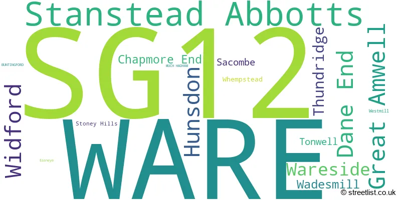
The largest settlement in the SG12 postal code is WARE followed by Stanstead Abbotts, and Hunsdon.
The SG12 Postcode shares a border with SG13 (HERTFORD, Hertford Heath, Bayford), EN11 (HODDESDON), CM19 (HARLOW, Roydon), CM20 (HARLOW, Gilston), CM21 (SAWBRIDGEWORTH, High Wych, Allens Green), SG10 (MUCH HADHAM), SG11 (Puckeridge, Standon, Little Hadham), SG14 (HERTFORD, Watton At Stone, Stapleford) and SG2 (STEVENAGE, Walkern, Benington).
The primary settlement in the SG12 postcode district is Ware, a town located in Hertfordshire, England. Other significant settlements in this district include Chapmore End, Dane End, Sacombe, Stoney Hills, Thundridge, Tonwell, Wadesmill, Westmill, and Whempstead. The most significant post town in this district is also Ware.
For the district SG12, we have data on 5 postcode sectors. Here's a breakdown: The sector SG12 0, covers Ware and Dane End in Hertfordshire. The sector SG12 4 is non-geographic. It's often designated for PO Boxes, large organisations, or special services. The sector SG12 7, covers Ware and Wareside in Hertfordshire. The sector SG12 8, covers Stanstead Abbotts and Widford and Hunsdon in Hertfordshire. The sector SG12 9, covers Ware and Great Amwell in Hertfordshire.

Map of the SG12 Postcode District
Explore the SG12 postcode district by using our free interactive map.

When it comes to local government, postal geography often disregards political borders. However, for a breakdown in the SG12 District: the district mostly encompasses the East Hertfordshire District area with a total of 946 postcodes.
Recent House Sales in SG12
| Date | Price | Address |
|---|---|---|
| 09/10/2023 | £325,000 | Coopers Court, Ware, SG12 9FG |
| 06/10/2023 | £410,000 | Grange Gardens, Ware, SG12 9NB |
| 06/10/2023 | £267,500 | Collett Road, Ware, SG12 7LX |
| 29/09/2023 | £400,000 | Tower Road, Ware, SG12 7LW |
| 26/09/2023 | £260,000 | Amwell End, Ware, SG12 9HW |
| 25/09/2023 | £172,500 | High Street, Stanstead Abbotts, Ware, SG12 8AG |
| 22/09/2023 | £195,000 | Palmer Court, Chapmore End, Ware, SG12 0PR |
| 19/09/2023 | £252,500 | Falcon Court, Ware, SG12 0XB |
| 15/09/2023 | £350,000 | River Meads, Stanstead Abbotts, Ware, SG12 8EL |
| 01/09/2023 | £555,000 | Park Road, Ware, SG12 0AN |
Weather Forecast for SG12
Press Button to Show Forecast for Ware
| Time Period | Icon | Description | Temperature | Rain Probability | Wind |
|---|---|---|---|---|---|
| 00:00 to 03:00 | Cloudy | 7.0°C (feels like 4.0°C) | 17.00% | ENE 7 mph | |
| 03:00 to 06:00 | Cloudy | 6.0°C (feels like 4.0°C) | 50.00% | NE 7 mph | |
| 06:00 to 09:00 | Light rain | 6.0°C (feels like 3.0°C) | 51.00% | NE 9 mph | |
| 09:00 to 12:00 | Overcast | 8.0°C (feels like 5.0°C) | 24.00% | NE 11 mph | |
| 12:00 to 15:00 | Overcast | 10.0°C (feels like 8.0°C) | 14.00% | NE 9 mph | |
| 15:00 to 18:00 | Cloudy | 12.0°C (feels like 10.0°C) | 13.00% | NE 9 mph | |
| 18:00 to 21:00 | Cloudy | 10.0°C (feels like 8.0°C) | 20.00% | NE 11 mph | |
| 21:00 to 00:00 | Light rain | 9.0°C (feels like 6.0°C) | 60.00% | NE 11 mph |
Press Button to Show Forecast for Ware
| Time Period | Icon | Description | Temperature | Rain Probability | Wind |
|---|---|---|---|---|---|
| 00:00 to 03:00 | Heavy rain | 8.0°C (feels like 5.0°C) | 86.00% | NNE 11 mph | |
| 03:00 to 06:00 | Heavy rain | 8.0°C (feels like 6.0°C) | 90.00% | NNE 11 mph | |
| 06:00 to 09:00 | Heavy rain | 9.0°C (feels like 6.0°C) | 90.00% | NE 9 mph | |
| 09:00 to 12:00 | Heavy rain | 9.0°C (feels like 7.0°C) | 84.00% | W 9 mph | |
| 12:00 to 15:00 | Heavy rain | 9.0°C (feels like 7.0°C) | 77.00% | W 11 mph | |
| 15:00 to 18:00 | Light rain | 10.0°C (feels like 7.0°C) | 50.00% | W 11 mph | |
| 18:00 to 21:00 | Cloudy | 10.0°C (feels like 9.0°C) | 10.00% | W 7 mph | |
| 21:00 to 00:00 | Cloudy | 8.0°C (feels like 7.0°C) | 6.00% | SW 7 mph |
Press Button to Show Forecast for Ware
| Time Period | Icon | Description | Temperature | Rain Probability | Wind |
|---|---|---|---|---|---|
| 00:00 to 03:00 | Partly cloudy (night) | 7.0°C (feels like 5.0°C) | 3.00% | SW 7 mph | |
| 03:00 to 06:00 | Clear night | 6.0°C (feels like 4.0°C) | 2.00% | SSW 4 mph | |
| 06:00 to 09:00 | Sunny day | 7.0°C (feels like 5.0°C) | 1.00% | S 4 mph | |
| 09:00 to 12:00 | Partly cloudy (day) | 12.0°C (feels like 10.0°C) | 1.00% | S 9 mph | |
| 12:00 to 15:00 | Partly cloudy (day) | 14.0°C (feels like 12.0°C) | 3.00% | S 11 mph | |
| 15:00 to 18:00 | Partly cloudy (day) | 15.0°C (feels like 12.0°C) | 1.00% | S 11 mph | |
| 18:00 to 21:00 | Sunny day | 14.0°C (feels like 12.0°C) | 1.00% | S 9 mph | |
| 21:00 to 00:00 | Clear night | 10.0°C (feels like 8.0°C) | 1.00% | SE 7 mph |
Press Button to Show Forecast for Ware
| Time Period | Icon | Description | Temperature | Rain Probability | Wind |
|---|---|---|---|---|---|
| 00:00 to 03:00 | Clear night | 9.0°C (feels like 7.0°C) | 1.00% | ESE 7 mph | |
| 03:00 to 06:00 | Clear night | 8.0°C (feels like 6.0°C) | 3.00% | ESE 7 mph | |
| 06:00 to 09:00 | Partly cloudy (day) | 9.0°C (feels like 8.0°C) | 6.00% | ESE 7 mph | |
| 09:00 to 12:00 | Cloudy | 13.0°C (feels like 12.0°C) | 7.00% | SE 9 mph | |
| 12:00 to 15:00 | Cloudy | 16.0°C (feels like 14.0°C) | 10.00% | SE 9 mph | |
| 15:00 to 18:00 | Cloudy | 16.0°C (feels like 15.0°C) | 12.00% | SE 9 mph | |
| 18:00 to 21:00 | Cloudy | 15.0°C (feels like 14.0°C) | 13.00% | ESE 9 mph | |
| 21:00 to 00:00 | Cloudy | 12.0°C (feels like 11.0°C) | 11.00% | ESE 7 mph |
Where is the SG12 Postcode District?
The postcode district SG12 is located in the town of Ware. It is situated in close proximity to several nearby towns. To the North East is Much Hadham, which is approximately 4.08 miles away. To the South East is Roydon, which is around 4.16 miles away. Hertford is located to the South West and is about 4.92 miles away. Broxbourne is to the South and is approximately 5.63 miles away. Sawbridgeworth is situated to the East and is around 6.86 miles away. Knebworth is to the West and is about 7.13 miles away. Furthermore, the postcode district SG12 is located approximately 22.59 miles away from the center of London.
The district covers the post towns of MUCH HADHAM, WARE.
The sector has postcodes within the nation of England.
The SG12 Postcode District is in the Hertfordshire region of Bedfordshire and Hertfordshire within the East of England.
| Postcode Sector | Delivery Office |
|---|---|
| SG12 0 | Ware Delivery Office |
| SG12 7 | Ware Delivery Office |
| SG12 8 | Ware Delivery Office |
| SG12 9 | Ware Delivery Office |
| S | G | 1 | 2 | - | X | X | X |
| S | G | 1 | 2 | Space | Numeric | Letter | Letter |
Current Monthly Rental Prices
| # Bedrooms | Min Price | Max Price | Avg Price |
|---|---|---|---|
| 1 | £995 | £1,100 | £1,030 |
| 2 | £1,150 | £2,000 | £1,461 |
| 3 | £1,595 | £2,850 | £2,166 |
| 4 | £2,150 | £2,995 | £2,432 |
| 5 | £5,200 | £5,200 | £5,200 |
| 6 | £13,000 | £13,000 | £13,000 |
Current House Prices
| # Bedrooms | Min Price | Max Price | Avg Price |
|---|---|---|---|
| £175,000 | £950,000 | £377,500 | |
| 1 | £110,000 | £295,000 | £223,189 |
| 2 | £55,000 | £950,000 | £338,157 |
| 3 | £296,250 | £900,000 | £533,423 |
| 4 | £499,950 | £1,750,000 | £774,151 |
| 5 | £495,000 | £2,250,000 | £1,090,904 |
| 6 | £950,000 | £1,750,000 | £1,433,333 |
| 7 | £1,800,000 | £5,500,000 | £3,673,750 |
Estate Agents who Operate in the SG12 District
| Logo | Name | Brand Name | Address | Contact Number | Total Properties |
|---|---|---|---|---|---|
 | Ware | Elliot Heath | 7 Star Street, Ware, SG12 7AA | 01920 455628 | 63 |
 | Ware | Keith Ian | 70-72 High Street, Ware, SG12 9AT | 01920 455439 | 32 |
 | Ware | Jonathan Hunt Estate Agency | 20 High Street, Ware, SG12 9BX | 01920 455602 | 28 |
 | Ware | William H. Brown | 80 High Street Ware SG12 9AT | 01920 455607 | 21 |
 | Ware | Taylor Phelps | 5 Frenchs Yard Ware Town Centre Hertfordshire SG12 9HP | 01920 459000 | 19 |
| Type of Property | 2018 Average | 2018 Sales | 2017 Average | 2017 Sales | 2016 Average | 2016 Sales | 2015 Average | 2015 Sales |
|---|---|---|---|---|---|---|---|---|
| Detached | £710,199 | 70 | £749,941 | 72 | £671,743 | 88 | £566,576 | 99 |
| Semi-Detached | £464,679 | 125 | £470,769 | 144 | £426,427 | 109 | £398,403 | 138 |
| Terraced | £390,835 | 149 | £381,940 | 131 | £391,113 | 177 | £338,116 | 170 |
| Flats | £255,222 | 198 | £255,395 | 197 | £228,741 | 211 | £207,855 | 251 |