The SG2 postcode district is a postal district located in the SG Stevenage postcode area with a population of 43,222 residents according to the 2021 England and Wales Census.
The area of the SG2 postcode district is 18.98 square miles which is 49.16 square kilometres or 12,148.49 acres.
Currently, the SG2 district has about 830 postcode units spread across 4 geographic postcode sectors.
Given that each sector allows for 400 unique postcode combinations, the district has a capacity of 1,600 postcodes. With 830 postcodes already in use, this leaves 770 units available.
The largest settlement in the SG2 postal code is STEVENAGE followed by Walkern, and Benington.
The SG2 Postcode shares a border with SG4 (HITCHIN, Codicote, Kimpton), SG7 (BALDOCK, Ashwell, Hinxworth), SG1 (STEVENAGE), SG12 (WARE, Stanstead Abbotts, Hunsdon) and SG14 (HERTFORD, Watton At Stone, Stapleford).
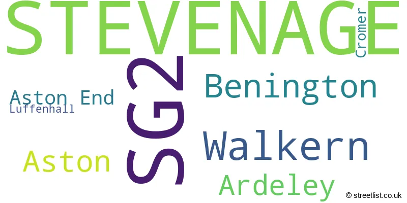
The primary settlement in the SG2 postcode district is Stevenage, which is located in the county of Hertfordshire, England. Other significant settlements within this district include Ardeley, Aston, Aston End, Benington, Cromer, Luffenhall, and Walkern. The most significant post town within this district is also Stevenage.
For the district SG2, we have data on 4 postcode sectors. Here's a breakdown: The sector SG2 0, covers Stevenage in Hertfordshire. The sector SG2 7, covers Stevenage and Walkern and Benington and Aston and Ardeley in Hertfordshire. The sector SG2 8, covers Stevenage in Hertfordshire. The sector SG2 9, covers Stevenage in Hertfordshire.

Map of the SG2 Postcode District
Explore the SG2 postcode district by using our free interactive map.

When it comes to local government, postal geography often disregards political borders. However, for a breakdown in the SG2 District: the district mostly encompasses the Stevenage District (B) (701 postcodes), followed by the East Hertfordshire District area (129 postcodes), and finally, the North Hertfordshire District area (3 postcodes).
Recent House Sales in SG2
| Date | Price | Address |
|---|---|---|
| 20/10/2023 | £360,000 | Hazelmere Road, Stevenage, SG2 8RX |
| 22/09/2023 | £237,500 | Downlands, Stevenage, SG2 7BJ |
| 21/09/2023 | £315,000 | Flinders Close, Stevenage, SG2 0NE |
| 08/09/2023 | £470,000 | Stirling Close, Stevenage, SG2 8TG |
| 08/09/2023 | £382,500 | Beech Drive, Stevenage, SG2 9TB |
| 04/09/2023 | £325,000 | Bandley Rise, Stevenage, SG2 9ND |
| 01/09/2023 | £140,000 | Angle Ways, Stevenage, SG2 9AW |
| 30/08/2023 | £435,000 | Hayfield, Stevenage, SG2 7JR |
| 30/08/2023 | £405,000 | Gonville Crescent, Stevenage, SG2 9LU |
| 30/08/2023 | £450,000 | Devonshire Close, Stevenage, SG2 8RY |
Weather Forecast for SG2
Press Button to Show Forecast for Benington Lordship
| Time Period | Icon | Description | Temperature | Rain Probability | Wind |
|---|---|---|---|---|---|
| 12:00 to 15:00 | Overcast | 9.0°C (feels like 6.0°C) | 16.00% | NE 11 mph | |
| 15:00 to 18:00 | Cloudy | 10.0°C (feels like 8.0°C) | 13.00% | NE 11 mph | |
| 18:00 to 21:00 | Cloudy | 9.0°C (feels like 6.0°C) | 18.00% | NE 11 mph | |
| 21:00 to 00:00 | Light rain | 8.0°C (feels like 5.0°C) | 60.00% | NE 11 mph |
Press Button to Show Forecast for Benington Lordship
| Time Period | Icon | Description | Temperature | Rain Probability | Wind |
|---|---|---|---|---|---|
| 00:00 to 03:00 | Heavy rain | 7.0°C (feels like 4.0°C) | 87.00% | NNE 13 mph | |
| 03:00 to 06:00 | Heavy rain | 7.0°C (feels like 4.0°C) | 88.00% | NNE 11 mph | |
| 06:00 to 09:00 | Heavy rain | 8.0°C (feels like 5.0°C) | 87.00% | NE 9 mph | |
| 09:00 to 12:00 | Heavy rain | 8.0°C (feels like 5.0°C) | 82.00% | NW 9 mph | |
| 12:00 to 15:00 | Heavy rain | 8.0°C (feels like 5.0°C) | 77.00% | WNW 11 mph | |
| 15:00 to 18:00 | Light rain | 9.0°C (feels like 6.0°C) | 50.00% | W 11 mph | |
| 18:00 to 21:00 | Light rain | 9.0°C (feels like 8.0°C) | 42.00% | W 7 mph | |
| 21:00 to 00:00 | Partly cloudy (night) | 7.0°C (feels like 5.0°C) | 3.00% | SW 7 mph |
Press Button to Show Forecast for Benington Lordship
| Time Period | Icon | Description | Temperature | Rain Probability | Wind |
|---|---|---|---|---|---|
| 00:00 to 03:00 | Partly cloudy (night) | 6.0°C (feels like 4.0°C) | 3.00% | SW 7 mph | |
| 03:00 to 06:00 | Clear night | 5.0°C (feels like 3.0°C) | 2.00% | SSW 7 mph | |
| 06:00 to 09:00 | Sunny day | 6.0°C (feels like 4.0°C) | 1.00% | S 7 mph | |
| 09:00 to 12:00 | Partly cloudy (day) | 11.0°C (feels like 9.0°C) | 1.00% | S 9 mph | |
| 12:00 to 15:00 | Partly cloudy (day) | 13.0°C (feels like 11.0°C) | 3.00% | S 11 mph | |
| 15:00 to 18:00 | Partly cloudy (day) | 14.0°C (feels like 12.0°C) | 1.00% | S 11 mph | |
| 18:00 to 21:00 | Sunny day | 13.0°C (feels like 11.0°C) | 1.00% | S 9 mph | |
| 21:00 to 00:00 | Clear night | 9.0°C (feels like 7.0°C) | 1.00% | SE 7 mph |
Press Button to Show Forecast for Benington Lordship
| Time Period | Icon | Description | Temperature | Rain Probability | Wind |
|---|---|---|---|---|---|
| 00:00 to 03:00 | Clear night | 8.0°C (feels like 6.0°C) | 1.00% | SE 7 mph | |
| 03:00 to 06:00 | Clear night | 7.0°C (feels like 5.0°C) | 3.00% | SE 7 mph | |
| 06:00 to 09:00 | Partly cloudy (day) | 8.0°C (feels like 6.0°C) | 6.00% | ESE 7 mph | |
| 09:00 to 12:00 | Partly cloudy (day) | 12.0°C (feels like 11.0°C) | 5.00% | SE 9 mph | |
| 12:00 to 15:00 | Cloudy | 15.0°C (feels like 13.0°C) | 10.00% | SE 9 mph | |
| 15:00 to 18:00 | Cloudy | 16.0°C (feels like 14.0°C) | 13.00% | SE 9 mph | |
| 18:00 to 21:00 | Cloudy | 14.0°C (feels like 13.0°C) | 12.00% | ESE 9 mph | |
| 21:00 to 00:00 | Cloudy | 11.0°C (feels like 10.0°C) | 10.00% | ESE 7 mph |
Where is the SG2 Postcode District?
The postcode district SG2 is located in the town of Stevenage. This district is surrounded by several nearby towns, including Knebworth to the South West, Buntingford to the North East, Baldock to the North, Letchworth Garden City to the North West, Ware to the South East, Hitchin to the West, and Welwyn Garden City to the South. Additionally, the distance from SG2 to the center of London is approximately 27.7 miles.
The district is within the post town of STEVENAGE.
The sector has postcodes within the nation of England.
The SG2 Postcode District is in the Hertfordshire region of Bedfordshire and Hertfordshire within the East of England.
| Postcode Sector | Delivery Office |
|---|---|
| SG2 0 | Stevenage Delivery Office |
| SG2 7 | Stevenage Delivery Office |
| SG2 8 | Stevenage Delivery Office |
| SG2 9 | Stevenage Delivery Office |
| S | G | 2 | - | X | X | X |
| S | G | 2 | Space | Numeric | Letter | Letter |
Current Monthly Rental Prices
| # Bedrooms | Min Price | Max Price | Avg Price |
|---|---|---|---|
| 1 | £450 | £1,095 | £910 |
| 2 | £1,100 | £1,400 | £1,283 |
| 3 | £1,450 | £1,700 | £1,535 |
| 4 | £2,000 | £3,250 | £2,625 |
| 5 | £1,750 | £1,750 | £1,750 |
| 6 | £6,500 | £6,500 | £6,500 |
Current House Prices
| # Bedrooms | Min Price | Max Price | Avg Price |
|---|---|---|---|
| £5,000 | £1,000,000 | £468,286 | |
| 1 | £150,000 | £235,000 | £190,893 |
| 2 | £200,000 | £481,995 | £306,348 |
| 3 | £250,000 | £900,000 | £422,573 |
| 4 | £375,000 | £2,500,000 | £761,923 |
| 5 | £350,000 | £1,250,000 | £818,333 |
| 6 | £550,000 | £1,899,995 | £1,224,998 |
Estate Agents who Operate in the SG2 District
| Logo | Name | Brand Name | Address | Contact Number | Total Properties |
|---|---|---|---|---|---|
 | Stevenage | Connells | 8 Market Place, Stevenage, SG1 1DB | 01438 901785 | 17 |
 | Stevenage | William H. Brown | 2-4 Market Place, Stevenage, SG1 1DB | 01438 584983 | 15 |
 | Stevenage | haart | 6 Market Place, Stevenage, SG1 1DB | 01438 901677 | 12 |
 | Stevenage | Own Homes | 41 High Street, Stevenage, SG1 3AH | 01438 902507 | 12 |
 | Stevenage | Putterills | 61-63 High Street, Stevenage, SG1 3AQ | 01438 901775 | 9 |
| Type of Property | 2018 Average | 2018 Sales | 2017 Average | 2017 Sales | 2016 Average | 2016 Sales | 2015 Average | 2015 Sales |
|---|---|---|---|---|---|---|---|---|
| Detached | £488,538 | 70 | £484,482 | 92 | £471,167 | 107 | £443,789 | 121 |
| Semi-Detached | £350,230 | 91 | £316,539 | 103 | £321,377 | 102 | £300,870 | 87 |
| Terraced | £279,028 | 290 | £270,118 | 378 | £254,705 | 389 | £227,606 | 387 |
| Flats | £179,517 | 44 | £180,007 | 62 | £170,235 | 68 | £144,503 | 73 |