
Map of the Postcode District
Explore the postcode district by using our interactive map.
Circles represent recorded crime; the larger the circle, the higher the crime rates.
Your support helps keep this site running!
If you enjoy using this website, consider buying me a coffee to help cover hosting costs.
The postcode district located in the SG Stevenage postal area , SG4 has a population of 30,135 residents according to the 2021 England and Wales Census.
The area of the district is 42.55 square miles (110.20 square kilometers or 27,231.31 acres).
Where is the SG4 District?
To give you an idea where the district is located we have created the following table showing nearby towns.
Nearest Towns to SG4
| Town | Distance (miles) | Direction |
|---|---|---|
| Stevenage | 2.26 | E |
| Hitchin | 3.18 | NNW |
| Letchworth | 4.98 | NNE |
| Baldock | 6.37 | NNE |
| Luton | 7.26 | WSW |
| Welwyn Garden City | 7.38 | SSE |
| Harpenden | 7.63 | SW |
| Stotfold | 7.63 | N |
| Shefford | 9.77 | NNW |
| Hatfield | 9.88 | S |
| Buntingford | 10.43 | ENE |
| Hertford | 10.70 | SE |
| St Albans | 11.28 | SSW |
| Ware | 11.35 | SE |
| Houghton Regis | 11.39 | W |
| Dunstable | 11.61 | W |
| Flitwick | 12.30 | WNW |
| Biggleswade | 12.48 | N |
| Ampthill | 13.41 | NW |
| Royston | 13.97 | NE |
The post town for this district is HITCHIN.
Postcode Information for District SG4 (Total Geographical Postcodes: 908)
| Location | Post Town | Sector | Number of Postcodes |
|---|---|---|---|
| HITCHIN | HITCHIN | SG4 9 | 241 |
| HITCHIN | HITCHIN | SG4 0 | 181 |
| Codicote | HITCHIN | SG4 8 | 90 |
| Kimpton | HITCHIN | SG4 8 | 63 |
| Weston | HITCHIN | SG4 7 | 51 |
| St. Ippolyts | HITCHIN | SG4 7 | 46 |
| Whitwell | HITCHIN | SG4 8 | 36 |
| Kings Walden | HITCHIN | SG4 8 | 33 |
| Preston | HITCHIN | SG4 7 | 27 |
| Little Wymondley | HITCHIN | SG4 7 | 25 |
| Gosmore | HITCHIN | SG4 7 | 25 |
| Breachwood Green | HITCHIN | SG4 8 | 22 |
| Graveley | HITCHIN | SG4 7 | 21 |
| St. Pauls Walden | HITCHIN | SG4 8 | 14 |
| Langley | HITCHIN | SG4 7 | 11 |
| Great Wymondley | HITCHIN | SG4 7 | 9 |
| Bendish | HITCHIN | SG4 8 | 7 |
| HITCHIN | HITCHIN | SG4 7 | 3 |
| Charlton | HITCHIN | SG4 7 | 1 |
| HITCHIN | HITCHIN | SG4 8 | 1 |
| Ashbrook | HITCHIN | SG4 7 | 1 |
Retail and Shopping in SG4
Street
Town
Locality
Number of Shops
Central Postcode
View on Google Maps
HIGH STREET
HITCHIN
CODICOTE
14
SG4 8XE
View on Google Maps
WALSWORTH ROAD
HITCHIN
12
SG4 9SU
View on Google Maps
CAMBRIDGE ROAD
HITCHIN
9
SG4 0JN
View on Google Maps
QUEEN STREET
HITCHIN
6
SG4 9TP
View on Google Maps
| Street | Town | Locality | Number of Shops | Central Postcode | View on Google Maps |
|---|---|---|---|---|---|
| HIGH STREET | HITCHIN | CODICOTE | 14 | SG4 8XE | View on Google Maps |
| WALSWORTH ROAD | HITCHIN | 12 | SG4 9SU | View on Google Maps | |
| CAMBRIDGE ROAD | HITCHIN | 9 | SG4 0JN | View on Google Maps | |
| QUEEN STREET | HITCHIN | 6 | SG4 9TP | View on Google Maps |
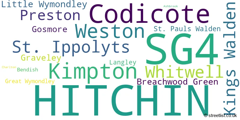
The primary settlement in the SG4 postcode district is Hitchin, located in Hertfordshire, England. Other significant settlements in the district include Ashbrook, Charlton, Gosmore, Graveley, Great Wymondley, Langley, Little Wymondley, Preston, St. Ippolyts, Weston, Bendish, Breachwood Green, Codicote, Kimpton, Kings Walden, St. Pauls Walden, and Whitwell. However, their mention is omitted due to their smaller proportion of the data. The most significant post town in the district is Hitchin.
When it comes to local government, postal geography often disregards political borders. However, this district intersects the following councils: the district mostly encompasses the North Hertfordshire District (887 postal codes), and finally, the Stevenage District (B) area (6 postal codes).
The largest settlement in the SG4 postal code is HITCHIN followed by Codicote, and Kimpton.
The SG4 Postcode shares a border with AL4 (ST. ALBANS, Wheathampstead, Sandridge), AL5 (HARPENDEN), AL6 (WELWYN, Tewin, Ayot St. Peter), LU2 (LUTON, Lilley, London Luton Airport), SG5 (HITCHIN, Stotfold, Fairfield), SG6 (LETCHWORTH GARDEN CITY), SG7 (BALDOCK, Ashwell, Hinxworth), SG1 (STEVENAGE) and SG2 (STEVENAGE, Walkern, Benington).


Schools in the Sector
Highover Junior Mixed and Infant School
Phase: Primary
Address: Cambridge Road , Hitchin
Postcode: SG4 0JP
Headteacher: Mrs Lisa Hayes (Headteacher)
Ofsted Rating: Good
Purwell Primary School
Phase: Primary
Address: Fairfield Way , Hitchin
Postcode: SG4 0PU
Headteacher: Mr Richard Cano (Headteacher)
Ofsted Rating: Requires improvement
Mary Exton Primary School
Phase: Primary
Address: St Michael's Road , Hitchin
Postcode: SG4 0QA
Headteacher: Mrs Angharad Paterson and Mrs Tracy Clements (Headteacher)
Ofsted Rating: Good
Weston Primary & Nursery School
Phase: Primary
Address: Maiden Street , Weston , Hitchin
Postcode: SG4 7AG
Headteacher: Mr Geoff Holmes (Headteacher)
Ofsted Rating: Good
Wymondley Junior Mixed and Infant School
Phase: Primary
Address: Siccut Road , Little Wymondley , Hitchin
Postcode: SG4 7HN
Headteacher: Mrs Alison Chadwick (Headteacher)
Ofsted Rating: Good
Graveley Primary School
Phase: Primary
Address: Ashwell Common , Graveley , Hitchin
Postcode: SG4 7LJ
Headteacher: Mrs Nicky Hand (Headteacher)
Ofsted Rating: Good
St Ippolyts Church of England Aided Primary School
Phase: Primary
Address: Ashbrook Lane , Hitchin
Postcode: SG4 7PB
Headteacher: Rachel Peddie (Headteacher)
Ofsted Rating: Good
Preston Primary School
Phase: Primary
Address: Back Lane , Preston , Hitchin
Postcode: SG4 7UJ
Headteacher: Mrs Jacomina Luitingh (Headteacher)
Ofsted Rating: Good
St Paul's Walden Primary School
Phase: Primary
Address: Bendish Lane , Whitwell , Hitchin
Postcode: SG4 8HX
Headteacher: Mrs Nancy Adshead (Headteacher)
Ofsted Rating: Requires improvement
Breachwood Green Junior Mixed and Infant School
Phase: Primary
Address: Oxford Road , Breachwood Green , Hitchin
Postcode: SG4 8NP
Headteacher: Mrs Kirsty Badham (Headteacher)
Ofsted Rating: Good
Kimpton Primary School
Phase: Primary
Address: High Street , Kimpton , Hitchin
Postcode: SG4 8RB
Headteacher: Mr John Ferguson (Headteacher)
Ofsted Rating: Good
Codicote Church of England Primary School
Phase: Primary
Address: Meadow Way , Codicote , Hitchin
Postcode: SG4 8YL
Headteacher: Mrs Liz Pollard (Headteacher)
Ofsted Rating: Outstanding
Highbury Infant School and Nursery
Phase: Primary
Address: Standhill Road , Hitchin
Postcode: SG4 9AG
Headteacher: Mrs Helen Avey (Headteacher)
Ofsted Rating: Good
Whitehill Junior School
Phase: Primary
Address: Whitehill Road , Hitchin
Postcode: SG4 9HT
Headteacher: Mr Steve Mills (Headteacher)
Ofsted Rating: Good
William Ransom Primary School
Phase: Primary
Address: Stuart Drive , Hitchin
Postcode: SG4 9QB
Headteacher: Mr Tony Plunkett (Headteacher)
Ofsted Rating: Outstanding
St Andrew's Church of England Voluntary Aided Primary School, Hitchin
Phase: Primary
Address: Benslow Lane , Hitchin
Postcode: SG4 9RD
Headteacher: Mrs Laura Murphy (Headteacher)
Ofsted Rating: Outstanding
Hitchin Girls' School
Phase: Secondary
Address: Highbury Road , Hitchin
Postcode: SG4 9RS
Headteacher: Mr James Crowther (Headteacher)
Ofsted Rating: Outstanding
Stations in the Sector
Hitchin
CRS Code: HIT
Operator: GN
Line: East Coast Main Line|Cambridge line
Company: Govia Thameslink Railway (Great Northern)
Accessable Motorway Junctions
A1(M) J8
Average Driving Time from within the district: 6.50
Average Driving Distance: 4.40
Number of Postcodes that can access the Motorway Junction: 821
A1(M) J9
Average Driving Time from within the district: 6.80
Average Driving Distance: 4.57
Number of Postcodes that can access the Motorway Junction: 666
A1(M) J4
Average Driving Time from within the district: 8.16
Average Driving Distance: 6.20
Number of Postcodes that can access the Motorway Junction: 93
A1(M) J7
Average Driving Time from within the district: 8.95
Average Driving Distance: 6.68
Number of Postcodes that can access the Motorway Junction: 882
A1(M) J10
Average Driving Time from within the district: 9.32
Average Driving Distance: 7.37
Number of Postcodes that can access the Motorway Junction: 577
A1(M) J5
Average Driving Time from within the district: 9.47
Average Driving Distance: 6.63
Number of Postcodes that can access the Motorway Junction: 214
A1(M) J3
Average Driving Time from within the district: 10.84
Average Driving Distance: 8.68
Number of Postcodes that can access the Motorway Junction: 1
A1(M) J6
Average Driving Time from within the district: 11.14
Average Driving Distance: 9.02
Number of Postcodes that can access the Motorway Junction: 838
M1 J10
Average Driving Time from within the district: 12.99
Average Driving Distance: 7.68
Number of Postcodes that can access the Motorway Junction: 184
M1 J9
Average Driving Time from within the district: 13.45
Average Driving Distance: 8.36
Number of Postcodes that can access the Motorway Junction: 90
M1 J11
Average Driving Time from within the district: 15.01
Average Driving Distance: 9.67
Number of Postcodes that can access the Motorway Junction: 43
M1 J11A
Average Driving Time from within the district: 16.48
Average Driving Distance: 10.80
Number of Postcodes that can access the Motorway Junction: 1
Weather Forecast for St Paul's Walden
| Time Period | Icon | Description | Temperature | Rain Probability | Wind |
|---|---|---|---|---|---|
| 12:00 to 15:00 | Cloudy | 14.0°C (feels like 11.0°C) | 6.00% | SW 11 mph | |
| 15:00 to 18:00 | Partly cloudy (day) | 14.0°C (feels like 13.0°C) | 6.00% | WSW 7 mph | |
| 18:00 to 21:00 | Clear night | 12.0°C (feels like 11.0°C) | 2.00% | SW 4 mph | |
| 21:00 to 00:00 | Clear night | 10.0°C (feels like 9.0°C) | 1.00% | SW 4 mph |
| Time Period | Icon | Description | Temperature | Rain Probability | Wind |
|---|---|---|---|---|---|
| 00:00 to 03:00 | Clear night | 9.0°C (feels like 8.0°C) | 2.00% | SW 4 mph | |
| 03:00 to 06:00 | Mist | 8.0°C (feels like 7.0°C) | 14.00% | SSW 4 mph | |
| 06:00 to 09:00 | Fog | 8.0°C (feels like 6.0°C) | 16.00% | SSW 7 mph | |
| 09:00 to 12:00 | Fog | 10.0°C (feels like 8.0°C) | 17.00% | SSW 7 mph | |
| 12:00 to 15:00 | Cloudy | 13.0°C (feels like 12.0°C) | 4.00% | SSW 9 mph | |
| 15:00 to 18:00 | Partly cloudy (day) | 14.0°C (feels like 13.0°C) | 2.00% | S 7 mph | |
| 18:00 to 21:00 | Clear night | 12.0°C (feels like 11.0°C) | 0.00% | S 7 mph | |
| 21:00 to 00:00 | Clear night | 10.0°C (feels like 9.0°C) | 0.00% | SSE 9 mph |
| Time Period | Icon | Description | Temperature | Rain Probability | Wind |
|---|---|---|---|---|---|
| 00:00 to 03:00 | Clear night | 10.0°C (feels like 8.0°C) | 0.00% | SSE 9 mph | |
| 03:00 to 06:00 | Clear night | 9.0°C (feels like 7.0°C) | 1.00% | SSE 9 mph | |
| 06:00 to 09:00 | Clear night | 9.0°C (feels like 6.0°C) | 1.00% | SSE 9 mph | |
| 09:00 to 12:00 | Partly cloudy (day) | 11.0°C (feels like 8.0°C) | 2.00% | SSE 11 mph | |
| 12:00 to 15:00 | Cloudy | 14.0°C (feels like 12.0°C) | 4.00% | SSE 13 mph | |
| 15:00 to 18:00 | Sunny day | 15.0°C (feels like 13.0°C) | 1.00% | S 11 mph | |
| 18:00 to 21:00 | Clear night | 13.0°C (feels like 11.0°C) | 2.00% | SSE 11 mph | |
| 21:00 to 00:00 | Partly cloudy (night) | 13.0°C (feels like 11.0°C) | 6.00% | SSE 11 mph |
| Time Period | Icon | Description | Temperature | Rain Probability | Wind |
|---|---|---|---|---|---|
| 00:00 to 03:00 | Light rain shower (night) | 13.0°C (feels like 11.0°C) | 39.00% | S 11 mph | |
| 03:00 to 06:00 | Light rain | 13.0°C (feels like 10.0°C) | 50.00% | SSW 11 mph | |
| 06:00 to 09:00 | Partly cloudy (night) | 11.0°C (feels like 9.0°C) | 11.00% | SSW 9 mph | |
| 09:00 to 12:00 | Partly cloudy (day) | 11.0°C (feels like 9.0°C) | 9.00% | SSW 11 mph | |
| 12:00 to 15:00 | Partly cloudy (day) | 13.0°C (feels like 10.0°C) | 13.00% | SSW 13 mph | |
| 15:00 to 18:00 | Partly cloudy (day) | 12.0°C (feels like 10.0°C) | 13.00% | SW 11 mph | |
| 18:00 to 21:00 | Clear night | 10.0°C (feels like 8.0°C) | 4.00% | SW 11 mph | |
| 21:00 to 00:00 | Clear night | 9.0°C (feels like 6.0°C) | 3.00% | SW 11 mph |
| Time Period | Icon | Description | Temperature | Rain Probability | Wind |
|---|---|---|---|---|---|
| 00:00 to 03:00 | Clear night | 8.0°C (feels like 5.0°C) | 1.00% | SW 9 mph | |
| 03:00 to 06:00 | Clear night | 7.0°C (feels like 5.0°C) | 3.00% | SW 9 mph | |
| 06:00 to 09:00 | Partly cloudy (night) | 8.0°C (feels like 5.0°C) | 6.00% | SW 11 mph | |
| 09:00 to 12:00 | Partly cloudy (day) | 9.0°C (feels like 7.0°C) | 9.00% | SW 11 mph | |
| 12:00 to 15:00 | Cloudy | 12.0°C (feels like 9.0°C) | 14.00% | SW 13 mph | |
| 15:00 to 18:00 | Partly cloudy (day) | 12.0°C (feels like 10.0°C) | 13.00% | SW 13 mph | |
| 18:00 to 21:00 | Cloudy | 11.0°C (feels like 9.0°C) | 8.00% | SW 11 mph | |
| 21:00 to 00:00 | Partly cloudy (night) | 11.0°C (feels like 8.0°C) | 5.00% | SW 11 mph |
| Postal Sector | Delivery Office |
|---|---|
| SG4 0 | Hitchin Delivery Office |
| SG4 7 | Weston Scale Payment Delivery Office |
| SG4 7 | Hitchin Delivery Office |
| SG4 8 | Hitchin Delivery Office |
| SG4 9 | Hitchin Delivery Office |
| SG4 8 | Codicote Scale Payment Delivery Office |
| SG4 8 | Kimpton Scale Payment Delivery Office |
| S | G | 4 | - | X | X | X |
| S | G | 4 | Space | Numeric | Letter | Letter |
Street List for the SG4 District
Current Monthly Rental Prices
| # Bedrooms | Min Price | Max Price | Avg Price |
|---|---|---|---|
| 1 | £775 | £965 | £902 |
| 2 | £1,000 | £2,500 | £1,350 |
| 3 | £1,400 | £1,850 | £1,590 |
| 4 | £2,300 | £3,000 | £2,650 |
Current House Prices
| # Bedrooms | Min Price | Max Price | Avg Price |
|---|---|---|---|
| 1 | £60,000 | £325,000 | £197,680 |
| 2 | £55,000 | £600,000 | £342,462 |
| 3 | £315,000 | £1,600,000 | £585,744 |
| 4 | £565,000 | £1,800,000 | £856,452 |
| 5 | £624,000 | £4,500,000 | £1,412,761 |
| 6 | £650,000 | £1,999,950 | £1,478,990 |
| 11 | £4,250,000 | £4,250,000 | £4,250,000 |
Estate Agents
| Logo | Name | Brand Name | Address | Contact Number |
|---|---|---|---|---|
 | Hitchin | Country Properties | 6 Brand Street, Hitchin, SG5 1HX | 01462 415830 |
 | Hitchin | Michael Graham | 20 Bucklersbury, Hitchin, SG5 1BG | 01462 415316 |
 | Hitchin | Connells | 15 High Street, Hitchin, SG5 1AT | 01462 416422 |
 | Land & New Homes | Ashtons | 32 Bridge Street Hitchin SG5 2DF | 01707 241293 |
 | Hitchin | Norgans Estate Agents | 8 Brand Street, Hitchin, SG5 1HX | 01462 415794 |
- Bendish
- Blackmore End
- Breachwood Green
- Codicote Bottom
- Codicote
- Frogmore
- Gosmore
- Graveley
- Great Wymondley
- Hall's Green
- Hitchin
- Kimpton
- King's Walden
- Langley
- Letchworth
- Ley Green
- Little Almshoe
- Little Wymondley
- Nup End Green
- Peters Green
- Preston
- St Ippolyts
- St Paul's Walden
- Stevenage
- Tea Green
- Temple Dinsley
- The Heath
- Todd's Green
- Weston
- Whitwell
Yearly House Price Averages for the District
| Type of Property | 2018 Average | 2018 Sales | 2017 Average | 2017 Sales | 2016 Average | 2016 Sales | 2015 Average | 2015 Sales |
|---|---|---|---|---|---|---|---|---|
| Detached | £874,738 | 90 | £737,687 | 109 | £690,014 | 105 | £629,934 | 119 |
| Semi-Detached | £460,139 | 130 | £452,489 | 143 | £418,880 | 129 | £386,435 | 157 |
| Terraced | £343,267 | 120 | £365,624 | 129 | £329,567 | 139 | £319,147 | 144 |
| Flats | £262,255 | 129 | £247,921 | 134 | £209,918 | 120 | £195,815 | 133 |