The SG7 postcode district is a postal district located in the SG Stevenage postcode area with a population of 13,840 residents according to the 2021 England and Wales Census.
The area of the SG7 postcode district is 26.60 square miles which is 68.89 square kilometres or 17,023.57 acres.
Currently, the SG7 district has about 438 postcode units spread across 2 geographic postcode sectors.
Given that each sector allows for 400 unique postcode combinations, the district has a capacity of 800 postcodes. With 438 postcodes already in use, this leaves 362 units available.
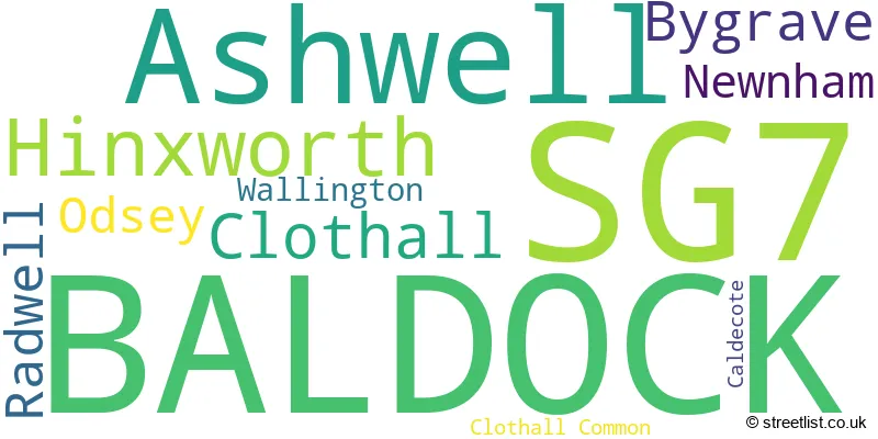
The largest settlement in the SG7 postal code is BALDOCK followed by Ashwell, and Hinxworth.
The SG7 Postcode shares a border with SG4 (HITCHIN, Codicote, Kimpton), SG5 (HITCHIN, Stotfold, Fairfield), SG6 (LETCHWORTH GARDEN CITY), SG9 (BUNTINGFORD, Sandon, Cottered), SG8 (ROYSTON, Melbourn, Bassingbourn), SG18 (BIGGLESWADE, Langford, Upper Caldecote) and SG2 (STEVENAGE, Walkern, Benington).
The primary settlement in the SG7 postcode district is Baldock in Hertfordshire county. Other significant settlements include Ashwell, Bygrave, Hinxworth, Newnham, and Radwell, all located within Hertfordshire county. The most significant post town is Baldock in Hertfordshire.
For the district SG7, we have data on 2 postcode sectors. Here's a breakdown: The sector SG7 5, covers Ashwell and Baldock and Hinxworth in Hertfordshire. The sector SG7 6, covers Baldock in Hertfordshire.

Map of the SG7 Postcode District
Explore the SG7 postcode district by using our free interactive map.

When it comes to local government, postal geography often disregards political borders. However, for a breakdown in the SG7 District: the district mostly encompasses the North Hertfordshire District (431 postcodes), and finally, the South Cambridgeshire District area (8 postcodes).
Recent House Sales in SG7
| Date | Price | Address |
|---|---|---|
| 03/10/2023 | £587,500 | High Street, Ashwell, Baldock, SG7 5NP |
| 14/09/2023 | £525,000 | Chalk Bank Close, Ashwell, Baldock, SG7 5FF |
| 01/09/2023 | £290,000 | Alder Close, Baldock, SG7 6HN |
| 31/08/2023 | £360,000 | Mercia Road, Baldock, SG7 6RZ |
| 31/08/2023 | £480,000 | Mercia Road, Baldock, SG7 6RZ |
| 30/08/2023 | £590,000 | Park Street, Baldock, SG7 6DY |
| 25/08/2023 | £415,000 | Grosvenor Road, Baldock, SG7 6NY |
| 25/08/2023 | £234,000 | Page Close, Baldock, SG7 6PU |
| 25/08/2023 | £400,000 | Jeve Close, Baldock, SG7 6TP |
| 23/08/2023 | £1,375,000 | Springhead, Ashwell, Baldock, SG7 5LL |
Weather Forecast for SG7
Press Button to Show Forecast for Baldock
| Time Period | Icon | Description | Temperature | Rain Probability | Wind |
|---|---|---|---|---|---|
| 09:00 to 12:00 | Light rain | 7.0°C (feels like 4.0°C) | 47.00% | NE 11 mph | |
| 12:00 to 15:00 | Overcast | 9.0°C (feels like 6.0°C) | 17.00% | NE 11 mph | |
| 15:00 to 18:00 | Cloudy | 10.0°C (feels like 8.0°C) | 16.00% | NE 11 mph | |
| 18:00 to 21:00 | Overcast | 9.0°C (feels like 7.0°C) | 19.00% | NE 11 mph | |
| 21:00 to 00:00 | Light rain | 8.0°C (feels like 5.0°C) | 61.00% | NE 11 mph |
Press Button to Show Forecast for Baldock
| Time Period | Icon | Description | Temperature | Rain Probability | Wind |
|---|---|---|---|---|---|
| 00:00 to 03:00 | Heavy rain | 7.0°C (feels like 4.0°C) | 85.00% | NNE 11 mph | |
| 03:00 to 06:00 | Heavy rain | 7.0°C (feels like 4.0°C) | 89.00% | NNE 11 mph | |
| 06:00 to 09:00 | Heavy rain | 8.0°C (feels like 5.0°C) | 88.00% | NE 9 mph | |
| 09:00 to 12:00 | Heavy rain | 8.0°C (feels like 6.0°C) | 86.00% | NNW 9 mph | |
| 12:00 to 15:00 | Heavy rain | 9.0°C (feels like 6.0°C) | 79.00% | NNW 11 mph | |
| 15:00 to 18:00 | Light rain | 10.0°C (feels like 7.0°C) | 49.00% | WNW 11 mph | |
| 18:00 to 21:00 | Cloudy | 10.0°C (feels like 8.0°C) | 9.00% | WNW 7 mph | |
| 21:00 to 00:00 | Cloudy | 8.0°C (feels like 6.0°C) | 6.00% | SW 7 mph |
Press Button to Show Forecast for Baldock
| Time Period | Icon | Description | Temperature | Rain Probability | Wind |
|---|---|---|---|---|---|
| 00:00 to 03:00 | Clear night | 7.0°C (feels like 4.0°C) | 2.00% | SSW 7 mph | |
| 03:00 to 06:00 | Clear night | 5.0°C (feels like 3.0°C) | 2.00% | SSW 7 mph | |
| 06:00 to 09:00 | Sunny day | 6.0°C (feels like 4.0°C) | 1.00% | S 7 mph | |
| 09:00 to 12:00 | Partly cloudy (day) | 11.0°C (feels like 9.0°C) | 1.00% | S 9 mph | |
| 12:00 to 15:00 | Cloudy | 13.0°C (feels like 11.0°C) | 5.00% | S 11 mph | |
| 15:00 to 18:00 | Partly cloudy (day) | 15.0°C (feels like 12.0°C) | 2.00% | S 11 mph | |
| 18:00 to 21:00 | Sunny day | 13.0°C (feels like 11.0°C) | 1.00% | S 9 mph | |
| 21:00 to 00:00 | Clear night | 9.0°C (feels like 7.0°C) | 1.00% | SE 9 mph |
Press Button to Show Forecast for Baldock
| Time Period | Icon | Description | Temperature | Rain Probability | Wind |
|---|---|---|---|---|---|
| 00:00 to 03:00 | Clear night | 8.0°C (feels like 6.0°C) | 1.00% | SE 7 mph | |
| 03:00 to 06:00 | Clear night | 8.0°C (feels like 5.0°C) | 4.00% | SE 7 mph | |
| 06:00 to 09:00 | Sunny day | 9.0°C (feels like 7.0°C) | 6.00% | ESE 7 mph | |
| 09:00 to 12:00 | Cloudy | 13.0°C (feels like 11.0°C) | 7.00% | SE 9 mph | |
| 12:00 to 15:00 | Cloudy | 15.0°C (feels like 13.0°C) | 10.00% | SE 11 mph | |
| 15:00 to 18:00 | Cloudy | 16.0°C (feels like 14.0°C) | 11.00% | SE 9 mph | |
| 18:00 to 21:00 | Light rain shower (day) | 15.0°C (feels like 13.0°C) | 30.00% | ESE 9 mph | |
| 21:00 to 00:00 | Cloudy | 11.0°C (feels like 10.0°C) | 10.00% | ESE 7 mph |
Where is the SG7 Postcode District?
The postcode district SG7 is located in the town of Baldock. It is situated in close proximity to several nearby towns, including Letchworth Garden City to the southwest (3.71 miles away), Henlow to the west (4.52 miles away), Royston to the east (5.51 miles away), Biggleswade to the northwest (6.31 miles away), Stevenage to the south (7.81 miles away), and Buntingford to the southeast (7.82 miles away). Additionally, Baldock is approximately 35.19 miles away from the center of London.
The district is within the post town of BALDOCK.
The sector has postcodes within the nation of England.
The SG7 Postcode District is covers the following regions.
- Hertfordshire - Bedfordshire and Hertfordshire - East of England
- Cambridgeshire CC - East Anglia - East of England
| Postcode Sector | Delivery Office |
|---|---|
| SG7 5 | Ashwell Scale Payment Delivery Office |
| SG7 5 | Letchworth Delivery Office |
| SG7 6 | Letchworth Delivery Office |
| S | G | 7 | - | X | X | X |
| S | G | 7 | Space | Numeric | Letter | Letter |
Tourist Attractions within the Postcode Area
We found 1 visitor attractions within the SG7 postcode area
| Ashwell Village Museum |
|---|
| Museums & Art Galleries |
| Museum and / or Art Gallery |
| View Ashwell Village Museum on Google Maps |
Current Monthly Rental Prices
| # Bedrooms | Min Price | Max Price | Avg Price |
|---|---|---|---|
| £460 | £460 | £460 | |
| 1 | £825 | £995 | £882 |
| 2 | £1,150 | £1,350 | £1,278 |
| 3 | £1,675 | £1,675 | £1,675 |
| 4 | £3,000 | £3,000 | £3,000 |
Current House Prices
| # Bedrooms | Min Price | Max Price | Avg Price |
|---|---|---|---|
| £125,000 | £125,000 | £125,000 | |
| 1 | £95,000 | £325,000 | £168,495 |
| 2 | £200,000 | £550,000 | £315,920 |
| 3 | £300,000 | £725,000 | £498,682 |
| 4 | £550,000 | £1,350,000 | £729,047 |
| 5 | £550,000 | £1,695,000 | £935,833 |
| 6 | £795,000 | £2,000,000 | £1,360,000 |
Estate Agents who Operate in the SG7 District
| Logo | Name | Brand Name | Address | Contact Number | Total Properties |
|---|---|---|---|---|---|
 | Baldock | Country Properties | 39 High Street, Baldock, SG7 6BG | 01462 415848 | 25 |
 | Baldock | Satchells Estate Agents | 8 High Street, Baldock, SG7 6AR | 01462 416048 | 21 |
 | East of England | eXp UK | 51 London Road, Rainham, Kent, ME8 7RG | 03304 609968 | 5 |
 | Royston | Ensum Brown | Kooky Nohmad, 42 High Street, Royston, SG8 9AG | 01763 750070 | 5 |
 | Letchworth Garden City | Connells | 6 Station Parade, Letchworth, SG6 3AR | 01462 415703 | 5 |
| Type of Property | 2018 Average | 2018 Sales | 2017 Average | 2017 Sales | 2016 Average | 2016 Sales | 2015 Average | 2015 Sales |
|---|---|---|---|---|---|---|---|---|
| Detached | £528,613 | 35 | £639,562 | 42 | £621,449 | 40 | £519,725 | 44 |
| Semi-Detached | £368,400 | 39 | £377,551 | 47 | £351,568 | 60 | £332,925 | 64 |
| Terraced | £299,056 | 73 | £293,920 | 65 | £294,038 | 93 | £280,055 | 76 |
| Flats | £242,552 | 59 | £211,796 | 67 | £183,771 | 44 | £160,358 | 56 |