The WA11 postcode district is a postal district located in the WA Warrington postcode area with a population of 39,986 residents according to the 2021 England and Wales Census.
The area of the WA11 postcode district is 18.73 square miles which is 48.51 square kilometres or 11,987.12 acres.
Currently, the WA11 district has about 1023 postcode units spread across 4 geographic postcode sectors.
Given that each sector allows for 400 unique postcode combinations, the district has a capacity of 1,600 postcodes. With 1023 postcodes already in use, this leaves 577 units available.
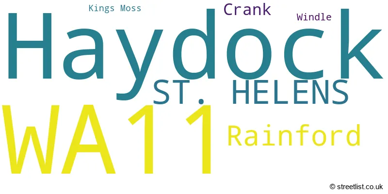
The largest settlement in the WA11 postal code is Haydock followed by ST. HELENS, and Rainford.
The WA11 Postcode shares a border with WA12 (NEWTON-LE-WILLOWS), WN4 (Ashton-in-Makerfield), WN5 (WIGAN, Orrell, Billinge), WN8 (SKELMERSDALE, Upholland, Parbold), WA10 (ST. HELENS, Eccleston, Dentons Green) and WA9 (ST. HELENS, Clock Face, Sutton Manor).
The primary settlement within the WA11 postcode district is St. Helens, located in Merseyside, England. Other significant settlements include Haydock, Crank, and Rainford. The post town for this postcode district is also St. Helens.
For the district WA11, we have data on 4 postcode sectors. Here's a breakdown: The sector WA11 0, covers Haydock in Merseyside. The sector WA11 7, covers St. Helens and Rainford in Merseyside. The sector WA11 8, covers Rainford in Merseyside. The sector WA11 9, covers St. Helens and Haydock in Merseyside.

Map of the WA11 Postcode District
Explore the WA11 postcode district by using our free interactive map.

When it comes to local government, postal geography often disregards political borders. However, for a breakdown in the WA11 District: the district mostly encompasses the St. Helens District (B) area with a total of 1023 postcodes.
Recent House Sales in WA11
| Date | Price | Address |
|---|---|---|
| 09/10/2023 | £130,000 | Lingmell Avenue, St Helens, WA11 7AZ |
| 02/10/2023 | £130,000 | Clipsley Lane, Haydock, St Helens, WA11 0UD |
| 22/09/2023 | £90,000 | Heron Grove, Rainford, St Helens, WA11 8BD |
| 15/09/2023 | £195,000 | Whiteside Road, Haydock, St Helens, WA11 0XN |
| 15/09/2023 | £225,000 | Newlands Road, St Helens, WA11 9AX |
| 08/09/2023 | £265,000 | Cartwright Close, Rainford, St Helens, WA11 8DG |
| 08/09/2023 | £165,000 | Washway Lane, St Helens, WA11 9LN |
| 06/09/2023 | £125,000 | Osullivan Crescent, St Helens, WA11 9RB |
| 05/09/2023 | £73,000 | Lingmell Avenue, St Helens, WA11 7AX |
| 01/09/2023 | £155,000 | Finney Grove, Haydock, St Helens, WA11 0NR |
Weather Forecast for WA11
Press Button to Show Forecast for Rainford
| Time Period | Icon | Description | Temperature | Rain Probability | Wind |
|---|---|---|---|---|---|
| 09:00 to 12:00 | Cloudy | 8.0°C (feels like 6.0°C) | 5.00% | E 9 mph | |
| 12:00 to 15:00 | Cloudy | 10.0°C (feels like 8.0°C) | 7.00% | E 9 mph | |
| 15:00 to 18:00 | Cloudy | 10.0°C (feels like 8.0°C) | 12.00% | ENE 9 mph | |
| 18:00 to 21:00 | Cloudy | 9.0°C (feels like 7.0°C) | 10.00% | ENE 7 mph | |
| 21:00 to 00:00 | Cloudy | 8.0°C (feels like 5.0°C) | 5.00% | ENE 7 mph |
Press Button to Show Forecast for Rainford
| Time Period | Icon | Description | Temperature | Rain Probability | Wind |
|---|---|---|---|---|---|
| 00:00 to 03:00 | Cloudy | 6.0°C (feels like 4.0°C) | 4.00% | NE 7 mph | |
| 03:00 to 06:00 | Cloudy | 5.0°C (feels like 2.0°C) | 5.00% | NNE 7 mph | |
| 06:00 to 09:00 | Cloudy | 5.0°C (feels like 3.0°C) | 10.00% | N 7 mph | |
| 09:00 to 12:00 | Cloudy | 8.0°C (feels like 5.0°C) | 12.00% | NW 9 mph | |
| 12:00 to 15:00 | Overcast | 10.0°C (feels like 7.0°C) | 15.00% | NW 11 mph | |
| 15:00 to 18:00 | Cloudy | 10.0°C (feels like 8.0°C) | 11.00% | WNW 11 mph | |
| 18:00 to 21:00 | Sunny day | 10.0°C (feels like 8.0°C) | 4.00% | W 9 mph | |
| 21:00 to 00:00 | Clear night | 8.0°C (feels like 6.0°C) | 2.00% | SW 7 mph |
Press Button to Show Forecast for Rainford
| Time Period | Icon | Description | Temperature | Rain Probability | Wind |
|---|---|---|---|---|---|
| 00:00 to 03:00 | Partly cloudy (night) | 7.0°C (feels like 5.0°C) | 2.00% | SSW 7 mph | |
| 03:00 to 06:00 | Partly cloudy (night) | 6.0°C (feels like 3.0°C) | 2.00% | S 7 mph | |
| 06:00 to 09:00 | Cloudy | 6.0°C (feels like 3.0°C) | 5.00% | SSE 9 mph | |
| 09:00 to 12:00 | Partly cloudy (day) | 10.0°C (feels like 8.0°C) | 1.00% | SSE 11 mph | |
| 12:00 to 15:00 | Cloudy | 13.0°C (feels like 10.0°C) | 7.00% | S 13 mph | |
| 15:00 to 18:00 | Cloudy | 14.0°C (feels like 11.0°C) | 9.00% | S 13 mph | |
| 18:00 to 21:00 | Cloudy | 13.0°C (feels like 11.0°C) | 8.00% | SSE 13 mph | |
| 21:00 to 00:00 | Partly cloudy (night) | 11.0°C (feels like 9.0°C) | 3.00% | SSE 11 mph |
Press Button to Show Forecast for Rainford
| Time Period | Icon | Description | Temperature | Rain Probability | Wind |
|---|---|---|---|---|---|
| 00:00 to 03:00 | Partly cloudy (night) | 10.0°C (feels like 7.0°C) | 3.00% | SE 11 mph | |
| 03:00 to 06:00 | Partly cloudy (night) | 9.0°C (feels like 6.0°C) | 4.00% | SE 11 mph | |
| 06:00 to 09:00 | Partly cloudy (day) | 9.0°C (feels like 7.0°C) | 2.00% | ESE 11 mph | |
| 09:00 to 12:00 | Sunny day | 13.0°C (feels like 10.0°C) | 3.00% | ESE 13 mph | |
| 12:00 to 15:00 | Partly cloudy (day) | 15.0°C (feels like 12.0°C) | 6.00% | SE 13 mph | |
| 15:00 to 18:00 | Cloudy | 16.0°C (feels like 13.0°C) | 13.00% | SE 11 mph | |
| 18:00 to 21:00 | Light rain shower (day) | 15.0°C (feels like 13.0°C) | 31.00% | ESE 9 mph | |
| 21:00 to 00:00 | Partly cloudy (night) | 13.0°C (feels like 11.0°C) | 7.00% | ESE 9 mph |
Where is the WA11 Postcode District?
The data shows that the WA11 postcode district is located in St. Helens, which is a district town. St. Helens is nearby several other towns, including Skelmersdale to the North, Newton-le-Willows to the South East, and Prescot to the South. It is also close to Wigan to the North East, Ormskirk to the North West, Liverpool to the West, and Leigh to the East. Furthermore, the distance between St. Helens and London is approximately 175.98 miles.
The district is within the post town of ST. HELENS.
The sector has postcodes within the nation of England.
The WA11 Postcode District is covers the following regions.
- East Merseyside - Merseyside - North West (England)
- Chorley and West Lancashire - Lancashire - North West (England)
| Postcode Sector | Delivery Office |
|---|---|
| WA11 0 | St Helens Delivery Office |
| WA11 7 | St Helens Delivery Office |
| WA11 8 | St Helens Delivery Office |
| WA11 9 | St Helens Delivery Office |
| W | A | 1 | 1 | - | X | X | X |
| W | A | 1 | 1 | Space | Numeric | Letter | Letter |
Current Monthly Rental Prices
| # Bedrooms | Min Price | Max Price | Avg Price |
|---|---|---|---|
| £355 | £355 | £355 | |
| 1 | £412 | £542 | £490 |
| 2 | £675 | £925 | £763 |
| 3 | £695 | £1,250 | £921 |
Current House Prices
| # Bedrooms | Min Price | Max Price | Avg Price |
|---|---|---|---|
| £175,000 | £400,000 | £287,500 | |
| 1 | £25,000 | £140,000 | £74,457 |
| 2 | £42,500 | £350,000 | £169,429 |
| 3 | £75,000 | £550,000 | £236,105 |
| 4 | £200,000 | £1,000,000 | £390,338 |
| 5 | £269,950 | £1,350,000 | £525,618 |
Estate Agents who Operate in the WA11 District
| Logo | Name | Brand Name | Address | Contact Number | Total Properties |
|---|---|---|---|---|---|
 | Haydock | Belvoir Sales | 143 Clipsley Lane, Haydock, St. Helens, WA11 0UD | 01744 411219 | 49 |
 | St Helens | Stapleton Derby | 73 Corporation Street St. Helens WA10 1SX | 01744 903754 | 40 |
 | Eccleston | David Davies Sales & Lettings | 168 Kiln Lane, Eccleston, St. Helens, WA10 4RB | 01744 415818 | 26 |
 | St Helens | Ashtons Estate Agency | 14 Hardshaw Street, St. Helens, WA10 1RE | 01744 903769 | 23 |
 | covering Warrington | Purplebricks | Suite 7 First Floor Cranmore Drive Shirley Solihull B90 4RZ | 020 3834 8353 | 11 |
| Type of Property | 2018 Average | 2018 Sales | 2017 Average | 2017 Sales | 2016 Average | 2016 Sales | 2015 Average | 2015 Sales |
|---|---|---|---|---|---|---|---|---|
| Detached | £246,432 | 72 | £249,726 | 77 | £247,701 | 66 | £242,749 | 77 |
| Semi-Detached | £142,718 | 299 | £138,262 | 297 | £123,902 | 269 | £126,028 | 267 |
| Terraced | £92,556 | 124 | £97,341 | 137 | £94,611 | 117 | £89,270 | 128 |
| Flats | £84,250 | 12 | £89,678 | 7 | £86,113 | 8 | £63,111 | 9 |