
Map of the Postcode District
Explore the postcode district by using our interactive map.
Circles represent recorded crime; the larger the circle, the higher the crime rates.
Your support helps keep this site running!
If you enjoy using this website, consider buying me a coffee to help cover hosting costs.
The postcode district located in the WA Warrington postal area , WA15 has a population of 43,533 residents according to the 2021 England and Wales Census.
The area of the district is 8.98 square miles (23.27 square kilometers or 5,750.10 acres).
Where is the WA15 District?
To give you an idea where the district is located we have created the following table showing nearby towns.
Nearest Towns to WA15
| Town | Distance (miles) | Direction |
|---|---|---|
| Altrincham | 1.75 | NW |
| Sale | 3.64 | N |
| Gatley | 3.70 | ENE |
| Wilmslow | 4.81 | SE |
| Cheadle | 5.04 | ENE |
| Stretford | 5.10 | N |
| Knutsford | 5.35 | SSW |
| Cheadle Hulme | 5.36 | E |
| Partington | 5.56 | NW |
| Urmston | 6.10 | NNW |
| Bramhall | 6.47 | E |
| Lymm | 6.63 | W |
| Irlam | 6.72 | NW |
| Stockport | 7.01 | ENE |
| Salford | 7.53 | N |
| Eccles | 7.67 | N |
| Manchester | 7.94 | NNE |
| Hazel Grove | 8.15 | E |
| Poynton | 8.25 | ESE |
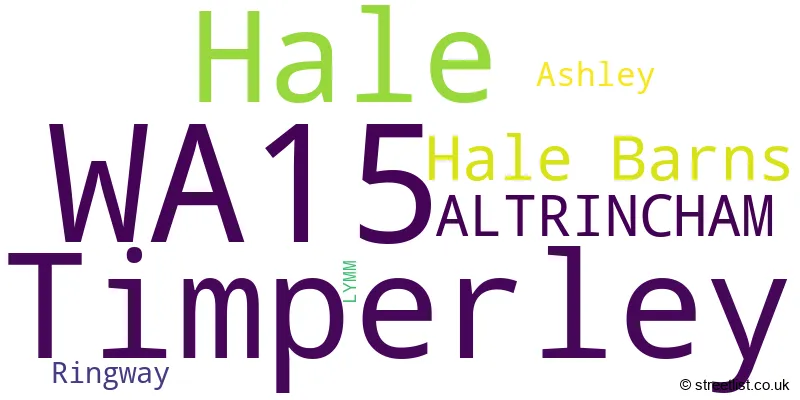
Post towns for this district are ALTRINCHAM, LYMM.
Postcode Information for District WA15 (Total Geographical Postcodes: 1256)
| Location | Post Town | Sector | Number of Postcodes |
|---|---|---|---|
| Timperley | ALTRINCHAM | WA15 7 | 292 |
| Timperley | ALTRINCHAM | WA15 6 | 257 |
| Hale | ALTRINCHAM | WA15 9 | 182 |
| Hale | ALTRINCHAM | WA15 8 | 172 |
| Hale Barns | ALTRINCHAM | WA15 0 | 109 |
| Hale | ALTRINCHAM | WA15 0 | 66 |
| ALTRINCHAM | ALTRINCHAM | WA15 8 | 52 |
| Hale Barns | ALTRINCHAM | WA15 8 | 41 |
| ALTRINCHAM | ALTRINCHAM | WA15 9 | 35 |
| Ashley | ALTRINCHAM | WA15 0 | 20 |
| Ringway | ALTRINCHAM | WA15 8 | 10 |
| Timperley | ALTRINCHAM | WA15 8 | 7 |
| Ringway | ALTRINCHAM | WA15 0 | 6 |
| Hale | ALTRINCHAM | WA15 7 | 5 |
| ALTRINCHAM | ALTRINCHAM | WA15 7 | 2 |
Retail and Shopping in WA15
Street
Town
Locality
Number of Shops
Central Postcode
View on Google Maps
ASHLEY ROAD
ALTRINCHAM
HALE
63
WA15 9SF
View on Google Maps
STOCKPORT ROAD
ALTRINCHAM
TIMPERLEY
48
WA15 7UG
View on Google Maps
HALE ROAD
ALTRINCHAM
HALE BARNS
17
WA15 8SS
View on Google Maps
PARK ROAD
ALTRINCHAM
TIMPERLEY
12
WA15 6TE
View on Google Maps
VICTORIA ROAD
ALTRINCHAM
HALE
10
WA15 9AD
View on Google Maps
STAMFORD PARK ROAD
ALTRINCHAM
HALE
9
WA15 9EZ
View on Google Maps
THORLEY LANE
ALTRINCHAM
TIMPERLEY
8
WA15 7BN
View on Google Maps
HEYES LANE
ALTRINCHAM
TIMPERLEY
7
WA15 6EA
View on Google Maps
MOSS LANE
ALTRINCHAM
HALE
7
WA15 8AN
View on Google Maps
RIDDINGS ROAD
ALTRINCHAM
TIMPERLEY
7
WA15 6BP
View on Google Maps
WOODHOUSE LANE EAST
ALTRINCHAM
TIMPERLEY
7
WA15 6AS
View on Google Maps
BROOMFIELD LANE
ALTRINCHAM
HALE
6
WA15 9AQ
View on Google Maps
PARK ROAD
ALTRINCHAM
HALE
6
WA15 9NN
View on Google Maps
| Street | Town | Locality | Number of Shops | Central Postcode | View on Google Maps |
|---|---|---|---|---|---|
| ASHLEY ROAD | ALTRINCHAM | HALE | 63 | WA15 9SF | View on Google Maps |
| STOCKPORT ROAD | ALTRINCHAM | TIMPERLEY | 48 | WA15 7UG | View on Google Maps |
| HALE ROAD | ALTRINCHAM | HALE BARNS | 17 | WA15 8SS | View on Google Maps |
| PARK ROAD | ALTRINCHAM | TIMPERLEY | 12 | WA15 6TE | View on Google Maps |
| VICTORIA ROAD | ALTRINCHAM | HALE | 10 | WA15 9AD | View on Google Maps |
| STAMFORD PARK ROAD | ALTRINCHAM | HALE | 9 | WA15 9EZ | View on Google Maps |
| THORLEY LANE | ALTRINCHAM | TIMPERLEY | 8 | WA15 7BN | View on Google Maps |
| HEYES LANE | ALTRINCHAM | TIMPERLEY | 7 | WA15 6EA | View on Google Maps |
| MOSS LANE | ALTRINCHAM | HALE | 7 | WA15 8AN | View on Google Maps |
| RIDDINGS ROAD | ALTRINCHAM | TIMPERLEY | 7 | WA15 6BP | View on Google Maps |
| WOODHOUSE LANE EAST | ALTRINCHAM | TIMPERLEY | 7 | WA15 6AS | View on Google Maps |
| BROOMFIELD LANE | ALTRINCHAM | HALE | 6 | WA15 9AQ | View on Google Maps |
| PARK ROAD | ALTRINCHAM | HALE | 6 | WA15 9NN | View on Google Maps |
The primary settlement in the WA15 postcode district is Hale Barns, located in the county of Greater Manchester. Other significant settlements include Hale and Timperley, also in Greater Manchester. The main post town is Altrincham.
When it comes to local government, postal geography often disregards political borders. However, this district intersects the following councils: the district mostly encompasses the Trafford District (B) (1174 postal codes), followed by the Cheshire East (B) area (19 postal codes), and finally, the Manchester District (B) area (17 postal codes).
The largest settlement in the WA15 postal code is Timperley followed by Hale, and Hale Barns.
The WA15 Postcode shares a border with WA14 (ALTRINCHAM, Bowdon, Broadheath), WA16 (KNUTSFORD, Mobberley, High Legh), M22 (MANCHESTER, Wythenshawe), M23 (MANCHESTER, Roundthorn Industrial Estate, Wythenshawe), M90 (Manchester Airport, Airport City) and M33 (SALE).


Schools in the Sector
St Ambrose College
Phase: Secondary
Address: Wicker Lane , Halebarns , Altrincham
Postcode: WA15 0HE
Headteacher: Mr M D Thompson (Headteacher)
Ofsted Rating: Outstanding
Saint Ambrose College
Phase: Secondary
Address: Hale Road , Hale Barns , Altrincham
Postcode: WA15 0HE
Headteacher: Dermot Rainey (Principal)
Ofsted Rating: Good
Elmridge Primary School
Phase: Primary
Address: Wilton Drive , Halebarns , Wilton Drive Halebarns , Altrincham
Postcode: WA15 0JF
Headteacher: Mrs J Appleyard (Headteacher)
Ofsted Rating: Outstanding
Elmridge Primary School
Phase: Primary
Address: Wilton Drive , Hale Barns , Altrincham
Postcode: WA15 0JF
Headteacher: Ms Rebecca Bolton (Headteacher)
Ofsted Rating: Good
Heyes Lane Primary School
Phase: Primary
Address: Crofton Avenue , Timperley , Altrincham
Postcode: WA15 6BZ
Headteacher: Ms Samantha Foord (Acting Headteacher)
Ofsted Rating: Good
Pictor School
Phase: Not applicable
Address: Grove Lane , Timperley
Postcode: WA15 6PH
Headteacher: Mrs Beverley Owens (Headteacher)
Ofsted Rating: Outstanding
Pictor Academy
Phase: Not applicable
Address: Grove Lane , Timperley
Postcode: WA15 6PH
Headteacher: Mr Andrew Taylor (Head of School)
Ofsted Rating: Outstanding
Willows Primary School
Phase: Primary
Address: Victoria Road , Timperley , Altrincham
Postcode: WA15 6PP
Headteacher: Headteacher Kirsten Warren (Headteacher)
Ofsted Rating: Good
St Hugh's Catholic Primary School
Phase: Primary
Address: Park Road , Timperley , Altrincham
Postcode: WA15 6TQ
Headteacher: Mrs Lisa Kelly (Headteacher)
Ofsted Rating: Outstanding
Broomwood Primary School
Phase: Primary
Address: Mainwood Road , Timperley , Altrincham
Postcode: WA15 7JU
Headteacher: Dr Louise Owen (Headteacher)
Ofsted Rating: Good
Cloverlea Primary School
Phase: Primary
Address: Green Lane North , Timperley , Altrincham
Postcode: WA15 7NQ
Headteacher: Mr C McConnell (Headteacher)
Ofsted Rating: Requires improvement
Wellington School
Phase: Secondary
Address: Wellington Road , Timperley , Altrincham
Postcode: WA15 7RH
Headteacher: Stuart Beeley (Headteacher)
Ofsted Rating: Good
St Vincent's Catholic Primary School
Phase: Primary
Address: Orchard Road , Altrincham
Postcode: WA15 8EY
Headteacher: Mrs A Harrop (Headteacher)
Ofsted Rating: Outstanding
Blessed Thomas Holford Catholic College
Phase: Secondary
Address: Urban Road , Altrincham
Postcode: WA15 8HT
Headteacher: Mrs Clare Hogg (Headteacher)
Ofsted Rating: Requires improvement
Well Green Primary School
Phase: Primary
Address: Briony Avenue , Hale , Altrincham
Postcode: WA15 8QA
Headteacher: Mrs Kathryn Markham (Headteacher)
Ofsted Rating: Good
Altrincham College
Phase: Secondary
Address: Green Lane , Timperley , Altrincham
Postcode: WA15 8QW
Headteacher: Ms Kim Earle (Headteacher)
Ofsted Rating: Good
Stamford Park Primary School
Phase: Primary
Address: Cedar Road , Hale , Altrincham
Postcode: WA15 9JB
Headteacher: Mrs Sarah Price (Headteacher)
Ofsted Rating: Good
Stamford Park Infant School
Phase: Primary
Address: Cedar Road , Hale , Altrincham
Postcode: WA15 9JB
Headteacher: Mrs L Johnson (Headteacher)
Ofsted Rating: Outstanding
Stations in the Sector
No stations found in this postcode district.
Accessable Motorway Junctions
M56 J6
Average Driving Time from within the district: 4.69
Average Driving Distance: 2.17
Number of Postcodes that can access the Motorway Junction: 871
M56 J3A
Average Driving Time from within the district: 5.58
Average Driving Distance: 2.73
Number of Postcodes that can access the Motorway Junction: 556
M56 J8
Average Driving Time from within the district: 6.10
Average Driving Distance: 3.39
Number of Postcodes that can access the Motorway Junction: 439
M602 J3
Average Driving Time from within the district: 6.43
Average Driving Distance: 3.06
Number of Postcodes that can access the Motorway Junction: 1
M56 J4
Average Driving Time from within the district: 6.43
Average Driving Distance: 3.10
Number of Postcodes that can access the Motorway Junction: 1159
M56 J2
Average Driving Time from within the district: 6.51
Average Driving Distance: 3.02
Number of Postcodes that can access the Motorway Junction: 43
M56 J5
Average Driving Time from within the district: 6.55
Average Driving Distance: 3.84
Number of Postcodes that can access the Motorway Junction: 1025
M56 J3
Average Driving Time from within the district: 7.03
Average Driving Distance: 4.17
Number of Postcodes that can access the Motorway Junction: 791
M60 J7
Average Driving Time from within the district: 7.46
Average Driving Distance: 3.51
Number of Postcodes that can access the Motorway Junction: 139
M60 J8
Average Driving Time from within the district: 7.91
Average Driving Distance: 4.07
Number of Postcodes that can access the Motorway Junction: 58
M60 J5
Average Driving Time from within the district: 7.92
Average Driving Distance: 3.06
Number of Postcodes that can access the Motorway Junction: 38
M602 J2
Average Driving Time from within the district: 8.05
Average Driving Distance: 4.75
Number of Postcodes that can access the Motorway Junction: 1
M60 J6
Average Driving Time from within the district: 8.12
Average Driving Distance: 3.72
Number of Postcodes that can access the Motorway Junction: 283
M60 J20
Average Driving Time from within the district: 9.42
Average Driving Distance: 4.30
Number of Postcodes that can access the Motorway Junction: 1
M60 J24
Average Driving Time from within the district: 9.68
Average Driving Distance: 4.71
Number of Postcodes that can access the Motorway Junction: 1
M60 J19
Average Driving Time from within the district: 10.24
Average Driving Distance: 4.78
Number of Postcodes that can access the Motorway Junction: 1
Weather Forecast for Hale Barns
| Time Period | Icon | Description | Temperature | Rain Probability | Wind |
|---|---|---|---|---|---|
| 12:00 to 15:00 | Partly cloudy (day) | 13.0°C (feels like 12.0°C) | 2.00% | W 9 mph | |
| 15:00 to 18:00 | Sunny day | 13.0°C (feels like 12.0°C) | 0.00% | W 7 mph | |
| 18:00 to 21:00 | Clear night | 10.0°C (feels like 10.0°C) | 0.00% | SW 2 mph | |
| 21:00 to 00:00 | Partly cloudy (night) | 9.0°C (feels like 8.0°C) | 0.00% | S 4 mph |
| Time Period | Icon | Description | Temperature | Rain Probability | Wind |
|---|---|---|---|---|---|
| 00:00 to 03:00 | Clear night | 8.0°C (feels like 6.0°C) | 0.00% | S 7 mph | |
| 03:00 to 06:00 | Partly cloudy (night) | 8.0°C (feels like 7.0°C) | 0.00% | S 7 mph | |
| 06:00 to 09:00 | Cloudy | 9.0°C (feels like 7.0°C) | 3.00% | S 7 mph | |
| 09:00 to 12:00 | Cloudy | 11.0°C (feels like 9.0°C) | 3.00% | S 9 mph | |
| 12:00 to 15:00 | Cloudy | 13.0°C (feels like 11.0°C) | 3.00% | SSW 9 mph | |
| 15:00 to 18:00 | Partly cloudy (day) | 14.0°C (feels like 12.0°C) | 1.00% | S 9 mph | |
| 18:00 to 21:00 | Cloudy | 12.0°C (feels like 10.0°C) | 5.00% | SSE 9 mph | |
| 21:00 to 00:00 | Partly cloudy (night) | 12.0°C (feels like 10.0°C) | 2.00% | S 11 mph |
| Time Period | Icon | Description | Temperature | Rain Probability | Wind |
|---|---|---|---|---|---|
| 00:00 to 03:00 | Cloudy | 11.0°C (feels like 9.0°C) | 7.00% | SSE 11 mph | |
| 03:00 to 06:00 | Cloudy | 11.0°C (feels like 8.0°C) | 7.00% | SSE 11 mph | |
| 06:00 to 09:00 | Partly cloudy (night) | 10.0°C (feels like 8.0°C) | 1.00% | SSE 11 mph | |
| 09:00 to 12:00 | Overcast | 11.0°C (feels like 9.0°C) | 6.00% | SSE 13 mph | |
| 12:00 to 15:00 | Cloudy | 14.0°C (feels like 11.0°C) | 5.00% | SSE 16 mph | |
| 15:00 to 18:00 | Overcast | 15.0°C (feels like 12.0°C) | 8.00% | SSE 13 mph | |
| 18:00 to 21:00 | Cloudy | 14.0°C (feels like 12.0°C) | 8.00% | SSE 13 mph | |
| 21:00 to 00:00 | Cloudy | 14.0°C (feels like 11.0°C) | 19.00% | SSE 13 mph |
| Time Period | Icon | Description | Temperature | Rain Probability | Wind |
|---|---|---|---|---|---|
| 00:00 to 03:00 | Heavy rain | 13.0°C (feels like 11.0°C) | 73.00% | S 11 mph | |
| 03:00 to 06:00 | Heavy rain shower (night) | 12.0°C (feels like 10.0°C) | 55.00% | S 11 mph | |
| 06:00 to 09:00 | Partly cloudy (night) | 11.0°C (feels like 9.0°C) | 14.00% | SSW 9 mph | |
| 09:00 to 12:00 | Partly cloudy (day) | 11.0°C (feels like 9.0°C) | 14.00% | SSW 11 mph | |
| 12:00 to 15:00 | Light rain shower (day) | 12.0°C (feels like 10.0°C) | 42.00% | SW 11 mph | |
| 15:00 to 18:00 | Light rain shower (day) | 12.0°C (feels like 10.0°C) | 40.00% | SW 11 mph | |
| 18:00 to 21:00 | Partly cloudy (night) | 10.0°C (feels like 8.0°C) | 18.00% | SSW 9 mph | |
| 21:00 to 00:00 | Cloudy | 9.0°C (feels like 7.0°C) | 17.00% | SSW 9 mph |
| Time Period | Icon | Description | Temperature | Rain Probability | Wind |
|---|---|---|---|---|---|
| 00:00 to 03:00 | Cloudy | 9.0°C (feels like 7.0°C) | 13.00% | SSW 9 mph | |
| 03:00 to 06:00 | Cloudy | 8.0°C (feels like 6.0°C) | 19.00% | SSW 9 mph | |
| 06:00 to 09:00 | Light rain shower (night) | 9.0°C (feels like 6.0°C) | 42.00% | SSW 9 mph | |
| 09:00 to 12:00 | Light rain | 10.0°C (feels like 8.0°C) | 54.00% | SW 11 mph | |
| 12:00 to 15:00 | Light rain shower (day) | 12.0°C (feels like 10.0°C) | 45.00% | SW 11 mph | |
| 15:00 to 18:00 | Light rain shower (day) | 12.0°C (feels like 10.0°C) | 42.00% | WSW 11 mph | |
| 18:00 to 21:00 | Partly cloudy (night) | 11.0°C (feels like 9.0°C) | 16.00% | WSW 9 mph | |
| 21:00 to 00:00 | Partly cloudy (night) | 10.0°C (feels like 8.0°C) | 11.00% | WSW 9 mph |
| Postal Sector | Delivery Office |
|---|---|
| WA15 0 | Lymm Scale Payment Delivery Office |
| WA15 0 | Altrincham Delivery Office |
| WA15 6 | Altrincham Delivery Office |
| WA15 7 | Altrincham Delivery Office |
| WA15 8 | Altrincham Delivery Office |
| WA15 9 | Altrincham Delivery Office |
| W | A | 1 | 5 | - | X | X | X |
| W | A | 1 | 5 | Space | Numeric | Letter | Letter |
Tourist Attractions
We found 1 visitor attractions.
| Runway Visitor Park |
|---|
| Visitor Centres |
| Heritage / Visitor Centre |
| View Runway Visitor Park on Google Maps |
Street List for the WA15 District
Current Monthly Rental Prices
| # Bedrooms | Min Price | Max Price | Avg Price |
|---|---|---|---|
| 1 | £800 | £1,100 | £950 |
| 2 | £1,000 | £1,550 | £1,324 |
| 3 | £1,350 | £12,000 | £2,714 |
| 4 | £2,200 | £6,000 | £3,534 |
| 5 | £2,600 | £17,000 | £6,978 |
| 6 | £12,000 | £14,000 | £13,000 |
| 7 | £4,750 | £5,300 | £5,025 |
Current House Prices
| # Bedrooms | Min Price | Max Price | Avg Price |
|---|---|---|---|
| £300,000 | £2,750,000 | £1,580,000 | |
| 1 | £149,950 | £275,000 | £203,317 |
| 2 | £100,000 | £900,000 | £364,721 |
| 3 | £235,000 | £2,000,000 | £524,145 |
| 4 | £375,000 | £1,675,000 | £800,244 |
| 5 | £459,950 | £4,500,000 | £1,607,072 |
| 6 | £900,000 | £4,000,000 | £1,962,083 |
| 8 | £2,250,000 | £2,250,000 | £2,250,000 |
Estate Agents
| Logo | Name | Brand Name | Address | Contact Number |
|---|---|---|---|---|
 | Hale | Ian Macklin | Old Bank Buildings, 160 Ashley Road, Altrincham, Hale, WA15 9SF | 0161 524 3934 |
 | Hale | Watersons | 212 Ashley Road, Hale, WA15 9SN | 0161 524 4860 |
 | Hale | Gascoigne Halman | 176 Ashley Road, Hale, WA15 9SF | 0161 524 9877 |
 | Hale | Jordan Fishwick | 172 Ashley Road Hale WA15 9SF | 0161 524 6068 |
 | Hale | Hibbert Homes | 175 Ashley Road Hale WA15 9SD | 0161 524 2895 |
Yearly House Price Averages for the District
| Type of Property | 2018 Average | 2018 Sales | 2017 Average | 2017 Sales | 2016 Average | 2016 Sales | 2015 Average | 2015 Sales |
|---|---|---|---|---|---|---|---|---|
| Detached | £757,742 | 177 | £848,347 | 187 | £820,241 | 177 | £642,846 | 194 |
| Semi-Detached | £403,544 | 267 | £380,649 | 307 | £382,180 | 317 | £329,093 | 313 |
| Terraced | £342,990 | 126 | £336,526 | 138 | £328,430 | 159 | £295,760 | 193 |
| Flats | £216,850 | 87 | £211,066 | 99 | £209,725 | 130 | £215,395 | 124 |