The SY4 postcode district is a postal district located in the SY Shrewsbury postcode area with a population of 26,534 residents according to the 2021 England and Wales Census.
The area of the SY4 postcode district is 138.76 square miles which is 359.39 square kilometres or 88,807.68 acres.
Currently, the SY4 district has about 1072 postcode units spread across 5 geographic postcode sectors.
Given that each sector allows for 400 unique postcode combinations, the district has a capacity of 2,000 postcodes. With 1072 postcodes already in use, this leaves 928 units available.
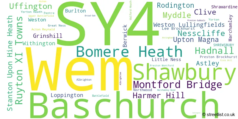
The largest settlement in the SY4 postal code is Wem followed by Baschurch, and Shawbury.
The SY4 Postcode shares a border with TF6 (High Ercall, Allscott, Waters Upton), SY3 (SHREWSBURY, Bicton Heath, Bayston Hill), SY5 (Minsterley, Pontesbury, Dorrington), TF9 (MARKET DRAYTON, Loggerheads, Hinstock), SY1 (SHREWSBURY, Battlefield Enterprise Park), SY12 (ELLESMERE, Cockshutt, Welshampton), SY13 (WHITCHURCH, Prees, Whixall), SY2 (SHREWSBURY) and SY10 (Weston Rhyn, Morda, OSWESTRY).
In the SY4 postcode district, the primary settlement is Shrewsbury, located in the county of Shropshire in England. Other significant settlements in the district include Baschurch, Shawbury, Wem, and Burlton.
For the district SY4, we have data on 6 postcode sectors. Here's a breakdown: The sector SY4 1, covers Montford Bridge and Ruyton Xi Towns and Nesscliffe in Shropshire. The sector SY4 2, covers Baschurch and Weston Lullingfields in Shropshire. The sector SY4 3, covers Bomere Heath and Harmer Hill and Myddle in Shropshire. The sector SY4 4, covers Shawbury and Hadnall and Uffington in Shropshire. The sector SY4 5, covers Wem in Shropshire. The sector SY4 9 is non-geographic. It's often designated for PO Boxes, large organisations, or special services.

Map of the SY4 Postcode District
Explore the SY4 postcode district by using our free interactive map.

When it comes to local government, postal geography often disregards political borders. However, for a breakdown in the SY4 District: the district mostly encompasses the Shropshire (1052 postcodes), and finally, the Telford and Wrekin (B) area (25 postcodes).
Recent House Sales in SY4
| Date | Price | Address |
|---|---|---|
| 27/10/2023 | £265,000 | Fothergill Way, Wem, Shrewsbury, SY4 5NX |
| 09/10/2023 | £330,000 | Astley, Shrewsbury, SY4 4BU |
| 03/10/2023 | £263,000 | Brook Drive, Wem, Shrewsbury, SY4 5HQ |
| 18/09/2023 | £365,000 | Newtown Gardens, Newtown, Shrewsbury, SY4 2HF |
| 15/09/2023 | £575,000 | Summerfield Road, Wem, Shrewsbury, SY4 5BW |
| 08/09/2023 | £245,000 | Pantulf Road, Wem, Shrewsbury, SY4 5LT |
| 08/09/2023 | £160,000 | Pyms Road, Wem, Shrewsbury, SY4 5AT |
| 08/09/2023 | £570,000 | Lower Road, Myddle, Shrewsbury, SY4 3QT |
| 08/09/2023 | £277,500 | Oakhurst Villas, Newtown, Shrewsbury, SY4 5NT |
| 08/09/2023 | £200,000 | Barnfield Avenue, Wem, Shrewsbury, SY4 5HT |
Where is the SY4 Postcode District?
The postcode district SY4 is located in the town of Shrewsbury. It is situated in close proximity to several nearby towns, including Ellesmere to the Northwest (9.42 miles), Whitchurch to the North (12.47 miles), Oswestry to the West (13.42 miles), Market Drayton to the Northeast (13.74 miles), Telford to the Southeast (14.16 miles), and Newport to the East (15.81 miles). Additionally, the distance from SY4 to the center of London is approximately 142.71 miles.
The district is within the post town of SHREWSBURY.
The sector has postcodes within the nation of England.
The SY4 Postcode District is covers the following regions.
- Shropshire CC - Shropshire and Staffordshire - West Midlands (England)
- Telford and Wrekin - Shropshire and Staffordshire - West Midlands (England)
Weather Forecast for SY4
Press Button to Show Forecast for Harmer Hill
| Time Period | Icon | Description | Temperature | Rain Probability | Wind |
|---|---|---|---|---|---|
| 18:00 to 21:00 | Cloudy | 21.0°C (feels like 21.0°C) | 3.00% | ESE 4 mph | |
| 21:00 to 00:00 | Partly cloudy (night) | 16.0°C (feels like 16.0°C) | 0.00% | S 4 mph |
Press Button to Show Forecast for Harmer Hill
| Time Period | Icon | Description | Temperature | Rain Probability | Wind |
|---|---|---|---|---|---|
| 00:00 to 03:00 | Cloudy | 14.0°C (feels like 14.0°C) | 3.00% | SE 4 mph | |
| 03:00 to 06:00 | Cloudy | 13.0°C (feels like 13.0°C) | 3.00% | SE 4 mph | |
| 06:00 to 09:00 | Cloudy | 14.0°C (feels like 14.0°C) | 4.00% | SE 4 mph | |
| 09:00 to 12:00 | Cloudy | 18.0°C (feels like 17.0°C) | 3.00% | SE 7 mph | |
| 12:00 to 15:00 | Cloudy | 21.0°C (feels like 19.0°C) | 4.00% | SE 7 mph | |
| 15:00 to 18:00 | Cloudy | 22.0°C (feels like 20.0°C) | 3.00% | SSE 9 mph | |
| 18:00 to 21:00 | Cloudy | 20.0°C (feels like 20.0°C) | 3.00% | SSE 4 mph | |
| 21:00 to 00:00 | Cloudy | 17.0°C (feels like 16.0°C) | 4.00% | SE 7 mph |
Press Button to Show Forecast for Harmer Hill
| Time Period | Icon | Description | Temperature | Rain Probability | Wind |
|---|---|---|---|---|---|
| 00:00 to 03:00 | Cloudy | 15.0°C (feels like 14.0°C) | 4.00% | ESE 7 mph | |
| 03:00 to 06:00 | Cloudy | 12.0°C (feels like 11.0°C) | 3.00% | ESE 7 mph | |
| 06:00 to 09:00 | Cloudy | 13.0°C (feels like 12.0°C) | 4.00% | ESE 4 mph | |
| 09:00 to 12:00 | Cloudy | 17.0°C (feels like 16.0°C) | 5.00% | ESE 7 mph | |
| 12:00 to 15:00 | Cloudy | 20.0°C (feels like 19.0°C) | 12.00% | SE 9 mph | |
| 15:00 to 18:00 | Light rain shower (day) | 20.0°C (feels like 18.0°C) | 37.00% | S 9 mph | |
| 18:00 to 21:00 | Heavy rain shower (day) | 18.0°C (feels like 18.0°C) | 56.00% | S 7 mph | |
| 21:00 to 00:00 | Cloudy | 15.0°C (feels like 14.0°C) | 13.00% | S 4 mph |
Press Button to Show Forecast for Harmer Hill
| Time Period | Icon | Description | Temperature | Rain Probability | Wind |
|---|---|---|---|---|---|
| 00:00 to 03:00 | Cloudy | 13.0°C (feels like 13.0°C) | 11.00% | S 4 mph | |
| 03:00 to 06:00 | Cloudy | 12.0°C (feels like 12.0°C) | 10.00% | SSW 7 mph | |
| 06:00 to 09:00 | Cloudy | 13.0°C (feels like 11.0°C) | 9.00% | S 7 mph | |
| 09:00 to 12:00 | Cloudy | 15.0°C (feels like 13.0°C) | 18.00% | SSE 11 mph | |
| 12:00 to 15:00 | Light rain | 16.0°C (feels like 13.0°C) | 54.00% | SSE 13 mph | |
| 15:00 to 18:00 | Heavy rain | 16.0°C (feels like 13.0°C) | 79.00% | SSE 13 mph | |
| 18:00 to 21:00 | Heavy rain | 14.0°C (feels like 13.0°C) | 77.00% | SSE 11 mph | |
| 21:00 to 00:00 | Light rain | 13.0°C (feels like 11.0°C) | 56.00% | SE 9 mph |
Press Button to Show Forecast for Harmer Hill
| Time Period | Icon | Description | Temperature | Rain Probability | Wind |
|---|---|---|---|---|---|
| 00:00 to 03:00 | Cloudy | 12.0°C (feels like 10.0°C) | 21.00% | SSE 9 mph | |
| 03:00 to 06:00 | Cloudy | 11.0°C (feels like 9.0°C) | 12.00% | SSE 9 mph | |
| 06:00 to 09:00 | Cloudy | 11.0°C (feels like 9.0°C) | 9.00% | SSE 11 mph | |
| 09:00 to 12:00 | Cloudy | 13.0°C (feels like 11.0°C) | 19.00% | S 13 mph | |
| 12:00 to 15:00 | Light rain shower (day) | 15.0°C (feels like 12.0°C) | 39.00% | SSE 13 mph | |
| 15:00 to 18:00 | Light rain shower (day) | 15.0°C (feels like 13.0°C) | 39.00% | S 13 mph | |
| 18:00 to 21:00 | Light rain shower (day) | 14.0°C (feels like 12.0°C) | 36.00% | S 11 mph | |
| 21:00 to 00:00 | Partly cloudy (night) | 12.0°C (feels like 10.0°C) | 6.00% | S 9 mph |
| Postcode Sector | Delivery Office |
|---|---|
| SY4 1 | Shrewsbury Delivery Office |
| SY4 2 | Shrewsbury Delivery Office |
| SY4 3 | Shrewsbury Delivery Office |
| SY4 4 | Shrewsbury Delivery Office |
| SY4 5 | Shrewsbury Delivery Office |
| SY4 5 | Wem Delivery Office |
| S | Y | 4 | - | X | X | X |
| S | Y | 4 | Space | Numeric | Letter | Letter |
Tourist Attractions within the SY4 Postcode Area
We found 4 visitor attractions within the SY4 postcode area
| THE MOAT SHED |
|---|
| Visitor Centres |
| Heritage / Visitor Centre |
| View THE MOAT SHED on Google Maps |
| Haughmond Abbey |
| Historic Properties |
| Historic Monument / Archaeological Site |
| View Haughmond Abbey on Google Maps |
| Attingham Park |
| Historic Properties |
| Historic House / House and Garden / Palace |
| View Attingham Park on Google Maps |
| Hawkstone Historic Park and Follies |
| Country Parks |
| Country Park |
| View Hawkstone Historic Park and Follies on Google Maps |
Current Monthly Rental Prices
| # Bedrooms | Min Price | Max Price | Avg Price |
|---|---|---|---|
| 1 | £625 | £625 | £625 |
| 2 | £675 | £925 | £823 |
| 3 | £725 | £1,600 | £1,134 |
| 4 | £1,400 | £1,550 | £1,475 |
| 5 | £2,200 | £2,200 | £2,200 |
Current House Prices
| # Bedrooms | Min Price | Max Price | Avg Price |
|---|---|---|---|
| £75,000 | £5,500,000 | £1,087,857 | |
| 1 | £125,000 | £125,000 | £125,000 |
| 2 | £72,500 | £425,000 | £229,748 |
| 3 | £161,210 | £825,000 | £332,446 |
| 4 | £250,000 | £1,500,000 | £504,754 |
| 5 | £350,000 | £4,220,000 | £1,047,308 |
| 6 | £550,000 | £895,000 | £717,500 |
| 9 | £2,000,000 | £2,000,000 | £2,000,000 |
Estate Agents who Operate in the SY4 District
| Logo | Name | Brand Name | Address | Contact Number | Total Properties |
|---|---|---|---|---|---|
 | Wem | Monks Estate & Letting Agents | 13A High Street, Wem, SY4 5AA | 020 3856 8078 | 30 |
 | Shrewsbury | Cooper Green Pooks | 3 Barker Street Shrewsbury Shropshire, SY1 1QF | 01743 652229 | 23 |
 | Shrewsbury | Monks Estate & Letting Agents | 10a Shoplatch, Shrewsbury, Shropshire, SY1 1HL | 01743 652071 | 22 |
 | Shrewsbury | Samuel Wood | 2 Shoplatch, Shrewsbury, SY1 1HF | 01743 652234 | 18 |
 | Shrewsbury | Holland Broadbridge | Agriculture House, 5 Barker Street, Shrewsbury, SY1 1QJ | 01743 652073 | 15 |
- Albrighton
- Astley
- Aston
- Atcham
- Barkers Green
- Baschurch
- Bomere Heath
- Burlton
- Clive
- Edgebolton
- Eyton
- Fauls
- Ford
- Forton Heath
- Grafton
- Grinshill
- Hadnall
- Harmer Hill
- Haston
- Haughton
- Hodnet
- Horton
- Kenstone
- Lee Brockhurst
- Little Ness
- Loppington
- Marchamley
- Marton
- Merrington
- Montford Bridge
- Muckleton
- Myddle
- Mytton
- Nesscliffe
- Newtown
- Noneley
- Northwood
- Pentre
- Peplow
- Petton
- Prees
- Preston Gubbals
- Preston
- Rodington Heath
- Rodington
- Ruyton-XI-Towns
- Sansaw Heath
- Shawbury
- Shotatton
- Shrawardine
- Shrewsbury
- Somerwood
- Stanton upon Hine Heath
- Stanwardine in the Fields
- Uffington
- Upper Battlefield
- Upton Magna
- Walford Heath
- Walford
- Weirbrook
- Wem
- Weston Lullingfields
- Weston
- Westoncommon
- Whixall
- Wilcott Marsh
- Wilcott
- Withington
- Wroxeter
- Wykey
- Yorton Heath
- Yorton
Yearly House Price Averages for the SY4 Postcode District
| Type of Property | 2018 Average | 2018 Sales | 2017 Average | 2017 Sales | 2016 Average | 2016 Sales | 2015 Average | 2015 Sales |
|---|---|---|---|---|---|---|---|---|
| Detached | £341,467 | 301 | £315,563 | 262 | £294,249 | 230 | £289,718 | 241 |
| Semi-Detached | £191,118 | 110 | £182,435 | 136 | £176,807 | 110 | £167,872 | 106 |
| Terraced | £192,410 | 43 | £173,198 | 72 | £191,589 | 54 | £149,821 | 67 |
| Flats | £111,650 | 10 | £125,000 | 5 | £97,445 | 10 | £76,200 | 10 |