The WR7 postcode district is a postal district located in the WR Worcester postcode area with a population of 5,737 residents according to the 2021 England and Wales Census.
The area of the WR7 postcode district is 29.16 square miles which is 75.52 square kilometres or 18,660.81 acres.
Currently, the WR7 district has about 214 postcode units spread across 1 geographic postcode sectors.
Given that each sector allows for 400 unique postcode combinations, the district has a capacity of 400 postcodes. With 214 postcodes already in use, this leaves 186 units available.
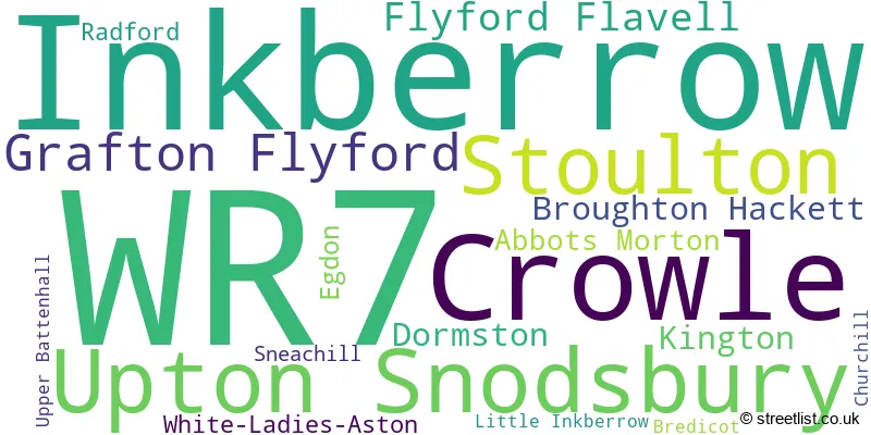
The largest settlement in the WR7 postal code is Inkberrow followed by Crowle, and Upton Snodsbury.
The WR7 Postcode shares a border with WR10 (PERSHORE, Drakes Broughton, Eckington), WR11 (EVESHAM, Badsey, Honeybourne), WR5 (WORCESTER, Kempsey, Whittington), WR9 (DROITWICH, Ombersley, Wychbold), B49 (ALCESTER, Great Alne, Cookhill) and B96 (Astwood Bank, Feckenham, Sambourne).
The primary settlement in the WR7 postcode district is Inkberrow, located in Worcestershire, England. Other significant settlements in the district include Crowle, Grafton Flyford, Stoulton, and Upton Snodsbury. The main post town in the district is Worcester.
For the district WR7, we have data on 1 postcode sectors. Here's a breakdown: The sector WR7 4, covers Inkberrow and Crowle in Worcestershire.
WR7 Postcode Sectors

Map of the WR7 Postcode District
Explore the WR7 postcode district by using our free interactive map.

When it comes to local government, postal geography often disregards political borders. However, for a breakdown in the WR7 District: the district mostly encompasses the Wychavon District (212 postcodes), and finally, the Worcester District (B) area (3 postcodes).
Recent House Sales in WR7
| Date | Price | Address |
|---|---|---|
| 06/10/2023 | £350,000 | Orchard Mead, Inkberrow, Worcester, WR7 4EH |
| 15/09/2023 | £260,000 | Meadow Close, Kington, Worcester, WR7 4DE |
| 12/09/2023 | £415,000 | Withybed Lane, Inkberrow, Worcester, WR7 4JJ |
| 31/08/2023 | £680,000 | White Ladies Aston, Worcester, WR7 4QQ |
| 25/08/2023 | £750,000 | Box Bush Drive, Stoulton, Worcester, WR7 4RG |
| 16/08/2023 | £830,000 | Village Green, Inkberrow, Worcester, WR7 4DZ |
| 15/08/2023 | £677,500 | Old Hill, Flyford Flavell, Worcester, WR7 4DA |
| 28/07/2023 | £450,000 | Netherwood Lane, Crowle, Worcester, WR7 4AB |
| 28/07/2023 | £398,000 | Worcester Road, Upton Snodsbury, Worcester, WR7 4NN |
| 26/07/2023 | £812,000 | Bishampton Road, Flyford Flavell, Worcester, WR7 4BX |
Weather Forecast for WR7
Press Button to Show Forecast for Upton Snodsbury
| Time Period | Icon | Description | Temperature | Rain Probability | Wind |
|---|---|---|---|---|---|
| 00:00 to 03:00 | Cloudy | 6.0°C (feels like 4.0°C) | 16.00% | ENE 9 mph | |
| 03:00 to 06:00 | Overcast | 6.0°C (feels like 3.0°C) | 16.00% | ENE 9 mph | |
| 06:00 to 09:00 | Overcast | 6.0°C (feels like 3.0°C) | 22.00% | ENE 9 mph | |
| 09:00 to 12:00 | Light rain | 7.0°C (feels like 4.0°C) | 46.00% | ENE 11 mph | |
| 12:00 to 15:00 | Overcast | 8.0°C (feels like 5.0°C) | 49.00% | ENE 11 mph | |
| 15:00 to 18:00 | Overcast | 9.0°C (feels like 7.0°C) | 15.00% | NE 9 mph | |
| 18:00 to 21:00 | Overcast | 9.0°C (feels like 6.0°C) | 12.00% | NE 11 mph | |
| 21:00 to 00:00 | Cloudy | 7.0°C (feels like 4.0°C) | 14.00% | NE 11 mph |
Press Button to Show Forecast for Upton Snodsbury
| Time Period | Icon | Description | Temperature | Rain Probability | Wind |
|---|---|---|---|---|---|
| 00:00 to 03:00 | Light rain | 6.0°C (feels like 3.0°C) | 54.00% | NNE 11 mph | |
| 03:00 to 06:00 | Light rain | 6.0°C (feels like 2.0°C) | 56.00% | N 11 mph | |
| 06:00 to 09:00 | Heavy rain | 6.0°C (feels like 2.0°C) | 76.00% | N 11 mph | |
| 09:00 to 12:00 | Heavy rain | 7.0°C (feels like 3.0°C) | 75.00% | NNW 11 mph | |
| 12:00 to 15:00 | Cloudy | 9.0°C (feels like 6.0°C) | 17.00% | NW 9 mph | |
| 15:00 to 18:00 | Cloudy | 11.0°C (feels like 9.0°C) | 11.00% | WNW 9 mph | |
| 18:00 to 21:00 | Partly cloudy (day) | 10.0°C (feels like 9.0°C) | 5.00% | W 7 mph | |
| 21:00 to 00:00 | Partly cloudy (night) | 7.0°C (feels like 5.0°C) | 1.00% | SW 7 mph |
Press Button to Show Forecast for Upton Snodsbury
| Time Period | Icon | Description | Temperature | Rain Probability | Wind |
|---|---|---|---|---|---|
| 00:00 to 03:00 | Clear night | 5.0°C (feels like 3.0°C) | 1.00% | SSW 7 mph | |
| 03:00 to 06:00 | Clear night | 4.0°C (feels like 2.0°C) | 1.00% | S 7 mph | |
| 06:00 to 09:00 | Sunny day | 6.0°C (feels like 3.0°C) | 1.00% | S 7 mph | |
| 09:00 to 12:00 | Partly cloudy (day) | 11.0°C (feels like 9.0°C) | 2.00% | S 13 mph | |
| 12:00 to 15:00 | Cloudy | 13.0°C (feels like 10.0°C) | 6.00% | S 13 mph | |
| 15:00 to 18:00 | Cloudy | 14.0°C (feels like 11.0°C) | 6.00% | S 13 mph | |
| 18:00 to 21:00 | Sunny day | 13.0°C (feels like 10.0°C) | 3.00% | S 11 mph | |
| 21:00 to 00:00 | Clear night | 9.0°C (feels like 7.0°C) | 3.00% | SSE 9 mph |
Press Button to Show Forecast for Upton Snodsbury
| Time Period | Icon | Description | Temperature | Rain Probability | Wind |
|---|---|---|---|---|---|
| 00:00 to 03:00 | Clear night | 8.0°C (feels like 6.0°C) | 3.00% | SE 9 mph | |
| 03:00 to 06:00 | Clear night | 8.0°C (feels like 5.0°C) | 2.00% | SE 9 mph | |
| 06:00 to 09:00 | Sunny day | 8.0°C (feels like 6.0°C) | 2.00% | ESE 9 mph | |
| 09:00 to 12:00 | Sunny day | 13.0°C (feels like 11.0°C) | 6.00% | SE 11 mph | |
| 12:00 to 15:00 | Partly cloudy (day) | 15.0°C (feels like 13.0°C) | 12.00% | SE 13 mph | |
| 15:00 to 18:00 | Partly cloudy (day) | 16.0°C (feels like 13.0°C) | 12.00% | SE 11 mph | |
| 18:00 to 21:00 | Partly cloudy (day) | 14.0°C (feels like 13.0°C) | 12.00% | SE 9 mph | |
| 21:00 to 00:00 | Partly cloudy (night) | 11.0°C (feels like 10.0°C) | 5.00% | ESE 7 mph |
Where is the WR7 Postcode District?
The data provided states that the WR7 postcode district is located in Worcester. Nearby towns include Pershore to the south, Droitwich to the northwest, Alcester to the east, Evesham to the southeast, Studley to the northeast, Bromsgrove to the north, and Malvern to the southwest. This district is approximately 95 miles away from the center of London.
The district is within the post town of WORCESTER.
The sector has postcodes within the nation of England.
The WR7 Postcode District is in the Worcestershire region of Herefordshire, Worcestershire and Warwickshire within the West Midlands (England).
Postcode Sectors within the WR7 District
| Postcode Sector | Delivery Office |
|---|---|
| WR7 4 | Worcester Apc |
| WR7 4 | Flyford Flavel Scale Payment Delivery Office |
| WR7 4 | Inkberrow Scale Payment Delivery Office |
| W | R | 7 | - | X | X | X |
| W | R | 7 | Space | Numeric | Letter | Letter |
Current Monthly Rental Prices
| # Bedrooms | Min Price | Max Price | Avg Price |
|---|
Current House Prices
| # Bedrooms | Min Price | Max Price | Avg Price |
|---|---|---|---|
| £1 | £70,000 | £35,001 | |
| 2 | £399,950 | £795,000 | £597,475 |
| 3 | £440,000 | £650,000 | £538,333 |
| 4 | £385,000 | £1,150,000 | £712,188 |
| 5 | £625,000 | £1,350,000 | £902,143 |
| 6 | £975,000 | £1,150,000 | £1,062,500 |
| 7 | £1,200,000 | £1,200,000 | £1,200,000 |
Estate Agents who Operate in the WR7 District
| Logo | Name | Brand Name | Address | Contact Number | Total Properties |
|---|---|---|---|---|---|
 | Worcester | Fisher German | Global House Hindlip Lane Worcester WR3 8SB | 03300 581934 | 6 |
 | Covering the West Midlands | Andrew Grant | Covering the West Midlands | 01905 673182 | 5 |
 | Worcester | Allan Morris Worcester | 32 Sidbury, Worcester, WR1 2HZ | 01905 917024 | 4 |
 | Redditch | Arden Estates | 373 Evesham Road, Redditch, B97 5JA | 01527 540654 | 3 |
 | Worcestershire | Fox Town and Country | Holy Oak Farm Upton Snodsbury, WR7 4NH | 01905 674825 | 3 |
- Bouts
- Broughton Hackett
- Churchill
- Crowle Green
- Crowle
- Dormston
- Drakes Broughton
- Dunnington
- Flyford Flavell
- Grafton Flyford
- Hawbridge
- Inkberrow
- Kington
- Little Inkberrow
- Naunton Beauchamp
- Oddingley
- Radford
- Rous Lench
- Spetchley
- Stock Green
- Stoulton
- Town's End
- Upper Wolverton
- Upton Snodsbury
- Windmill Hill
- Worcester
| Type of Property | 2018 Average | 2018 Sales | 2017 Average | 2017 Sales | 2016 Average | 2016 Sales | 2015 Average | 2015 Sales |
|---|---|---|---|---|---|---|---|---|
| Detached | £433,223 | 57 | £455,561 | 68 | £427,454 | 81 | £419,362 | 71 |
| Semi-Detached | £289,318 | 11 | £252,295 | 22 | £237,713 | 21 | £265,749 | 19 |
| Terraced | £214,000 | 2 | £214,429 | 7 | £188,000 | 4 | £182,938 | 6 |
| Flats | £0 | 0 | £0 | 0 | £0 | 0 | £0 | 0 |