The AL4 8 postcode sector is within the county of Hertfordshire.
Did you know? According to the 2021 Census, the AL4 8 postcode sector is home to a bustling 6,561 residents!
Given that each sector allows for 400 unique postcode combinations. Letters C, I, K, M, O and V are not allowed in the last two letters of a postcode. With 209 postcodes already in use, this leaves 191 units available.
The AL4 8 postal code covers the settlement of Wheathampstead.
The AL4 8 Postcode shares a border with AL4 9 (ST. ALBANS, Sandridge), AL5 1 (HARPENDEN), AL5 5 (HARPENDEN, Bower Heath), AL6 9 (WELWYN, Ayot St. Peter, Ayot St. Lawrence), AL10 9 (HATFIELD), SG4 8 (Codicote, Kimpton, Whitwell) and AL8 7 (WELWYN GARDEN CITY, Lemsford).
The sector is within the post town of ST. ALBANS.
AL4 8 is a postcode sector within the AL4 postcode district which is within the AL St Albans postcode area.
The Royal Mail delivery office for the AL4 8 postal sector is the St. Albans Delivery Office.
The area of the AL4 8 postcode sector is 6.99 square miles which is 18.11 square kilometres or 4,476.15 square acres.
Waterways within the AL4 8 postcode sector include the River Lea, Lea.

Map of the AL4 8 Postcode Sector
Explore the AL4 8 postcode sector by using our free interactive map.
| A | L | 4 | - | 8 | X | X |
| A | L | 4 | Space | 8 | Letter | Letter |
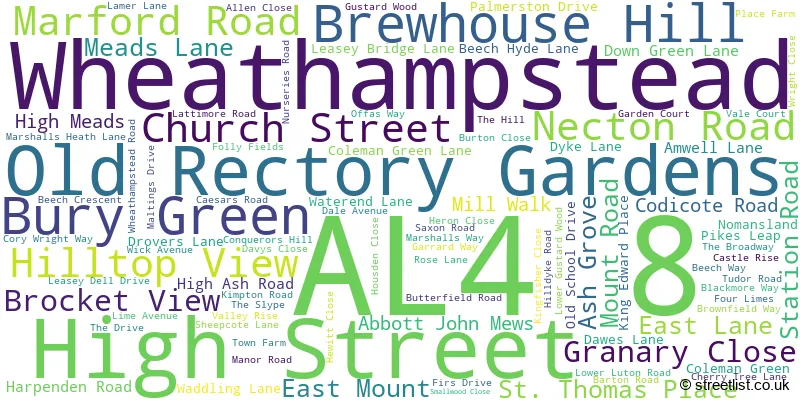
Official List of Streets
Wheathampstead (95 Streets)
Unofficial Streets or Alternative Spellings
Sandridge
TOWER HILL LANE AYOT GREENWAY BALLSLOUGH HILL BATTLEVIEW BLACKMORE MANOR BULL LANE BURY GREEN COTTAGES CANONS FIELD CORY-WRIGHT WAY FERRERS LANE LATCHFORD MEWS MARFORD BRIDGE MEADOW VALE PARKINSON CLOSE PORTERS END LANE SHEEPCOTE LANE, AYOT GREENWAY ST. HELENS CLOSE THE MALTINGS THE PADDOCKS WALNUT COURTHARPENDEN
MACKERYE END MARQUIS LANE PIGGOTTSHILL LANE PIPERS LANE SAUNCEY WOOD LANE WHEATHAMPSTEAD ROADAyot St. Lawrence
BRIDE HALL LANEEast Hyde
LOWER LUTON ROADWeather Forecast for AL4 8
Press Button to Show Forecast for Rothamsted No2
| Time Period | Icon | Description | Temperature | Rain Probability | Wind |
|---|---|---|---|---|---|
| 06:00 to 09:00 | Cloudy | 3.0°C (feels like 1.0°C) | 4.00% | NE 4 mph | |
| 09:00 to 12:00 | Cloudy | 7.0°C (feels like 4.0°C) | 5.00% | ENE 7 mph | |
| 12:00 to 15:00 | Overcast | 9.0°C (feels like 8.0°C) | 10.00% | E 7 mph | |
| 15:00 to 18:00 | Overcast | 9.0°C (feels like 8.0°C) | 13.00% | E 7 mph | |
| 18:00 to 21:00 | Cloudy | 9.0°C (feels like 7.0°C) | 11.00% | E 7 mph | |
| 21:00 to 00:00 | Cloudy | 6.0°C (feels like 4.0°C) | 11.00% | E 7 mph |
Press Button to Show Forecast for Rothamsted No2
| Time Period | Icon | Description | Temperature | Rain Probability | Wind |
|---|---|---|---|---|---|
| 00:00 to 03:00 | Cloudy | 5.0°C (feels like 3.0°C) | 13.00% | ENE 7 mph | |
| 03:00 to 06:00 | Overcast | 5.0°C (feels like 2.0°C) | 17.00% | ENE 7 mph | |
| 06:00 to 09:00 | Cloudy | 5.0°C (feels like 2.0°C) | 24.00% | ENE 9 mph | |
| 09:00 to 12:00 | Overcast | 8.0°C (feels like 5.0°C) | 21.00% | ENE 9 mph | |
| 12:00 to 15:00 | Cloudy | 10.0°C (feels like 8.0°C) | 18.00% | E 11 mph | |
| 15:00 to 18:00 | Cloudy | 11.0°C (feels like 9.0°C) | 18.00% | E 11 mph | |
| 18:00 to 21:00 | Cloudy | 10.0°C (feels like 8.0°C) | 22.00% | ENE 9 mph | |
| 21:00 to 00:00 | Heavy rain | 9.0°C (feels like 6.0°C) | 72.00% | ENE 9 mph |
Press Button to Show Forecast for Rothamsted No2
| Time Period | Icon | Description | Temperature | Rain Probability | Wind |
|---|---|---|---|---|---|
| 00:00 to 03:00 | Heavy rain | 8.0°C (feels like 6.0°C) | 72.00% | ENE 9 mph | |
| 03:00 to 06:00 | Heavy rain | 8.0°C (feels like 5.0°C) | 75.00% | ENE 9 mph | |
| 06:00 to 09:00 | Heavy rain | 8.0°C (feels like 6.0°C) | 75.00% | E 9 mph | |
| 09:00 to 12:00 | Light rain shower (day) | 9.0°C (feels like 7.0°C) | 43.00% | E 9 mph | |
| 12:00 to 15:00 | Heavy rain shower (day) | 11.0°C (feels like 9.0°C) | 57.00% | E 11 mph | |
| 15:00 to 18:00 | Light rain shower (day) | 12.0°C (feels like 9.0°C) | 41.00% | ESE 11 mph | |
| 18:00 to 21:00 | Light rain shower (day) | 11.0°C (feels like 9.0°C) | 37.00% | SW 9 mph | |
| 21:00 to 00:00 | Clear night | 9.0°C (feels like 7.0°C) | 6.00% | SW 7 mph |
Schools and Places of Education Within the AL4 8 Postcode Sector
Beech Hyde Primary School and Nursery
Academy sponsor led
Nurseries Road, St. Albans, Hertfordshire, AL4 8TP
Head: Ms Karen Thomas
Ofsted Rating: Good
Inspection: 2022-09-29 (575 days ago)
Website: Visit Beech Hyde Primary School and Nursery Website
Phone: 01582832661
Number of Pupils: 168
St Helen's Church of England Primary School
Voluntary aided school
Brewhouse Hill, St Albans, Hertfordshire, AL4 8AN
Head: Headteacher Kaye Healy
Ofsted Rating: Good
Inspection: 2018-12-05 (1969 days ago)
Website: Visit St Helen's Church of England Primary School Website
Phone: 01582832106
Number of Pupils: 256

House Prices in the AL4 8 Postcode Sector
| Type of Property | 2018 Average | 2018 Sales | 2017 Average | 2017 Sales | 2016 Average | 2016 Sales | 2015 Average | 2015 Sales |
|---|---|---|---|---|---|---|---|---|
| Detached | £896,977 | 33 | £870,904 | 28 | £734,684 | 30 | £796,055 | 37 |
| Semi-Detached | £606,444 | 27 | £568,094 | 33 | £544,010 | 24 | £484,571 | 28 |
| Terraced | £380,100 | 15 | £409,734 | 19 | £383,610 | 26 | £371,541 | 23 |
| Flats | £302,000 | 9 | £233,740 | 10 | £318,431 | 8 | £286,211 | 14 |
Important Postcodes AL4 8 in the Postcode Sector
AL4 8AN is the postcode for St. Helens C of E Primary School, Brewhouse Hill, St. Helens C of E Primary School, Brewhouse Hill, Wheathampstead, and CLASSROOM EXTENSION, St. Helens C of E Primary School, Brewhouse Hill
AL4 8DJ is the postcode for St. Albans High School for Girls, Wheathampstead House, Codicote Road
AL4 8TP is the postcode for Beech Hyde Primary & Nursery School, Nurseries Road
| The AL4 8 Sector is within these Local Authorities |
|
|---|---|
| The AL4 8 Sector is within these Counties |
|
| The AL4 8 Sector is within these Water Company Areas |
|