
Map of the Postcode District
Explore the postcode district by using our interactive map.
Circles represent recorded crime; the larger the circle, the higher the crime rates.
Your support helps keep this site running!
If you enjoy using this website, consider buying me a coffee to help cover hosting costs.
The postcode district located in the CM Chelmsford postal area , CM4 has a population of 10,413 residents according to the 2021 England and Wales Census.
The area of the district is 25.45 square miles (65.92 square kilometers or 16,290.11 acres).
Where is the CM4 District?
To give you an idea where the district is located we have created the following table showing nearby towns.
Nearest Towns to CM4
| Town | Distance (miles) | Direction |
|---|---|---|
| Billericay | 4.20 | SSE |
| Chelmsford | 5.31 | NE |
| Brentwood | 5.47 | SW |
| Chipping Ongar | 6.25 | WNW |
| Wickford | 7.49 | SE |
| Basildon | 8.23 | SSE |
| South Woodham Ferrers | 10.43 | ESE |
| Stanford-le-Hope | 11.18 | SSE |
| Rayleigh | 11.53 | SE |
| Epping | 11.91 | W |
| Maldon | 12.98 | ENE |
| Great Dunmow | 13.08 | N |
| Sawbridgeworth | 13.52 | NW |
| Witham | 13.57 | NE |
| Harlow | 13.85 | WNW |
| Loughton | 13.87 | W |
| Chigwell | 14.06 | WSW |
| Canvey Island | 14.14 | SE |
| Grays | 14.28 | S |
| Braintree | 15.30 | NNE |
The post town for this district is INGATESTONE.
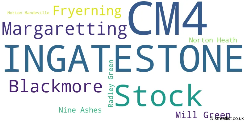
Postcode Information for District CM4 (Total Geographical Postcodes: 435)
| Location | Post Town | Sector | Number of Postcodes |
|---|---|---|---|
| Stock | INGATESTONE | CM4 9 | 110 |
| INGATESTONE | INGATESTONE | CM4 9 | 89 |
| INGATESTONE | INGATESTONE | CM4 0 | 87 |
| Blackmore | INGATESTONE | CM4 0 | 47 |
| Margaretting | INGATESTONE | CM4 9 | 26 |
| Fryerning | INGATESTONE | CM4 0 | 24 |
| Margaretting | INGATESTONE | CM4 0 | 22 |
| Mill Green | INGATESTONE | CM4 0 | 12 |
| Nine Ashes | INGATESTONE | CM4 0 | 7 |
| Radley Green | INGATESTONE | CM4 0 | 5 |
| Norton Heath | INGATESTONE | CM4 0 | 5 |
| Norton Mandeville | INGATESTONE | CM4 0 | 1 |
Retail and Shopping in CM4
Street
Town
Locality
Number of Shops
Central Postcode
View on Google Maps
HIGH STREET
INGATESTONE
46
CM4 9DW
View on Google Maps
| Street | Town | Locality | Number of Shops | Central Postcode | View on Google Maps |
|---|---|---|---|---|---|
| HIGH STREET | INGATESTONE | 46 | CM4 9DW | View on Google Maps |
The primary settlement in the CM4 postcode district is Ingastestone, which is located in the county of Essex in England. Other significant settlements in this postcode district include Blackmore, Fryerning, Margaretting, Mill Green, Nine Ashes, Norton Heath, Norton Mandeville, and Radley Green. Ingastestone has the highest count of postcodes in this district. The most significant post town in the CM4 postcode district is Ingastestone.
When it comes to local government, postal geography often disregards political borders. However, this district intersects the following councils: the district mostly encompasses the Brentwood District (B) (242 postal codes), followed by the Chelmsford District (B) area (164 postal codes), followed by the Epping Forest District area (21 postal codes), and finally, the Basildon District (B) area (5 postal codes).
The largest settlement in the CM4 postal code is INGATESTONE followed by Stock, and Blackmore.
The CM4 Postcode shares a border with CM11 (BILLERICAY, Ramsden Heath, Crays Hill), CM12 (BILLERICAY, Little Burstead), CM13 (Hutton, BRENTWOOD, WEST HORNDON), CM15 (Pilgrims Hatch, Shenfield, BRENTWOOD), CM2 (CHELMSFORD, Great Baddow, West Hanningfield), CM5 (ONGAR, Fyfield, High Ongar), CM1 (CHELMSFORD, Writtle, Springfield) and CM3 (South Woodham Ferrers, Danbury, Hatfield Peverel).


Schools in the Sector
Ingatestone and Fryerning Church of England Voluntary Aided Junior School
Phase: Primary
Address: The Furlongs , Ingatestone
Postcode: CM4 0AL
Headteacher: Mr Neil Taggart (Headteacher)
Ofsted Rating: Good
Ingatestone Infant School
Phase: Primary
Address: Fryerning Lane , Ingatestone
Postcode: CM4 0DF
Headteacher: Mr Neil Taggart (Headteacher)
Ofsted Rating: Good
Anglo European School
Phase: Secondary
Address: Willow Green , Ingatestone
Postcode: CM4 0DJ
Headteacher: Mrs Jody Gee (Headteachers)
Ofsted Rating: Good
Margaretting Church of England Voluntary Controlled Primary School
Phase: Primary
Address: Penny's Lane , Margaretting , Ingatestone
Postcode: CM4 0HA
Headteacher: Mrs Maire O'Regan (Headteacher)
Ofsted Rating: Good
Margaretting Church of England Voluntary Controlled Primary School
Phase: Primary
Address: Penny's Lane , Margaretting , Ingatestone
Postcode: CM4 0HA
Headteacher: Mrs Melissa Taylor (Headteacher)
Ofsted Rating: Good
Blackmore Primary School
Phase: Primary
Address: Nine Ashes Road , Blackmore , Ingatestone
Postcode: CM4 0QR
Headteacher: Mrs Andrea Farrant (Headteacher)
Ofsted Rating: Good
Stock Church of England Primary School
Phase: Primary
Address: Swan Lane , Stock , Ingatestone
Postcode: CM4 9BQ
Headteacher: Mrs Alina Clay (Headteacher)
Ofsted Rating: Good
Stations in the Sector
Ingatestone
CRS Code: INT
Operator: LE
Line: Great Eastern Main Line
Company: Greater Anglia
Accessable Motorway Junctions
M25 J28
Average Driving Time from within the district: 9.95
Average Driving Distance: 8.85
Number of Postcodes that can access the Motorway Junction: 428
M25 J29
Average Driving Time from within the district: 12.07
Average Driving Distance: 10.98
Number of Postcodes that can access the Motorway Junction: 404
M25 J27
Average Driving Time from within the district: 17.03
Average Driving Distance: 15.75
Number of Postcodes that can access the Motorway Junction: 363
M11 J7
Average Driving Time from within the district: 17.15
Average Driving Distance: 13.07
Number of Postcodes that can access the Motorway Junction: 317
M11 J6
Average Driving Time from within the district: 17.36
Average Driving Distance: 16.19
Number of Postcodes that can access the Motorway Junction: 428
M25 J30
Average Driving Time from within the district: 20.22
Average Driving Distance: 18.35
Number of Postcodes that can access the Motorway Junction: 103
M11 J7A
Average Driving Time from within the district: 20.27
Average Driving Distance: 17.15
Number of Postcodes that can access the Motorway Junction: 68
Weather Forecast for Ingatestone
| Time Period | Icon | Description | Temperature | Rain Probability | Wind |
|---|---|---|---|---|---|
| 12:00 to 15:00 | Partly cloudy (day) | 15.0°C (feels like 12.0°C) | 5.00% | WSW 13 mph | |
| 15:00 to 18:00 | Partly cloudy (day) | 15.0°C (feels like 13.0°C) | 8.00% | WSW 9 mph | |
| 18:00 to 21:00 | Clear night | 12.0°C (feels like 11.0°C) | 7.00% | SW 4 mph | |
| 21:00 to 00:00 | Clear night | 10.0°C (feels like 9.0°C) | 0.00% | SW 4 mph |
| Time Period | Icon | Description | Temperature | Rain Probability | Wind |
|---|---|---|---|---|---|
| 00:00 to 03:00 | Cloudy | 10.0°C (feels like 9.0°C) | 15.00% | SW 4 mph | |
| 03:00 to 06:00 | Fog | 9.0°C (feels like 8.0°C) | 17.00% | SW 4 mph | |
| 06:00 to 09:00 | Fog | 9.0°C (feels like 8.0°C) | 18.00% | SSW 4 mph | |
| 09:00 to 12:00 | Fog | 11.0°C (feels like 10.0°C) | 15.00% | SSW 4 mph | |
| 12:00 to 15:00 | Partly cloudy (day) | 15.0°C (feels like 14.0°C) | 1.00% | SSW 7 mph | |
| 15:00 to 18:00 | Partly cloudy (day) | 15.0°C (feels like 14.0°C) | 1.00% | S 7 mph | |
| 18:00 to 21:00 | Clear night | 12.0°C (feels like 11.0°C) | 1.00% | SSE 7 mph | |
| 21:00 to 00:00 | Clear night | 10.0°C (feels like 9.0°C) | 0.00% | SSE 4 mph |
| Time Period | Icon | Description | Temperature | Rain Probability | Wind |
|---|---|---|---|---|---|
| 00:00 to 03:00 | Clear night | 10.0°C (feels like 8.0°C) | 0.00% | SE 7 mph | |
| 03:00 to 06:00 | Clear night | 9.0°C (feels like 7.0°C) | 0.00% | SE 7 mph | |
| 06:00 to 09:00 | Clear night | 9.0°C (feels like 7.0°C) | 1.00% | SE 9 mph | |
| 09:00 to 12:00 | Sunny day | 12.0°C (feels like 10.0°C) | 1.00% | SSE 9 mph | |
| 12:00 to 15:00 | Partly cloudy (day) | 15.0°C (feels like 13.0°C) | 1.00% | S 13 mph | |
| 15:00 to 18:00 | Sunny day | 16.0°C (feels like 13.0°C) | 1.00% | S 11 mph | |
| 18:00 to 21:00 | Clear night | 13.0°C (feels like 12.0°C) | 1.00% | SSE 9 mph | |
| 21:00 to 00:00 | Clear night | 14.0°C (feels like 12.0°C) | 5.00% | SSE 11 mph |
| Time Period | Icon | Description | Temperature | Rain Probability | Wind |
|---|---|---|---|---|---|
| 00:00 to 03:00 | Clear night | 14.0°C (feels like 12.0°C) | 16.00% | S 11 mph | |
| 03:00 to 06:00 | Cloudy | 13.0°C (feels like 11.0°C) | 18.00% | SSW 11 mph | |
| 06:00 to 09:00 | Cloudy | 12.0°C (feels like 10.0°C) | 11.00% | SSW 9 mph | |
| 09:00 to 12:00 | Partly cloudy (day) | 12.0°C (feels like 11.0°C) | 6.00% | SSW 9 mph | |
| 12:00 to 15:00 | Partly cloudy (day) | 14.0°C (feels like 12.0°C) | 8.00% | SSW 13 mph | |
| 15:00 to 18:00 | Partly cloudy (day) | 13.0°C (feels like 11.0°C) | 8.00% | SSW 13 mph | |
| 18:00 to 21:00 | Clear night | 11.0°C (feels like 8.0°C) | 3.00% | SSW 11 mph | |
| 21:00 to 00:00 | Clear night | 9.0°C (feels like 7.0°C) | 1.00% | SW 11 mph |
| Time Period | Icon | Description | Temperature | Rain Probability | Wind |
|---|---|---|---|---|---|
| 00:00 to 03:00 | Clear night | 8.0°C (feels like 6.0°C) | 1.00% | SW 9 mph | |
| 03:00 to 06:00 | Clear night | 8.0°C (feels like 5.0°C) | 1.00% | SW 9 mph | |
| 06:00 to 09:00 | Clear night | 8.0°C (feels like 5.0°C) | 2.00% | SW 9 mph | |
| 09:00 to 12:00 | Sunny day | 10.0°C (feels like 7.0°C) | 4.00% | SW 11 mph | |
| 12:00 to 15:00 | Partly cloudy (day) | 12.0°C (feels like 10.0°C) | 7.00% | SW 13 mph | |
| 15:00 to 18:00 | Cloudy | 13.0°C (feels like 10.0°C) | 13.00% | SW 13 mph | |
| 18:00 to 21:00 | Cloudy | 11.0°C (feels like 9.0°C) | 10.00% | SW 11 mph | |
| 21:00 to 00:00 | Clear night | 11.0°C (feels like 8.0°C) | 5.00% | SW 11 mph |
| Postal Sector | Delivery Office |
|---|---|
| CM4 0 | Ingatestone Scale Payment Delivery Office |
| CM4 0 | Blackmore Scale Payment Delivery Office |
| CM4 9 | Ingatestone Scale Payment Delivery Office |
| C | M | 4 | - | X | X | X |
| C | M | 4 | Space | Numeric | Letter | Letter |
Tourist Attractions
We found 2 visitor attractions.
| Blanket Hall |
|---|
| Historic Properties |
| Other Historic Property |
| View Blanket Hall on Google Maps |
| Ingatestone Hall |
| Historic Properties |
| Historic House / House and Garden / Palace |
| View Ingatestone Hall on Google Maps |
Street List for the CM4 District
Current Monthly Rental Prices
| # Bedrooms | Min Price | Max Price | Avg Price |
|---|---|---|---|
| 1 | £975 | £1,395 | £1,157 |
| 2 | £1,095 | £1,450 | £1,273 |
| 3 | £1,650 | £2,000 | £1,825 |
| 6 | £3,000 | £3,000 | £3,000 |
Current House Prices
| # Bedrooms | Min Price | Max Price | Avg Price |
|---|---|---|---|
| 3 | £2,300,000 | £2,300,000 | £2,300,000 |
| 4 | £1,350,000 | £3,485,000 | £1,888,235 |
| 5 | £1,695,000 | £2,350,000 | £1,886,250 |
| 6 | £1,750,000 | £6,500,000 | £3,383,333 |
Estate Agents
| Logo | Name | Brand Name | Address | Contact Number |
|---|---|---|---|---|
 | Ingatestone | Beresfords | 122 High Street, Ingatestone, CM4 0BA | 01277 674283 |
 | Ingatestone | Walkers | 90 High Street, Ingatestone, CM4 9DW | 01277 674491 |
 | Stock | Chalmers Agency | 38 High Street, Stock, CM4 9BW | 01277 674509 |
 | Ingatestone | Period Homes | 80 High Street, Ingatestone, CM4 9DW | 01277 288000 |
 | Blossom Park | Redrow | Roman Road, Ingatestone, CM4 9AU | 01277 674276 |
Yearly House Price Averages for the District
| Type of Property | 2018 Average | 2018 Sales | 2017 Average | 2017 Sales | 2016 Average | 2016 Sales | 2015 Average | 2015 Sales |
|---|---|---|---|---|---|---|---|---|
| Detached | £944,346 | 64 | £961,436 | 73 | £1,005,272 | 79 | £828,632 | 63 |
| Semi-Detached | £538,768 | 41 | £508,617 | 51 | £487,453 | 43 | £425,072 | 52 |
| Terraced | £481,946 | 18 | £415,860 | 25 | £423,223 | 28 | £407,250 | 17 |
| Flats | £408,962 | 26 | £327,840 | 25 | £317,500 | 18 | £230,309 | 21 |