The PE28 5 postcode sector stands on the Cambridgeshire and Northamptonshire border.
Did you know? According to the 2021 Census, the PE28 5 postcode sector is home to a bustling 7,933 residents!
Given that each sector allows for 400 unique postcode combinations. Letters C, I, K, M, O and V are not allowed in the last two letters of a postcode. With 242 postcodes already in use, this leaves 158 units available.
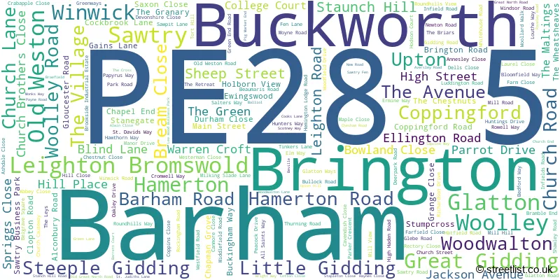
The largest settlement in the PE28 5 postal code is Sawtry followed by Glatton, and Woodwalton.
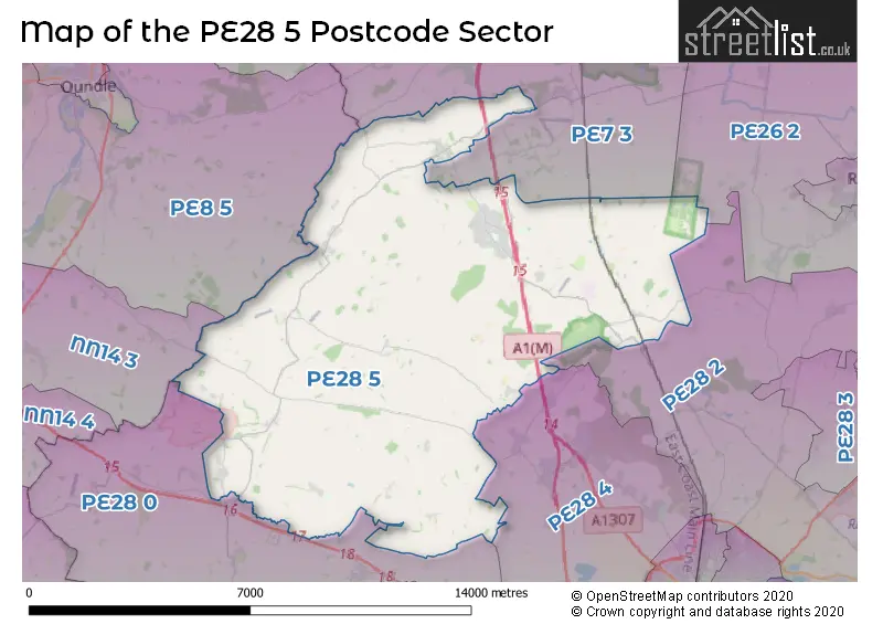
The PE28 5 Postcode shares a border with PE7 3 (Yaxley, Farcet, Stilton), PE26 2 (Ramsey), PE28 0 (Kimbolton, Perry, Ellington), PE28 2 (Warboys, Wyton, Houghton), PE28 4 (Brampton, Alconbury, Alconbury Weald), NN14 3 (Brigstock, Islip, Titchmarsh) and PE8 5 (Barnwell, Oundle, Polebrook).
The sector is within the post town of HUNTINGDON.
PE28 5 is a postcode sector within the PE2 postcode district which is within the PE Peterborough postcode area.
The Royal Mail delivery office for the PE28 5 postal sector is the Peterborough South Postal Delivery Office.
The area of the PE28 5 postcode sector is 50.14 square miles which is 129.86 square kilometres or 32,089.56 square acres.
The PE28 5 postcode sector is crossed by the A1M Major A road.
The PE28 5 postcode sector is crossed by the A14 Major A road.
Waterways within the PE28 5 postcode sector include the Great Raveley Drain, Monks Lode.

Map of the PE28 5 Postcode Sector
Explore the PE28 5 postcode sector by using our free interactive map.
| P | E | 2 | 8 | - | 5 | X | X |
| P | E | 2 | 8 | Space | 5 | Letter | Letter |
Official List of Streets
Sawtry (115 Streets)
Old Weston (7 Streets)
Buckworth (4 Streets)
Leighton Bromswold (6 Streets)
Woodwalton (8 Streets)
Glatton (10 Streets)
Great Gidding (9 Streets)
Brington (5 Streets)
Winwick (6 Streets)
Woolley (1 Streets)
Steeple Gidding (2 Streets)
Upton (6 Streets)
Hamerton (2 Streets)
Barham (2 Streets)
Unofficial Streets or Alternative Spellings
Alconbury Weston
HAMERTON ROADHaddon
BULLOCK ROADCatworth
FOX ROADBythorn
THRAPSTON ROADSchools and Places of Education Within the PE28 5 Postcode Sector
Brington CofE Primary School
Voluntary controlled school
Church Lane, Huntingdon, Cambridgeshire, PE28 5AE
Head: Mr Mark Farrell
Ofsted Rating: Good
Inspection: 2023-01-19 (490 days ago)
Website: Visit Brington CofE Primary School Website
Phone: 01832710383
Number of Pupils: 106
Sawtry Infants' School
Community school
Middlefield Road, Huntingdon, Cambridgeshire, PE28 5SH
Head: Mrs Yasmine Trace
Ofsted Rating: Good
Inspection: 2019-07-04 (1785 days ago)
Website: Visit Sawtry Infants' School Website
Phone: 01487830678
Number of Pupils: 184
Sawtry Junior Academy
Academy converter
Middlefield Road, Huntingdon, Cambridgeshire, PE28 5SH
Head: Mrs Sarah Flack
Ofsted Rating: Good
Inspection: 2019-10-09 (1688 days ago)
Website: Visit Sawtry Junior Academy Website
Phone: 01487830204
Number of Pupils: 275
Sawtry Village Academy
Academy converter
Fen Lane, Huntingdon, Cambridgeshire, PE28 5TQ
Head: Mr Simon Parsons
Ofsted Rating: Good
Inspection: 2023-09-15 (251 days ago)
Website: Visit Sawtry Village Academy Website
Phone: 01487830701
Number of Pupils: 916
House Prices in the PE28 5 Postcode Sector
| Type of Property | 2018 Average | 2018 Sales | 2017 Average | 2017 Sales | 2016 Average | 2016 Sales | 2015 Average | 2015 Sales |
|---|---|---|---|---|---|---|---|---|
| Detached | £370,166 | 71 | £336,917 | 83 | £324,388 | 94 | £300,034 | 99 |
| Semi-Detached | £228,154 | 54 | £227,927 | 45 | £210,571 | 49 | £175,564 | 40 |
| Terraced | £177,000 | 6 | £170,104 | 12 | £180,656 | 16 | £154,049 | 30 |
| Flats | £0 | 0 | £0 | 0 | £0 | 0 | £0 | 0 |
Important Postcodes PE28 5 in the Postcode Sector
PE28 5AE is the postcode for Brington C of E School, Church Lane
PE28 5NX is the postcode for MOBILE BLOCK, Great Gidding C of E Primary School, Main Street
PE28 5SH is the postcode for Sawtry Infants School, Middlefield Road, Sawtry, Sawtry Infants School, Middlefield Road, SAWTRY JUNIOR SCHOOL, MIDDLEFIELD ROAD, SAWTRY, and Sawtry Junior School, Middlefield Road
PE28 5SU is the postcode for Wellside Surgery, 45 High Street
PE28 5TQ is the postcode for Main Block, Sawtry Community College, Fen Lane, FOREIGN LANGUAGES BLOCK, Sawtry Village Academy, Fen Lane, SAWTRY VILLAGE ACADEMY, FEN LANE, SAWTRY, HUMANITIES BLOCK, Sawtry Village Academy, Fen Lane, MAIN BLOCK, Sawtry Village Academy, Fen Lane, and Sawtry Village Academy, Fen Lane
PE28 5UX is the postcode for Sawtry Community Centre, Green End Road
PE28 5UY is the postcode for One Leisure Sawtry, Green End Road
| The PE28 5 Sector is within these Local Authorities |
|
|---|---|
| The PE28 5 Sector is within these Counties |
|
| The PE28 5 Sector is within these Water Company Areas |
|