The LE67 postcode district is a postal district located in the LE Leicester postcode area with a population of 64,811 residents according to the 2021 England and Wales Census.
The area of the LE67 postcode district is 50.27 square miles which is 130.19 square kilometres or 32,171.21 acres.
Currently, the LE67 district has about 1475 postcode units spread across 8 geographic postcode sectors.
Given that each sector allows for 400 unique postcode combinations, the district has a capacity of 3,200 postcodes. With 1475 postcodes already in use, this leaves 1725 units available.
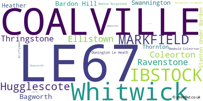
The largest settlement in the LE67 postal code is COALVILLE followed by Whitwick, and IBSTOCK.
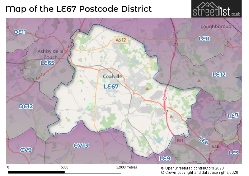
The LE67 Postcode shares a border with CV13 (Market Bosworth, Barlestone, Stoke Golding), DE12 (Measham, Overseal, Moira), LE12 (Shepshed, Sileby, Mountsorrel), LE6 (Groby, Ratby, Newtown Linford), LE65 (ASHBY-DE-LA-ZOUCH, Packington, Worthington) and LE9 (Earl Shilton, Barwell, Broughton Astley).
The primary settlement in the LE67 postcode district is Coalville, located in the county of Leicestershire in England. Other significant settlements within this district include Bagworth, Bardon Hill, Ellistown, Thornton, Donington Le Heath, Heather, Hugglescote, Newton Burgoland, Normanton Le Heath, Ravenstone, Swepstone, Whitwick, Ibstock, Coleorton, Griffydam, Newbold Coleorton, Swannington, Thringstone, Markfield, Copt Oak, Stanton Under Bardon, and Ulverscroft. The most significant post town in this district is Coalville. Leicestershire is the county within which these settlements are located.
For the district LE67, we have data on 9 postcode sectors. Here's a breakdown: The sector LE67 0 is non-geographic. It's often designated for PO Boxes, large organisations, or special services. The sector LE67 1, covers Ellistown and Bagworth and Bardon Hill and Thornton in Leicestershire. The sector LE67 2, covers Hugglescote and Ravenstone and Heather in Leicestershire. The sector LE67 3, covers Coalville in Leicestershire. The sector LE67 4, covers Coalville in Leicestershire. The sector LE67 5, covers Whitwick in Leicestershire. The sector LE67 6, covers Ibstock in Leicestershire. The sector LE67 8, covers Coleorton and Thringstone and Swannington in Leicestershire. The sector LE67 9, covers Markfield and Stanton Under Bardon in Leicestershire.

Map of the LE67 Postcode District
Explore the LE67 postcode district by using our free interactive map.
When it comes to local government, postal geography often disregards political borders. However, for a breakdown in the LE67 District: the district mostly encompasses the North West Leicestershire District (1308 postcodes), followed by the Hinckley and Bosworth District (B) area (203 postcodes), and finally, the Charnwood District (B) area (12 postcodes).
Recent House Sales in LE67
| Date | Price | Address |
|---|---|---|
| 27/10/2023 | £290,000 | London Road, Coalville, LE67 3JD |
| 26/10/2023 | £440,000 | Beesley Lane, Ravenstone, Coalville, LE67 2EP |
| 24/10/2023 | £270,000 | St Davids Crescent, Coalville, LE67 4ST |
| 29/09/2023 | £204,436 | Devana Avenue, Coalville, LE67 4BQ |
| 29/09/2023 | £425,000 | Willow Woods Close, Newbold Coleorton, Coalville, LE67 8AR |
| 29/09/2023 | £330,000 | Spring Lane, Swannington, Coalville, LE67 8QQ |
| 28/09/2023 | £252,000 | Staples Drive, Coalville, LE67 4GB |
| 26/09/2023 | £265,000 | Jackson Road, Bagworth, Coalville, LE67 1HL |
| 25/09/2023 | £265,000 | Castle Rock Drive, Coalville, LE67 4SE |
| 22/09/2023 | £285,000 | Argyle Street, Ibstock, LE67 6NB |
Weather Forecast for LE67
Press Button to Show Forecast for Coalville
| Time Period | Icon | Description | Temperature | Rain Probability | Wind |
|---|---|---|---|---|---|
| 06:00 to 09:00 | Partly cloudy (day) | 2.0°C (feels like 0.0°C) | 1.00% | NE 4 mph | |
| 09:00 to 12:00 | Partly cloudy (day) | 6.0°C (feels like 4.0°C) | 1.00% | NE 7 mph | |
| 12:00 to 15:00 | Cloudy | 8.0°C (feels like 7.0°C) | 9.00% | ENE 4 mph | |
| 15:00 to 18:00 | Cloudy | 9.0°C (feels like 8.0°C) | 7.00% | ENE 4 mph | |
| 18:00 to 21:00 | Cloudy | 7.0°C (feels like 5.0°C) | 8.00% | ENE 7 mph | |
| 21:00 to 00:00 | Partly cloudy (night) | 4.0°C (feels like 2.0°C) | 7.00% | ENE 7 mph |
Press Button to Show Forecast for Coalville
| Time Period | Icon | Description | Temperature | Rain Probability | Wind |
|---|---|---|---|---|---|
| 00:00 to 03:00 | Partly cloudy (night) | 3.0°C (feels like 1.0°C) | 7.00% | ENE 4 mph | |
| 03:00 to 06:00 | Cloudy | 2.0°C (feels like 0.0°C) | 12.00% | NE 4 mph | |
| 06:00 to 09:00 | Cloudy | 3.0°C (feels like 1.0°C) | 11.00% | NE 7 mph | |
| 09:00 to 12:00 | Cloudy | 7.0°C (feels like 4.0°C) | 13.00% | ENE 9 mph | |
| 12:00 to 15:00 | Overcast | 9.0°C (feels like 7.0°C) | 20.00% | E 9 mph | |
| 15:00 to 18:00 | Overcast | 10.0°C (feels like 7.0°C) | 22.00% | ENE 11 mph | |
| 18:00 to 21:00 | Cloudy | 9.0°C (feels like 6.0°C) | 18.00% | ENE 11 mph | |
| 21:00 to 00:00 | Cloudy | 7.0°C (feels like 3.0°C) | 20.00% | NE 11 mph |
Press Button to Show Forecast for Coalville
| Time Period | Icon | Description | Temperature | Rain Probability | Wind |
|---|---|---|---|---|---|
| 00:00 to 03:00 | Cloudy | 6.0°C (feels like 3.0°C) | 21.00% | NE 11 mph | |
| 03:00 to 06:00 | Light rain | 6.0°C (feels like 2.0°C) | 51.00% | NE 13 mph | |
| 06:00 to 09:00 | Heavy rain | 6.0°C (feels like 3.0°C) | 77.00% | NE 13 mph | |
| 09:00 to 12:00 | Heavy rain | 8.0°C (feels like 5.0°C) | 77.00% | NNE 11 mph | |
| 12:00 to 15:00 | Heavy rain | 9.0°C (feels like 7.0°C) | 74.00% | NE 11 mph | |
| 15:00 to 18:00 | Light rain | 9.0°C (feels like 7.0°C) | 51.00% | N 11 mph | |
| 18:00 to 21:00 | Light rain | 9.0°C (feels like 7.0°C) | 47.00% | N 9 mph | |
| 21:00 to 00:00 | Overcast | 7.0°C (feels like 5.0°C) | 14.00% | SSE 7 mph |
Where is the LE67 Postcode District?
The postcode district LE67 is located in Coalville, a town in the East Midlands region of England. Coalville is situated in close proximity to several nearby towns, including Ibstock to the southwest (2.15 miles away), Markfield to the east (3.36 miles away), Ashby-de-la-Zouch to the northwest (5.43 miles away), Loughborough to the northeast (6.92 miles away), Swadlincote to the west (8.16 miles away), Leicester to the southeast (11.28 miles away), and Hinckley to the south (12.11 miles away). Additionally, the distance from Coalville to London is 98.28 miles.
The district covers the post towns of COALVILLE, IBSTOCK, MARKFIELD.
The sector has postcodes within the nation of England.
The LE67 Postcode District is in the Leicestershire CC and Rutland region of Leicestershire, Rutland and Northamptonshire within the East Midlands (England).
| Postcode Sector | Delivery Office |
|---|---|
| LE67 1 | Markfield Scale Payment Delivery Office |
| LE67 1 | Bagworth Scale Payment Delivery Office |
| LE67 1 | Coalville Delivery Office |
| LE67 2 | Coalville Delivery Office |
| LE67 3 | Coalville Delivery Office |
| LE67 4 | Coalville Delivery Office |
| LE67 5 | Coalville Delivery Office |
| LE67 6 | Coalville Delivery Office |
| LE67 6 | Ibstock Scale Payment Delivery Office |
| LE67 8 | Coalville Delivery Office |
| LE67 9 | Markfield Scale Payment Delivery Office |
| L | E | 6 | 7 | - | X | X | X |
| L | E | 6 | 7 | Space | Numeric | Letter | Letter |
Tourist Attractions within the Postcode Area
We found 1 visitor attractions within the LE67 postcode area
| Donington le Heath Manor House |
|---|
| Museums & Art Galleries |
| Museum and / or Art Gallery |
| View Donington le Heath Manor House on Google Maps |
Current Monthly Rental Prices
| # Bedrooms | Min Price | Max Price | Avg Price |
|---|---|---|---|
| £700 | £700 | £700 | |
| 1 | £425 | £650 | £499 |
| 2 | £550 | £1,200 | £841 |
| 3 | £795 | £1,450 | £1,018 |
| 4 | £1,100 | £1,950 | £1,533 |
| 6 | £450 | £3,500 | £2,400 |
Current House Prices
| # Bedrooms | Min Price | Max Price | Avg Price |
|---|---|---|---|
| £75,500 | £1,350,000 | £422,625 | |
| 1 | £92,500 | £209,950 | £132,175 |
| 2 | £76,000 | £570,000 | £214,715 |
| 3 | £110,000 | £1,350,000 | £292,991 |
| 4 | £125,000 | £2,100,000 | £403,767 |
| 5 | £250,000 | £1,250,000 | £605,674 |
| 6 | £280,000 | £1,900,000 | £925,995 |
| 7 | £1,000,000 | £4,000,000 | £2,500,000 |
Estate Agents who Operate in the LE67 District
| Logo | Name | Brand Name | Address | Contact Number | Total Properties |
|---|---|---|---|---|---|
 | Coalville | Newton Fallowell | 1 Belvoir Road, Coalville Leicestershire LE67 3PD | 01530 441467 | 61 |
 | Coalville | Sinclair Estate Agents | 3 Belvoir Road Coalville LE67 3PD | 01530 443552 | 41 |
 | Coalville | Your Move | 2 Belvoir Road, Coalville, LE67 3PE | 01530 440753 | 37 |
 | Coalville | S P Sales & Lettings | 7 Belvoir Road, Coalville, LE67 3PD | 01530 442965 | 31 |
 | Coalville | Frank Innes | 13 Belvoir Road Coalville LE67 3PD | 01530 443551 | 23 |
- Ashby-de-la-Zouch
- Bagworth
- Bardon
- Battram
- Belcher's Bar
- Coalville
- Coleorton
- Donington le Heath
- Ellistown
- Griffydam
- Heather
- Hugglescote
- Ibstock
- Markfield
- Merry Lees
- Newbold
- Newton Burgoland
- Normanton le Heath
- Oaks in Charnwood
- Osgathorpe
- Ravenstone
- Sinope
- Stanton under Bardon
- Swannington
- Swepstone
- Thornton
- Thringstone
- Whitwick
- Woodhouse Eaves
| Type of Property | 2018 Average | 2018 Sales | 2017 Average | 2017 Sales | 2016 Average | 2016 Sales | 2015 Average | 2015 Sales |
|---|---|---|---|---|---|---|---|---|
| Detached | £276,954 | 613 | £270,414 | 619 | £260,093 | 548 | £237,843 | 455 |
| Semi-Detached | £174,841 | 467 | £165,233 | 511 | £160,083 | 412 | £147,880 | 383 |
| Terraced | £131,656 | 316 | £129,952 | 355 | £121,186 | 358 | £115,599 | 323 |
| Flats | £123,056 | 26 | £121,512 | 13 | £115,799 | 28 | £86,339 | 16 |