The SG12 7 postcode sector is within the county of Hertfordshire.
Did you know? According to the 2021 Census, the SG12 7 postcode sector is home to a bustling 9,509 residents!
Given that each sector allows for 400 unique postcode combinations. Letters C, I, K, M, O and V are not allowed in the last two letters of a postcode. With 214 postcodes already in use, this leaves 186 units available.
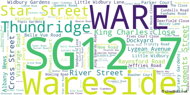
The largest settlement in the SG12 7 postal code is WARE followed by Wareside, and Thundridge.
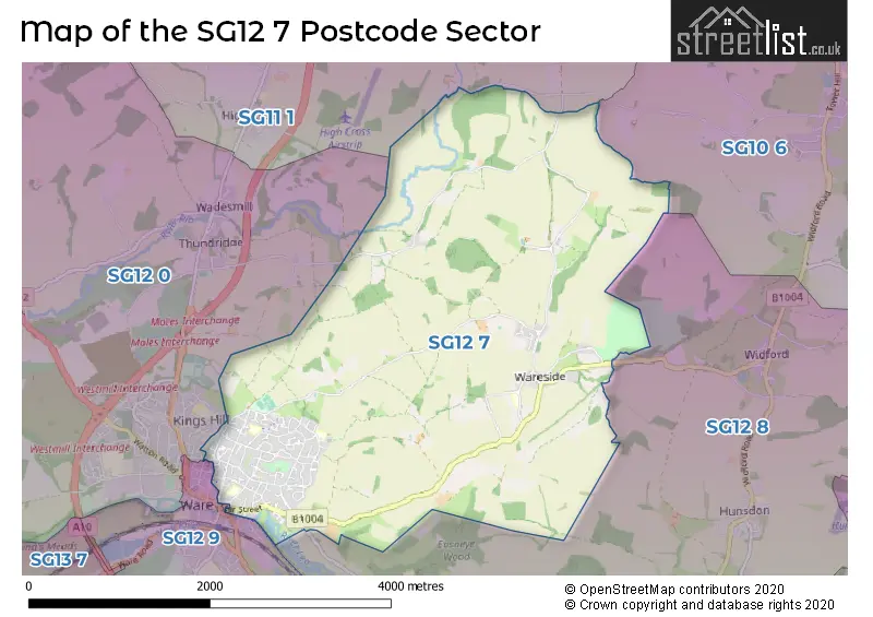
The SG12 7 Postcode shares a border with SG10 6 (MUCH HADHAM), SG11 1 (Puckeridge, Standon, High Cross), SG12 0 (WARE, Dane End, Thundridge), SG12 9 (WARE, Great Amwell) and SG12 8 (Stanstead Abbotts, Hunsdon, Widford).
The sector is within the post town of WARE.
SG12 7 is a postcode sector within the SG12 postcode district which is within the SG Stevenage postcode area.
The Royal Mail delivery office for the SG12 7 postal sector is the Ware Delivery Office.
The area of the SG12 7 postcode sector is 6.48 square miles which is 16.78 square kilometres or 4,146.44 square acres.
Waterways within the SG12 7 postcode sector include the Lee Navigation, River Rib, Nimney Bourne.

Map of the SG12 7 Postcode Sector
Explore the SG12 7 postcode sector by using our free interactive map.
| S | G | 1 | 2 | - | 7 | X | X |
| S | G | 1 | 2 | Space | 7 | Letter | Letter |
Official List of Streets
WARE (86 Streets)
Wareside (6 Streets)
Thundridge (1 Streets)
Unofficial Streets or Alternative Spellings
Schools and Places of Education Within the SG12 7 Postcode Sector
Christ Church CofE (VA) Primary School and Nursery
Voluntary aided school
New Road, Ware, Hertfordshire, SG12 7BT
Head: Mrs Ania Vaughan
Ofsted Rating: Good
Inspection: 2023-07-20 (314 days ago)
Website: Visit Christ Church CofE (VA) Primary School and Nursery Website
Phone: 01920462158
Number of Pupils: 311
Larkspur Academy
Academy sponsor led
Tower Road, Ware, Hertfordshire, SG12 7LP
Head: Mrs Kerry McEwan
Ofsted Rating: Good
Inspection: 2023-01-12 (503 days ago)
Website: Visit Larkspur Academy Website
Phone: 01920411000
Number of Pupils: 113
Priors Wood Primary School
Community school
Cozens Road, Ware, Hertfordshire, SG12 7HZ
Head: Mr Alan Bishop
Ofsted Rating: Good
Inspection: 2021-06-16 (1078 days ago)
Website: Visit Priors Wood Primary School Website
Phone: 01920464135
Number of Pupils: 203
House Prices in the SG12 7 Postcode Sector
| Type of Property | 2018 Average | 2018 Sales | 2017 Average | 2017 Sales | 2016 Average | 2016 Sales | 2015 Average | 2015 Sales |
|---|---|---|---|---|---|---|---|---|
| Detached | £670,833 | 12 | £700,955 | 11 | £550,068 | 22 | £515,652 | 28 |
| Semi-Detached | £430,164 | 45 | £457,272 | 55 | £386,711 | 42 | £368,947 | 42 |
| Terraced | £394,089 | 49 | £383,484 | 48 | £414,584 | 64 | £355,267 | 65 |
| Flats | £246,814 | 46 | £243,119 | 50 | £230,416 | 54 | £208,540 | 61 |
Important Postcodes SG12 7 in the Postcode Sector
SG12 7BT is the postcode for Christ Church (C of E) VA Primary & Nursery School, New Road
SG12 7HZ is the postcode for Priors Wood Primary School, Cozens Road, and Priors Wood Primary School, Cozens Road,
SG12 7LP is the postcode for Larkspur Academy, Tower Road
| The SG12 7 Sector is within these Local Authorities |
|
|---|---|
| The SG12 7 Sector is within these Counties |
|
| The SG12 7 Sector is within these Water Company Areas |
|