The NN7 postcode district is a postal district located in the NN Northampton postcode area with a population of 30,086 residents according to the 2021 England and Wales Census.
The area of the NN7 postcode district is 89.20 square miles which is 231.04 square kilometres or 57,090.30 acres.
Currently, the NN7 district has about 814 postcode units spread across 4 geographic postcode sectors.
Given that each sector allows for 400 unique postcode combinations, the district has a capacity of 1,600 postcodes. With 814 postcodes already in use, this leaves 786 units available.
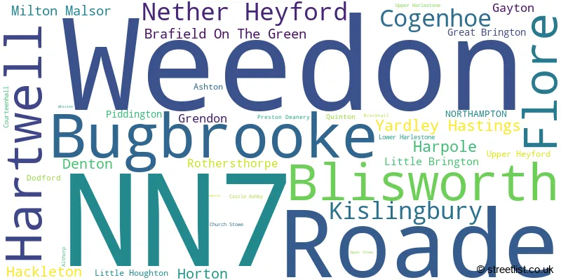
The largest settlement in the NN7 postal code is Weedon followed by Roade, and Bugbrooke.
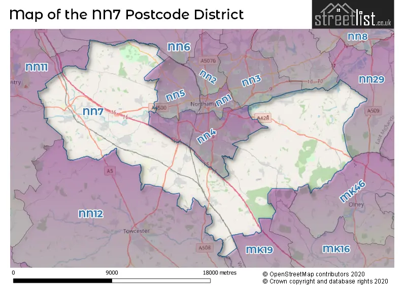
The NN7 Postcode shares a border with NN11 (DAVENTRY, Woodford Halse, Braunston), MK46 (OLNEY, Lavendon, Emberton), NN12 (TOWCESTER, Silverstone, Potterspury), MK16 (NEWPORT PAGNELL, Sherington, North Crawley), MK19 (Hanslope, Deanshanger, Old Stratford), NN29 (Irchester, Wollaston, Bozeat), NN3 (NORTHAMPTON, Moulton, Little Billing), NN4 (NORTHAMPTON, Wootton, Grange Park), NN5 (NORTHAMPTON, Upton, Duston) and NN6 (Earls Barton, Brixworth, Long Buckby).
The primary settlement in the NN7 postcode district is Northampton, located in the county of Northamptonshire, England. Other significant settlements in this postcode district include Brafield On The Green, Castle Ashby, Cogenhoe, Denton, Grendon, Little Houghton, Whiston, Yardley Hastings, Ashton, Courteenhall, Hackleton, Hartwell, Horton, Piddington, Preston Deanery, Quinton, Roade, Blisworth, Bugbrooke, Gayton, Milton Malsor, Nether Heyford, Rothersthorpe, Upper Heyford, Althorp, Brockhall, Church Stowe, Dodford, Flore, Great Brington, Harlestone, Harpole, Kislingbury, Little Brington, Lower Harlestone, Muscott, Nobottle, Upper Harlestone, Upper Heyford, Upper Stowe, and Weedon. The most significant post town in this postcode district is Northampton.
For the district NN7, we have data on 5 postcode sectors. Here's a breakdown: The sector NN7 1, covers Cogenhoe and Yardley Hastings and Denton and Brafield On The Green and Grendon in Northamptonshire. The sector NN7 2, covers Roade and Hartwell and Hackleton and Horton in Northamptonshire. The sector NN7 3, covers Bugbrooke and Blisworth and Nether Heyford in Northamptonshire. The sector NN7 4, covers Weedon and Flore and Kislingbury and Harpole in Northamptonshire. The sector NN7 9 is non-geographic. It's often designated for PO Boxes, large organisations, or special services.

Map of the NN7 Postcode District
Explore the NN7 postcode district by using our free interactive map.
When it comes to local government, postal geography often disregards political borders. However, for a breakdown in the NN7 District: the district mostly encompasses the West Northamptonshire (808 postcodes), and finally, the North Northamptonshire area (18 postcodes).
Recent House Sales in NN7
| Date | Price | Address |
|---|---|---|
| 18/10/2023 | £580,000 | Green Street, Milton Malsor, Northampton, NN7 3AT |
| 04/10/2023 | £287,000 | Grafton Road, Roade, Northampton, NN7 2NQ |
| 04/10/2023 | £292,500 | Blisworth Road, Roade, Northampton, NN7 2ND |
| 20/09/2023 | £515,000 | Manor Road, Weedon, Northampton, NN7 4QN |
| 15/09/2023 | £270,000 | Beech Close, Bugbrooke, Northampton, NN7 3RB |
| 08/09/2023 | £290,000 | Oaklands, Bugbrooke, Northampton, NN7 3QU |
| 07/09/2023 | £740,000 | High Street, Bugbrooke, Northampton, NN7 3PG |
| 04/09/2023 | £285,000 | West Brook, Blisworth, Northampton, NN7 3EN |
| 01/09/2023 | £305,000 | Stoneway, Hartwell, Northampton, NN7 2JY |
| 01/09/2023 | £532,500 | School Lane, Hartwell, Northampton, NN7 2HL |
Weather Forecast for NN7
Press Button to Show Forecast for Towcester
| Time Period | Icon | Description | Temperature | Rain Probability | Wind |
|---|---|---|---|---|---|
| 12:00 to 15:00 | Overcast | 8.0°C (feels like 5.0°C) | 15.00% | ENE 11 mph | |
| 15:00 to 18:00 | Overcast | 9.0°C (feels like 6.0°C) | 13.00% | ENE 11 mph | |
| 18:00 to 21:00 | Overcast | 8.0°C (feels like 5.0°C) | 14.00% | NE 11 mph | |
| 21:00 to 00:00 | Drizzle | 7.0°C (feels like 4.0°C) | 60.00% | NE 11 mph |
Press Button to Show Forecast for Towcester
| Time Period | Icon | Description | Temperature | Rain Probability | Wind |
|---|---|---|---|---|---|
| 00:00 to 03:00 | Light rain | 7.0°C (feels like 3.0°C) | 64.00% | NNE 13 mph | |
| 03:00 to 06:00 | Heavy rain | 6.0°C (feels like 3.0°C) | 89.00% | NNE 13 mph | |
| 06:00 to 09:00 | Heavy rain | 6.0°C (feels like 3.0°C) | 93.00% | N 13 mph | |
| 09:00 to 12:00 | Heavy rain | 7.0°C (feels like 3.0°C) | 81.00% | NNW 11 mph | |
| 12:00 to 15:00 | Light rain | 8.0°C (feels like 4.0°C) | 57.00% | NW 11 mph | |
| 15:00 to 18:00 | Light rain | 9.0°C (feels like 7.0°C) | 43.00% | WNW 9 mph | |
| 18:00 to 21:00 | Cloudy | 9.0°C (feels like 8.0°C) | 7.00% | WSW 7 mph | |
| 21:00 to 00:00 | Clear night | 6.0°C (feels like 4.0°C) | 2.00% | SW 7 mph |
Press Button to Show Forecast for Towcester
| Time Period | Icon | Description | Temperature | Rain Probability | Wind |
|---|---|---|---|---|---|
| 00:00 to 03:00 | Clear night | 5.0°C (feels like 3.0°C) | 1.00% | SW 7 mph | |
| 03:00 to 06:00 | Clear night | 4.0°C (feels like 1.0°C) | 1.00% | SSW 7 mph | |
| 06:00 to 09:00 | Sunny day | 5.0°C (feels like 3.0°C) | 1.00% | S 7 mph | |
| 09:00 to 12:00 | Sunny day | 11.0°C (feels like 8.0°C) | 1.00% | S 11 mph | |
| 12:00 to 15:00 | Cloudy | 13.0°C (feels like 11.0°C) | 5.00% | S 13 mph | |
| 15:00 to 18:00 | Cloudy | 14.0°C (feels like 11.0°C) | 5.00% | S 13 mph | |
| 18:00 to 21:00 | Sunny day | 12.0°C (feels like 10.0°C) | 1.00% | S 9 mph | |
| 21:00 to 00:00 | Clear night | 8.0°C (feels like 6.0°C) | 2.00% | SSE 7 mph |
Press Button to Show Forecast for Towcester
| Time Period | Icon | Description | Temperature | Rain Probability | Wind |
|---|---|---|---|---|---|
| 00:00 to 03:00 | Clear night | 7.0°C (feels like 4.0°C) | 2.00% | SE 7 mph | |
| 03:00 to 06:00 | Clear night | 7.0°C (feels like 4.0°C) | 2.00% | SE 7 mph | |
| 06:00 to 09:00 | Sunny day | 8.0°C (feels like 6.0°C) | 3.00% | ESE 9 mph | |
| 09:00 to 12:00 | Partly cloudy (day) | 13.0°C (feels like 11.0°C) | 2.00% | ESE 11 mph | |
| 12:00 to 15:00 | Cloudy | 15.0°C (feels like 13.0°C) | 7.00% | SE 11 mph | |
| 15:00 to 18:00 | Cloudy | 16.0°C (feels like 14.0°C) | 7.00% | SE 11 mph | |
| 18:00 to 21:00 | Partly cloudy (day) | 14.0°C (feels like 13.0°C) | 5.00% | ESE 9 mph | |
| 21:00 to 00:00 | Partly cloudy (night) | 11.0°C (feels like 10.0°C) | 6.00% | ESE 7 mph |
Where is the NN7 Postcode District?
The postcode district NN7 is located in the town of Northampton. This district is surrounded by several nearby towns: Towcester to the South West (at a distance of 6.33 miles), Olney to the East (at a distance of 9.35 miles), Daventry to the West (at a distance of 11.17 miles), Wellingborough to the North East (at a distance of 11.71 miles), Newport Pagnell to the South East (at a distance of 11.94 miles), and Buckingham to the South (at a distance of 15.50 miles). Additionally, NN7 is approximately 59.01 miles away from the center of London.
The district is within the post town of NORTHAMPTON.
The sector has postcodes within the nation of England.
The NN7 Postcode District is covers the following regions.
- West Northamptonshire - Leicestershire, Rutland and Northamptonshire - East Midlands (England)
- North Northamptonshire - Leicestershire, Rutland and Northamptonshire - East Midlands (England)
- Milton Keynes - Berkshire, Buckinghamshire and Oxfordshire - South East (England)
| Postcode Sector | Delivery Office |
|---|---|
| NN7 1 | Brafield-on-the-green Scale Payment Delivery Office |
| NN7 1 | Cogenhoe Scale Payment Delivery Office |
| NN7 1 | Little Houghton Scale Payment Delivery Office |
| NN7 1 | Yardley Hastings Scale Payment Delivery Office |
| NN7 1 | Northampton Rurals Delivery Office |
| NN7 2 | Northampton Rurals Delivery Office |
| NN7 3 | Northampton Rurals Delivery Office |
| NN7 3 | Bugbrooke Scale Payment Delivery Office |
| NN7 3 | Nether Heyford Scale Payment Delivery Office |
| NN7 4 | Northampton Rurals Delivery Office |
| NN7 4 | Nether Heyford Scale Payment Delivery Office |
| NN7 4 | Flore Scale Payment Delivery Office |
| NN7 4 | Kislingbury Scale Payment Delivery Office |
| NN7 4 | Weedelivery Officen Scale Payment Delivery Office |
| N | N | 7 | - | X | X | X |
| N | N | 7 | Space | Numeric | Letter | Letter |
Tourist Attractions within the Postcode Area
We found 2 visitor attractions within the NN7 postcode area
| Salcey Forest |
|---|
| Country Parks |
| Country Park |
| View Salcey Forest on Google Maps |
| The Piddington Roman Villa Museum |
| Museums & Art Galleries |
| Museum and / or Art Gallery |
| View The Piddington Roman Villa Museum on Google Maps |
Current Monthly Rental Prices
| # Bedrooms | Min Price | Max Price | Avg Price |
|---|---|---|---|
| 2 | £875 | £1,375 | £1,085 |
| 3 | £1,695 | £1,750 | £1,723 |
| 4 | £1,995 | £2,000 | £1,998 |
Current House Prices
| # Bedrooms | Min Price | Max Price | Avg Price |
|---|---|---|---|
| £205,000 | £6,000,000 | £1,059,374 | |
| 1 | £120,000 | £185,000 | £152,500 |
| 2 | £59,950 | £700,000 | £283,334 |
| 3 | £155,000 | £750,000 | £365,909 |
| 4 | £178,000 | £1,200,000 | £548,733 |
| 5 | £325,000 | £1,150,000 | £736,739 |
| 6 | £725,000 | £3,000,000 | £1,800,000 |
| 7 | £850,000 | £2,850,000 | £1,850,000 |
| 8 | £1,100,000 | £1,650,000 | £1,375,000 |
| 9 | £1,000,000 | £1,000,000 | £1,000,000 |
Estate Agents who Operate in the NN7 District
| Logo | Name | Brand Name | Address | Contact Number | Total Properties |
|---|---|---|---|---|---|
 | Northampton | Jackson-Stops | 20 Bridge Street, Northampton, NN1 1NR | 01604 632991 | 20 |
 | Northampton | Horts Estate Agents | Horts Estate Agents, 1 Guildhall Road, Northampton, NN1 1DP | 01604 279510 | 17 |
 | Duston | O'Riordan Bond | 28 Kent Road, Duston, Northampton, NN5 4DR | 01604 279089 | 11 |
 | Northampton | Michael Graham | 19 Market Square, Northampton, NN1 2DL | 01604 279563 | 11 |
 | Towcester | Michael Graham | 138 Watling Street East, Towcester, NN12 6BT | 01327 221904 | 11 |
- Ashton
- Blisworth
- Brafield-on-the-Green
- Bugbrooke
- Church Stowe
- Cogenhoe
- Denton
- Dodford
- Earls Barton
- Flore
- Gayton
- Great Brington
- Great Houghton
- Grendon
- Hackleton
- Harlestone
- Harpole
- Hartwell
- Horton
- Kislingbury
- Little Brington
- Little Houghton
- Milton Malsor
- Nether Heyford
- Northampton
- Norton
- Piddington
- Preston Deanery
- Quinton
- Ravenstone
- Roade
- Rothersthorpe
- Stoke Bruerne
- Stowehill
- Upper Heyford
- Upper Stowe
- Weedon Bec
- Whilton
- Yardley Hastings
| Type of Property | 2018 Average | 2018 Sales | 2017 Average | 2017 Sales | 2016 Average | 2016 Sales | 2015 Average | 2015 Sales |
|---|---|---|---|---|---|---|---|---|
| Detached | £440,257 | 265 | £419,883 | 258 | £419,040 | 240 | £417,726 | 273 |
| Semi-Detached | £259,143 | 203 | £256,370 | 190 | £238,583 | 178 | £221,398 | 163 |
| Terraced | £259,276 | 55 | £228,920 | 77 | £226,737 | 77 | £215,278 | 91 |
| Flats | £205,441 | 17 | £161,607 | 20 | £144,066 | 15 | £133,098 | 20 |