The SP11 postcode district is a postal district located in the SP Salisbury postcode area with a population of 35,724 residents according to the 2021 England and Wales Census.
The area of the SP11 postcode district is 117.20 square miles which is 303.54 square kilometres or 75,005.27 acres.
Currently, the SP11 district has about 1265 postcode units spread across 5 geographic postcode sectors.
Given that each sector allows for 400 unique postcode combinations, the district has a capacity of 2,000 postcodes. With 1265 postcodes already in use, this leaves 735 units available.
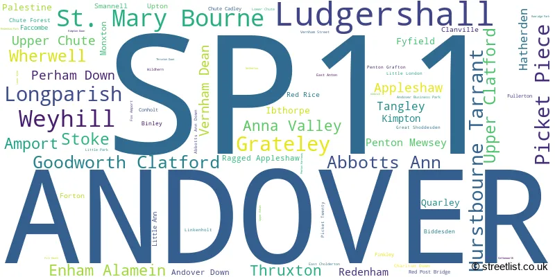
The largest settlement in the SP11 postal code is ANDOVER followed by Ludgershall, and Picket Piece.
The SP11 Postcode shares a border with RG17 (HUNGERFORD, Lambourn, Kintbury), RG20 (Kingsclere, Woolton Hill, Compton), RG28 (WHITCHURCH, Hurstbourne Priors, Laverstoke), SN8 (MARLBOROUGH, Ramsbury, Aldbourne), SP10 (ANDOVER, Charlton), SP9 (TIDWORTH, Shipton Bellinger), SP5 (Downton, Winterslow, Alderbury), SO21 (Colden Common, Sutton Scotney, Twyford) and SO20 (Kings Somborne, Middle Wallop, STOCKBRIDGE).
In the SP11 postcode district, the primary settlement is Andover, located in Hampshire, England. Other significant settlements include Abbotts Ann and Ludgershall, also in Hampshire. The main post town associated with the SP11 postcode district is Andover.
For the district SP11, we have data on 5 postcode sectors. Here's a breakdown: The sector SP11 0, covers Hurstbourne Tarrant and Weyhill and Stoke in Hampshire. The sector SP11 6, covers Andover and St. Mary Bourne and Picket Piece and Longparish in Hampshire. The sector SP11 7, covers Abbotts Ann and Goodworth Clatford and Upper Clatford and Wherwell and Anna Valley in Hampshire. The sector SP11 8, covers Grateley and Amport and Weyhill and Thruxton in Hampshire. The sector SP11 9, covers Ludgershall in Wiltshire.

Map of the SP11 Postcode District
Explore the SP11 postcode district by using our free interactive map.

When it comes to local government, postal geography often disregards political borders. However, for a breakdown in the SP11 District: the district mostly encompasses the Test Valley District (950 postcodes), followed by the Wiltshire area (219 postcodes), and finally, the Basingstoke and Deane District (B) area (111 postcodes).
Recent House Sales in SP11
| Date | Price | Address |
|---|---|---|
| 16/10/2023 | £365,000 | Lords Way, Andover, SP11 6FA |
| 03/10/2023 | £375,000 | Boulter Road, Andover, SP11 6TN |
| 29/09/2023 | £345,000 | Imelda Gardens, Ludgershall, Andover, SP11 9HJ |
| 21/09/2023 | £212,500 | Cashmere Drive, Andover, SP11 6ZR |
| 15/09/2023 | £1,110,000 | Dauntsey Lane, Weyhill, Andover, SP11 8EB |
| 08/09/2023 | £790,000 | St Annes Close, Goodworth Clatford, Andover, SP11 7RW |
| 08/09/2023 | £325,000 | Fairways, Weyhill, Andover, SP11 8DW |
| 08/09/2023 | £170,000 | Cashmere Drive, Andover, SP11 6ZS |
| 05/09/2023 | £300,000 | Clatford Manor, Upper Clatford, Andover, SP11 7PZ |
| 04/09/2023 | £850,000 | Goodworth Clatford, Andover, SP11 7RN |
Weather Forecast for SP11
Press Button to Show Forecast for Thruxton Motor Racing Circuit
| Time Period | Icon | Description | Temperature | Rain Probability | Wind |
|---|---|---|---|---|---|
| 09:00 to 12:00 | Cloudy | 7.0°C (feels like 4.0°C) | 8.00% | ENE 9 mph | |
| 12:00 to 15:00 | Cloudy | 9.0°C (feels like 8.0°C) | 14.00% | E 9 mph | |
| 15:00 to 18:00 | Cloudy | 10.0°C (feels like 8.0°C) | 16.00% | ENE 7 mph | |
| 18:00 to 21:00 | Cloudy | 9.0°C (feels like 8.0°C) | 15.00% | ENE 7 mph | |
| 21:00 to 00:00 | Cloudy | 6.0°C (feels like 4.0°C) | 11.00% | ENE 7 mph |
Press Button to Show Forecast for Thruxton Motor Racing Circuit
| Time Period | Icon | Description | Temperature | Rain Probability | Wind |
|---|---|---|---|---|---|
| 00:00 to 03:00 | Overcast | 5.0°C (feels like 2.0°C) | 17.00% | ENE 7 mph | |
| 03:00 to 06:00 | Light rain | 5.0°C (feels like 2.0°C) | 50.00% | ENE 7 mph | |
| 06:00 to 09:00 | Light rain | 5.0°C (feels like 2.0°C) | 50.00% | NE 9 mph | |
| 09:00 to 12:00 | Overcast | 8.0°C (feels like 5.0°C) | 21.00% | ENE 11 mph | |
| 12:00 to 15:00 | Overcast | 11.0°C (feels like 9.0°C) | 19.00% | E 11 mph | |
| 15:00 to 18:00 | Light rain | 11.0°C (feels like 9.0°C) | 50.00% | ENE 11 mph | |
| 18:00 to 21:00 | Light rain | 10.0°C (feels like 7.0°C) | 51.00% | ENE 11 mph | |
| 21:00 to 00:00 | Light rain | 8.0°C (feels like 6.0°C) | 52.00% | NE 11 mph |
Press Button to Show Forecast for Thruxton Motor Racing Circuit
| Time Period | Icon | Description | Temperature | Rain Probability | Wind |
|---|---|---|---|---|---|
| 00:00 to 03:00 | Heavy rain | 8.0°C (feels like 4.0°C) | 75.00% | NE 13 mph | |
| 03:00 to 06:00 | Heavy rain | 7.0°C (feels like 4.0°C) | 76.00% | NE 11 mph | |
| 06:00 to 09:00 | Heavy rain | 8.0°C (feels like 5.0°C) | 72.00% | ENE 9 mph | |
| 09:00 to 12:00 | Light rain shower (day) | 10.0°C (feels like 8.0°C) | 40.00% | NE 9 mph | |
| 12:00 to 15:00 | Light rain | 11.0°C (feels like 9.0°C) | 51.00% | SW 11 mph | |
| 15:00 to 18:00 | Light rain shower (day) | 11.0°C (feels like 8.0°C) | 39.00% | W 11 mph | |
| 18:00 to 21:00 | Light rain shower (day) | 10.0°C (feels like 8.0°C) | 32.00% | W 9 mph | |
| 21:00 to 00:00 | Partly cloudy (night) | 7.0°C (feels like 5.0°C) | 5.00% | W 7 mph |
Where is the SP11 Postcode District?
The postcode district SP11 is located in Andover, a town in Hampshire. Andover is situated near several other towns. To the west is Tidworth, which is approximately 6.6 miles away. Whitchurch is located to the east, around 7.8 miles from Andover. Stockbridge is located to the south, about 8 miles away. Hungerford is to the north, approximately 11.3 miles away. Pewsey is located to the northwest, around 12.6 miles away. Newbury is located to the northeast, approximately 14.3 miles away. Finally, Winchester is situated to the southeast, around 14.4 miles from Andover. The postcode district SP11, while not directly connected to the center of London, is situated approximately 62.6 miles away from London.
The district is within the post town of ANDOVER.
The sector has postcodes within the nation of England.
The SP11 Postcode District is covers the following regions.
- Central Hampshire - Hampshire and Isle of Wight - South East (England)
- North Hampshire - Hampshire and Isle of Wight - South East (England)
- Wiltshire - Gloucestershire, Wiltshire and Bath/Bristol area - South West (England)
| Postcode Sector | Delivery Office |
|---|---|
| SP11 0 | Andover Delivery Office |
| SP11 6 | Andover Delivery Office |
| SP11 7 | Andover Delivery Office |
| SP11 8 | Andover Delivery Office |
| SP11 9 | Andover Delivery Office |
| SP11 9 | Tidworth Delivery Office |
| S | P | 1 | 1 | - | X | X | X |
| S | P | 1 | 1 | Space | Numeric | Letter | Letter |
Current Monthly Rental Prices
| # Bedrooms | Min Price | Max Price | Avg Price |
|---|---|---|---|
| 1 | £650 | £650 | £650 |
| 2 | £950 | £1,500 | £1,057 |
| 3 | £875 | £3,250 | £1,563 |
| 4 | £1,995 | £3,250 | £2,415 |
| 5 | £3,200 | £5,000 | £4,100 |
Current House Prices
| # Bedrooms | Min Price | Max Price | Avg Price |
|---|---|---|---|
| £80,000 | £7,410,000 | £1,189,579 | |
| 1 | £75,000 | £169,995 | £120,174 |
| 2 | £128,250 | £615,000 | £258,003 |
| 3 | £201,000 | £1,575,000 | £454,092 |
| 4 | £310,000 | £1,500,000 | £589,087 |
| 5 | £450,000 | £1,800,000 | £1,062,497 |
| 6 | £1,200,000 | £11,500,000 | £3,620,833 |
| 7 | £699,950 | £975,000 | £883,317 |
| 9 | £3,650,000 | £3,650,000 | £3,650,000 |
Estate Agents who Operate in the SP11 District
| Logo | Name | Brand Name | Address | Contact Number | Total Properties |
|---|---|---|---|---|---|
 | Andover | Graham & Co | 13 London Street, Andover, SP10 2NU | 01264 312452 | 45 |
 | Andover | Austin Hawk Estate Agents | 1-2 Swan Court East Street Andover SP10 1EZ | 01264 312482 | 35 |
 | Andover | Connells | Winchester House Winchester street Andover SP10 2EA | 01264 608252 | 18 |
 | Stockbridge | Evans & Partridge | Agriculture House,High Street, Stockbridge, SO20 6HF | 01264 810702 | 18 |
 | Andover | Belvoir | 18 Bridge Street Andover SP10 1BH | 01264 608119 | 15 |
- Abbotts Ann
- Amport
- Andover Down
- Andover
- Anna Valley
- Appleshaw
- Ashmansworth
- Binley
- Buttermere
- Chilbolton
- Chute Cadley
- Chute Forest
- Clanville
- Cottonworth
- East Anton
- East Cholderton
- Enham Alamein
- Faccombe
- Forton
- Fullerton
- Fyfield
- Goodworth Clatford
- Grateley
- Great Shoddesden
- Hatherden
- Hurstbourne Priors
- Hurstbourne Tarrant
- Ibthorpe
- Kentsboro
- Kimpton
- Linkenholt
- Longparish
- Longstock
- Ludgershall
- Middleton
- Monxton
- Mullenspond
- Palestine
- Penton Corner
- Penton Grafton
- Penton Mewsey
- Perham Down
- Picket Piece
- Quarley
- Red Rice
- Redenham
- Smannell
- St Mary Bourne
- Stoke
- Tangley
- Thruxton
- Upper Chute
- Upper Clatford
- Upton
- Vernham Dean
- Vernham Street
- Wadwick
- Weyhill
- Wherwell
- Whitchurch
- Wildhern
| Type of Property | 2018 Average | 2018 Sales | 2017 Average | 2017 Sales | 2016 Average | 2016 Sales | 2015 Average | 2015 Sales |
|---|---|---|---|---|---|---|---|---|
| Detached | £472,137 | 256 | £460,653 | 287 | £438,251 | 235 | £431,998 | 282 |
| Semi-Detached | £271,734 | 249 | £280,690 | 215 | £287,145 | 215 | £250,140 | 208 |
| Terraced | £257,139 | 176 | £254,772 | 125 | £248,831 | 179 | £227,168 | 194 |
| Flats | £147,691 | 69 | £157,148 | 100 | £164,776 | 74 | £131,743 | 97 |