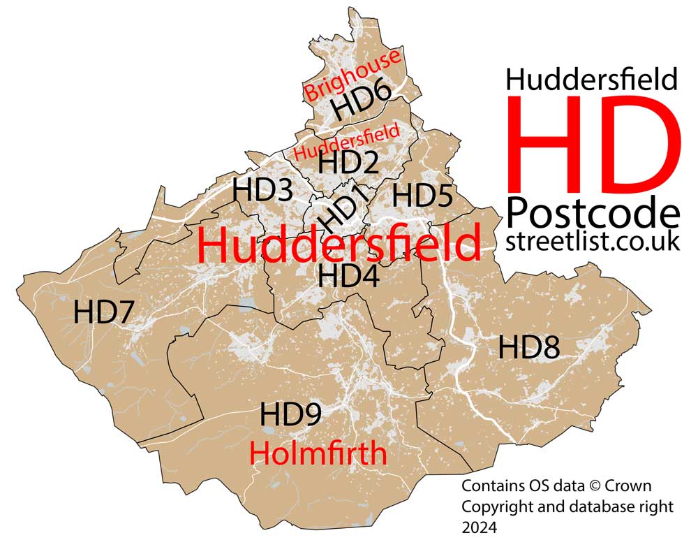
This section of the site is all about the HD Postcode area, also known as the Huddersfield Postal Area. Explore links to the next level to learn more about specific postcode districts such as HD1.
Quick Facts about the HD Postcode
| Width from East to West | 17.78 mi |
| Height from North to South | 14.62 mi |
| Area of HD | 128.69 mi² |
| Maximum Width | 17.80 mi |
| Perimeter of Postcode Area | 66.03 mi |
| Number of Postcode Districts | 9 |
| Number of Postcode Sectors | 39 |
| Number of Post Towns | 3 |
| Number of Postcodes | 7,125 |
The HD postcode area represents a group of postal districts in the Huddersfield area of the United Kingdom. The area code HD stands for the letters h and d in HuDdersfield. HD has a population of 262,814 and covers an area of 333,317 hectares. Fun fact: 0.40% of the population of Great Britain lives in this area.
The postcode area falls within the following counties: West Yorkshire (99.87%), South Yorkshire (0.13%).
Post Towns and Postcode Districts for the HD Postcode
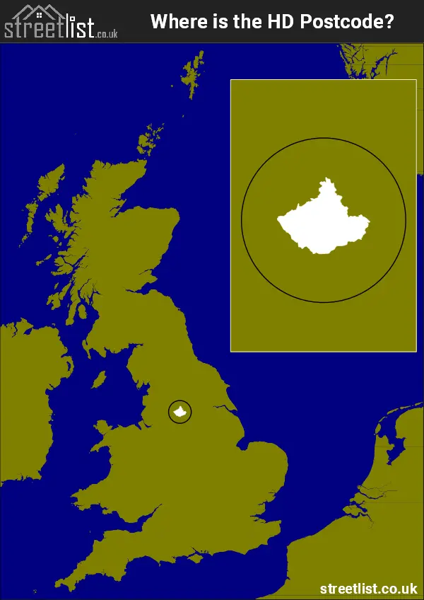
Where is the HD Postcode Area?
The HD Huddersfield,Postcode is in the Yorkshire and the Humber Region of England. TheHD postal area borders the following neighbouring postal areas: SK - Stockport, WF - Wakefield, OL - Oldham, BD - Bradford, S - Sheffield and HX - Halifax, and is located inland.
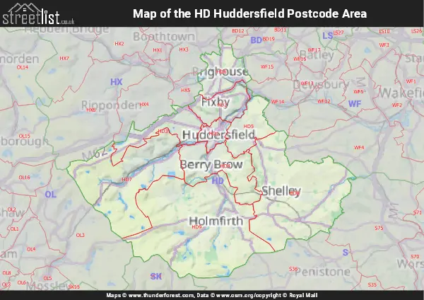
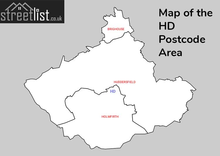
Map of the HD Huddersfield Postcode Area
Explore the HD Huddersfield postcode area by using our interactive map.
How built up is the HD Postcode?
I've calculated the total area covered by building footprints within the HD postcode area.
By analyzing this against the total area, I've determined the percentage of the area that's developed, this will give you an idea of how urban or rural the HD postcode region is.
The higher the percentage the more urban the area is. For example the least urban district is HD7 and the most urban is HD1.
| Postcode District | Total Area (m²) | Footprint Area (m²) | Built Percentage % |
|---|---|---|---|
| HD7 | 60,865,391 | 1,128,640 | 1.85% |
| HD9 | 97,009,485 | 2,004,479 | 2.07% |
| HD8 | 75,773,355 | 1,973,985 | 2.61% |
| HD4 | 26,857,788 | 1,232,519 | 4.59% |
| HD3 | 18,101,957 | 1,365,680 | 7.54% |
| HD5 | 16,610,856 | 1,263,527 | 7.61% |
| HD6 | 17,113,207 | 1,468,829 | 8.58% |
| HD2 | 14,809,535 | 1,373,276 | 9.27% |
| HD1 | 6,173,820 | 1,402,315 | 22.71% |
| HD Total | 333,315,394 (m²) | 13,213,250 (m²) | 3.96% |
Postcode Districts within the HD Huddersfield Postcode Area
There are 9 postcode districts within the Huddersfield postcode area
A map showing the boundary of HD in relation to other areas
There are 5 towns within the Huddersfield postcode area.
| Unit | Area² |
|---|---|
| Hectares | 333,317² |
| Miles | 1,287² |
| Feet | 35,877,908,563² |
| Kilometres | 3,333² |
Postal Delivery Offices serving the HD Huddersfield Postcode Area
- Brighouse Delivery Office
- Holmfirth Delivery Office
- Huddersfield Delivery Office
- Scissett Delivery Office
- Slaithwaite Delivery Office
Councils with Postcodes in HD
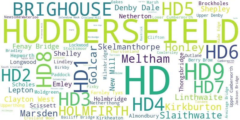
Towns and Villages within the HD Huddersfield Postcode Area
- Birds Edge - village
- Bolster Moor - village
- Brighouse - town
- Brockholes - village
- Clayton West - village
- Colne Bridge - village
- Cross Roads - village
- Denby Dale - village
- Elland Upper Edge - village
- Emley - village
- Farnley Tyas - village
- Hade Edge - village
- Hepworth - village
- Hole Bottom - village
- Holmbridge - village
- Holme - village
- Holmfirth - town
- Holt Head - village
- Honley - village
- Huddersfield - town
- Jackson Bridge - village
- Kirkburton - village
- Kirkheaton - village
- Lane Head - village
- Lepton - village
- Lingards Wood - village
- Linthwaite - village
- Lower Cumberworth - village
- Lower Denby - village
- Lower Wellhouse - village
- Lydgate - village
- Marsden - village
- Meltham - town
- Mirfield - town
- Netherthong - village
- Netherton - village
- Nettleton Hill - village
- New Mill - village
- Outlane - village
- Scapegoat Hill - village
- Scholes - village
- Scissett - village
- Shelley - village
- Shepley - village
- Skelmanthorpe - village
- Slaithwaite - village
- Snowgate Head - village
- Stocksmoor - village
- Thongsbridge - village
- Thurstonland - village
- Totties - village
- Town End - village
- Upper Cumberworth - village
- Upper Denby - village
- Upperthong - village
- Wilshaw - village
- Wooldale - village