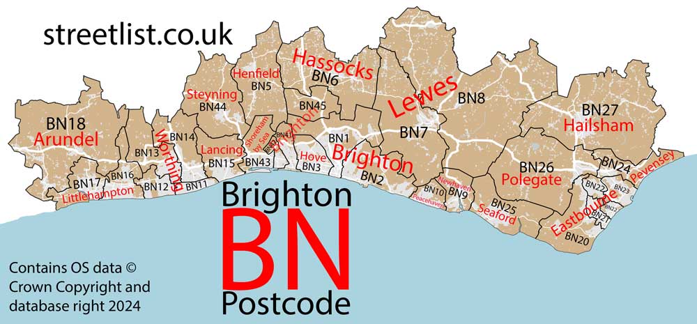
This section of the site is all about the BN Postcode area, also known as the Brighton Postal Area. Explore links to the next level to learn more about specific postcode districts such as BN1.
The BN postcode area represents a group of postal districts in the Brighton area of the United Kingdom. The area code BN stands for the letters b and n in BrightoN. BN has a population of 802,831 and covers an area of 1,110,168 hectares. Fun fact: 1.24% of the population of Great Britain lives in this area.
The postcode area falls within the following counties: East Sussex (65.02%), West Sussex (34.98%).
Post Towns and Postcode Districts for the BN Postcode
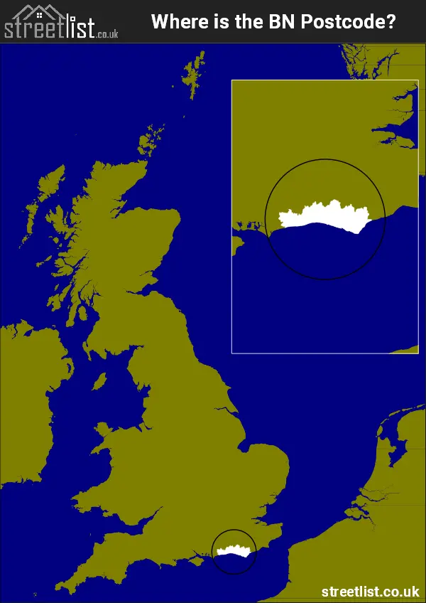
Where is the BN Postcode Area?
The BN Brighton Postcode is in the South East of England The postal area borders the following neighbouring postal areas: PO - Portsmouth, GU - Guildford, RH - Redhill and TN - Tonbridge, It also borders The English Channel,
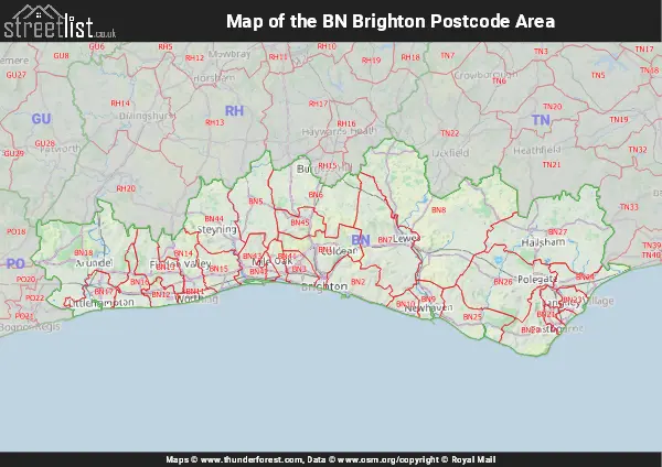
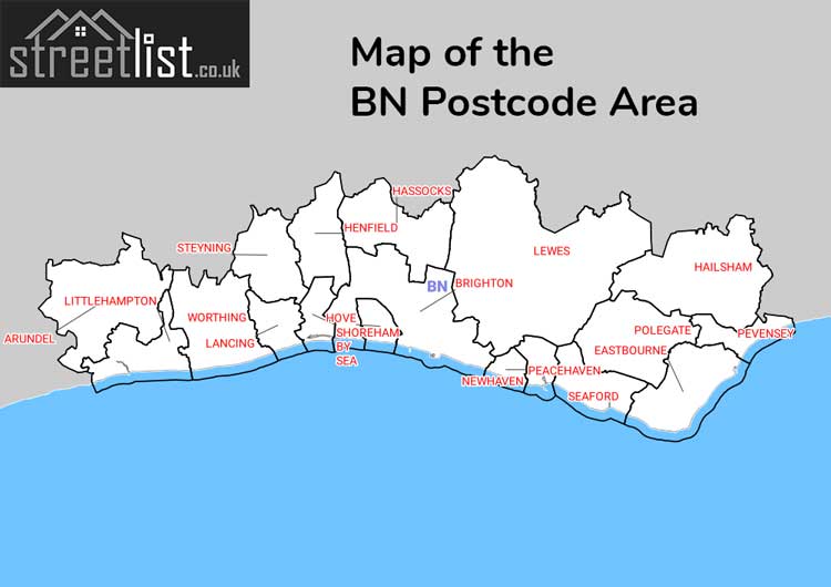
Map of the BN Brighton Postcode Area
Explore the BN Brighton postcode area by using our interactive map.
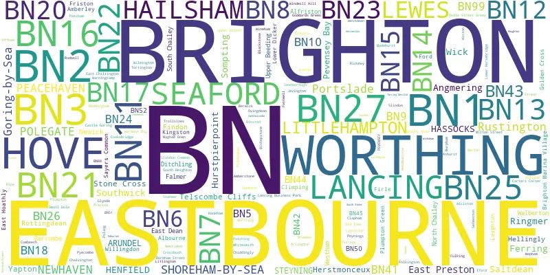
Postcode Districts within the BN Brighton Postcode Area
There are 30 postcode districts within the Brighton postcode area
A map showing the boundary of in relation to other areas
There are 14 towns within the Brighton postcode area.
| Unit | Area² |
|---|---|
| Hectares | 1,110,168² |
| Miles | 4,286² |
| Feet | 119,497,373,352² |
| Kilometres | 11,102² |
Postal Delivery Offices serving the BN Brighton Postcode Area
- Arundel Delivery Office
- Brighton Delivery Office
- Eastbourne Delivery Office
- Goring On Sea Delivery Office
- Hailsham Delivery Office
- Hassocks Delivery Office
- Henfield Delivery Office
- Hove Delivery Office
- Lancing Delivery Office
- Lewes Delivery Office
- Littlehampton Delivery Office
- Newhaven Delivery Office
- Peacehaven Delivery Office
- Polegate Delivery Office
- Portslade Delivery Office
- Rottingdean Delivery Office
- Seaford Delivery Office
- Shoreham By Sea Delivery Office
- Steyning Delivery Office
- Westham Delivery Office
- Worthing Delivery Office
Councils with Postcodes in BN
Towns and Villages within the BN Brighton Postcode Area
- Albourne - village
- Albourne Green - village
- Albourne Street - village
- Alciston - village
- Alfriston - village
- Amberley - village
- Angmering - village
- Arundel - town
- Ashurst - village
- Atherington - village
- Barcombe Cross - village
- Barnham - village
- Berwick - village
- Berwick - village
- Bishopstone - village
- Blackstone - village
- Bodle Street Green - village
- Boreham Street - village
- Bramber - village
- Brighton - City
- Broyle Side - village
- Burgess Hill - town
- Burpham - village
- Castle Town - village
- Chalvington - village
- Clapham - village
- Clayton - village
- Climping - otherSettlement
- Cooksbridge - village
- Cowbeech - village
- Cowbeech Hill - village
- Cross Gate - village
- Crossbush - village
- Ditchling - village
- East Chiltington - village
- East Dean - village
- East Hoathly - village
- East Preston - village
- East Saltdean - Village
- Eastbourne - town
- Falmer - village
- Ferring - village
- Findon - village
- Firle - village
- Flowers Green - village
- Fontwell - village
- Ford - village
- Friston - village
- Fulking - village
- Glynde - village
- Golden Cross - village
- Hailsham - town
- Halland - village
- Hankham - village
- Hassocks - village
- Hellingly - village
- Henfield - village
- Herstmonceux - village
- Horsemere Green - village
- Hove - city
- Hurst Wickham - village
- Hurstpierpoint - village
- Iford - village
- Jevington - village
- Keymer - village
- Kingston near Lewes - village
- Lancing - Settlement
- Laughton - village
- Lewes - town
- Litlington - village
- Littlehampton - town
- Lower Dicker - village
- Lower Horsebridge - village
- Lyminster - village
- Magham Down - village
- Milton Street - village
- Muddles Green - village
- Newhaven - town
- Newick - village
- Normans' Bay - village
- North Chailey - village
- Offham - village
- Old Shoreham - otherSettlement
- Ovingdean - Village
- Patching - village
- Peacehaven - town
- Pevensey - village
- Pevensey Bay - village
- Piddinghoe - village
- Plumpton - village
- Plumpton Green - village
- Polegate - town
- Portslade-by-Sea - Urban Area
- Poynings - village
- Pyecombe - village
- Ringmer - village
- Ripe - village
- Rodmell - village
- Rottingdean - Village
- Rustington - Urban Area
- Saltdean - Village
- Sayers Common - village
- Seaford - town
- Selmeston - village
- Shoreham-by-Sea - town
- Slindon - village
- Slindon Common - village
- Small Dole - village
- Sompting - village
- South Chailey - village
- South Heighton - village
- South Street - village
- Southwick - town
- Steyning - town
- Stone Cross - village
- Telscombe Cliffs - village
- Tortington - village
- Upper Beeding - village
- Upper Dicker - village
- Walberton - village
- Warningcamp - village
- Wepham - village
- West Barnham - village
- Westham - village
- Westmeston - village
- Wick - village
- Willingdon - village
- Wilmington - village
- Windmill Hill - village
- Wineham - village
- Woodingdean - Village
- Woodmancote - village
- Worthing - town
- Yapton - village